This highly photogenic cone tornado formed at 7:30 pm out of an isolated supercell that developed on a lake breeze front. It caused extensive damage at a pig farm where trees were snapped and uprooted, cattle hutches blown around and a barn unroofed and torn apart, killing a number of pigs. The family that owned the property sought shelter in the basement of their farmhouse which was left with shattered windows and torn off siding and roofing. In addition, it was left impaled by lumber from the barn, pockmarked by impact damage from debris, and shifted slightly off of its foundation.
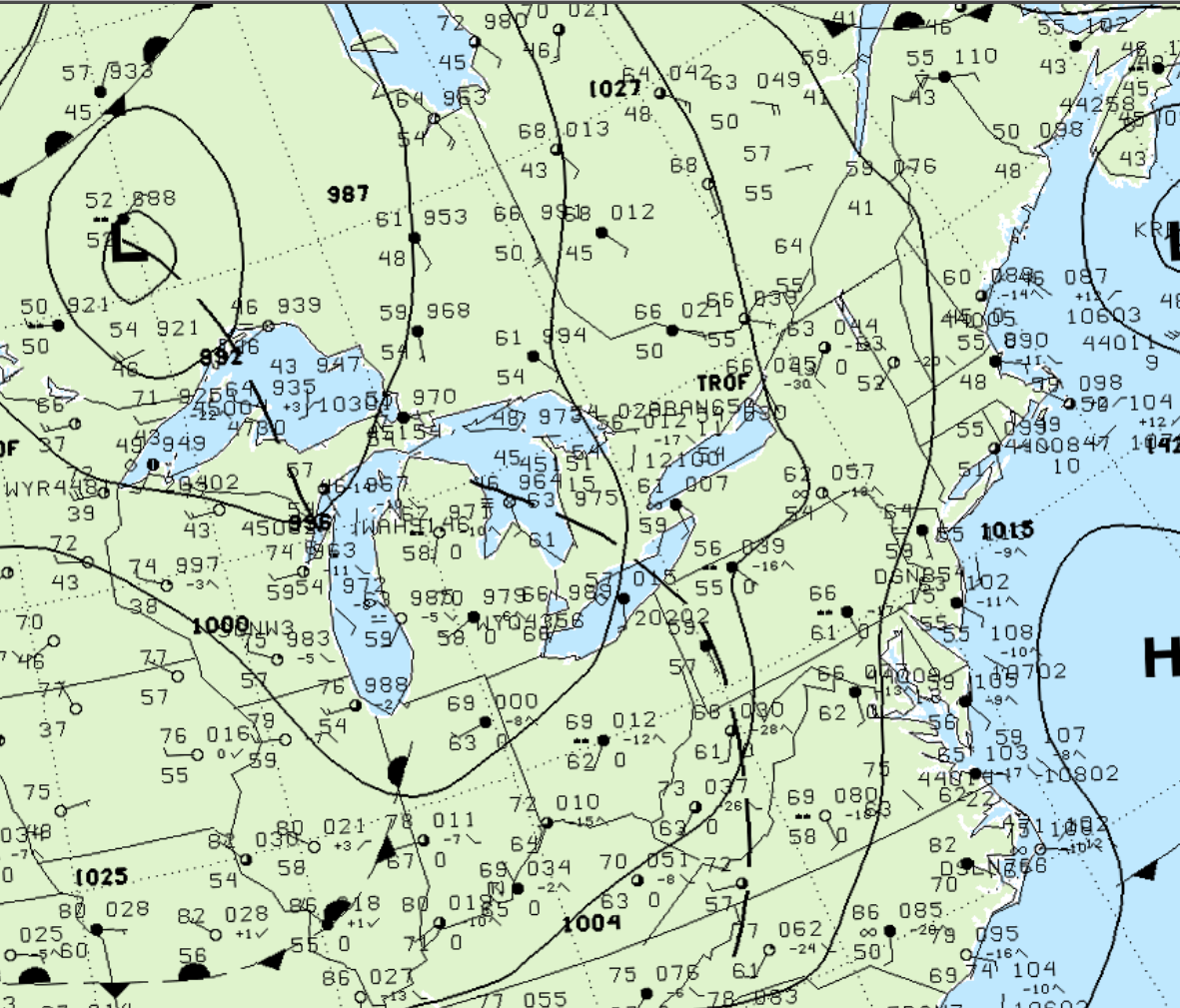
Figure 1 depicts the surface observations at 2:00 pm, which depicts a trough of low pressure developing over the Great Lakes and extending into southwestern Ontario. This trough would become the focus for convergence as southerly winds blew over Lake Erie and Lake Ontario, causing lake-breeze boundaries ahead of the trough. This area of strong convergence was ideal for thunderstorm development throughout the afternoon across southern Ontario, which ultimately resulted in this F1 tornado.

According to Environment and Climate Change Canada (2018), an F1 tornado touched down at 7:30 pm EDT near Appin, ON. The path and width of the tornado was not documented by ECCC. The tornado caused no fatalities or injuries, but caused $1 million dollars in property damage.
Sources
NWS Weather Prediction Center Surface Analysis Archive. (2017). Surface analysis 18Z Tue May 23 2000. Retrieved from: https://www.wpc.ncep.noaa.gov/archives/web_pages/sfc/sfc_archive.php
Environment and Climate Change Canada Data. (2018). Canadian National Tornado Database: Verified Events (1980-2009) – Public. Retrieved from: http://donnees.ec.gc.ca/data/weather/products/canadian-national-tornado-database-verified-events-1980-2009-public/

