

This tornado occurred at 2:00 pm and touched down only briefly, however it caused considerable damage to a farm on Casey Road, north of the town of Belleville. A covered riding arena was left mangled and destroyed, a large drive shed was thrown over 100 metres, a barn suffered roof damage and hay wagons were tossed about. Damage was estimated at $280,000.
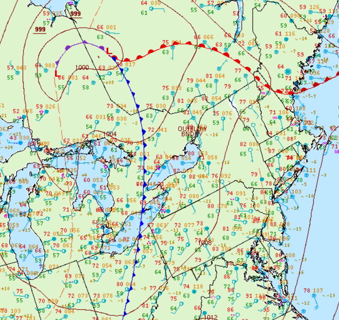
Figure 1 depicts the Doppler radar reflectivity at the time of the tornado. The storm depicted near Prince Edward County is responsible for the F1 tornado near Belleville.
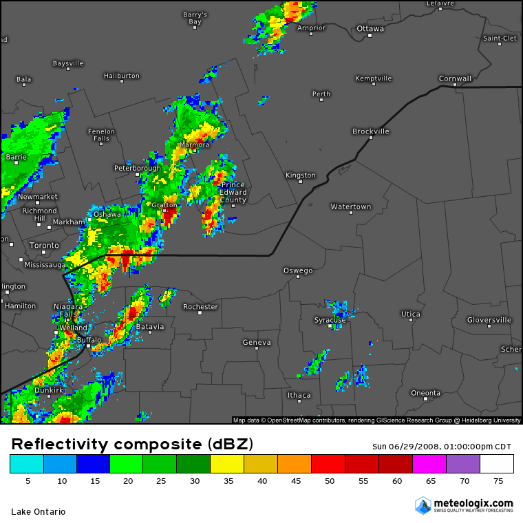
Figure 2 depicts the surface observations at 2:00 pm EDT, which shows a cold front slicing through southern Ontario, a warm front advecting north into Quebec and an outflow boundary near Kingston. This outflow boundary, possibly aided by the forcing of the cold front, triggered thunderstorm development in the early afternoon hours of June 29th near Belleville, which ultimately resulted in a brief F1 tornado.
According to Environment and Climate Change Canada (2018), an F1 tornado touched down at 2:00 pm near Belleville, ON. The tornado travelled for 200 metres, but its width was not documented by ECCC. The tornado caused no fatalities or injuries, but caused $280 thousand dollars in property damage.
Sources
NWS Weather Prediction Center Surface Analysis Archive. (2017). Surface analysis 18Z Sun Jun 29 2008. Retrieved from: https://www.wpc.ncep.noaa.gov/archives/web_pages/sfc/sfc_archive.php
Environment and Climate Change Canada Data. (2018). Canadian National Tornado Database: Verified Events (1980-2009) – Public. Retrieved from: http://donnees.ec.gc.ca/data/weather/products/canadian-national-tornado-database-verified-events-1980-2009-public/