

This tornado touched down at about 5:00 pm and caused significant damage along a path that was 8 km long and 20m to 30m wide; it tracked from near the village of Dalkeith to the provincial border near Ste. Anne de Prescott. From there the tornado may have continued on into Quebec, where damage occurred along the same trajectory but further to the east, in the town of Saint Marte.
Between Dalkeith and Ste Anne de Prescott, houses, mobile homes, barns, grain bins, and corn silos all received extensive damage. Power poles were downed and dozens of trees were snapped or uprooted.
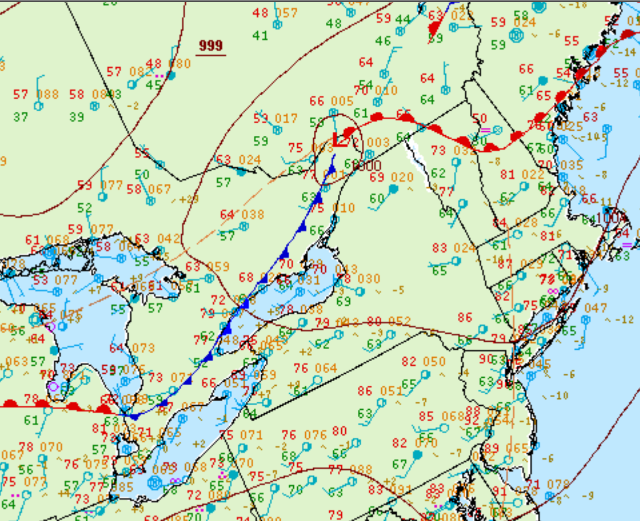
Figure 1 depicts the surface observations at 2:00 pm EDT, which shows a cold front slicing through southeastern Ontario. This front became the focus of intense thunderstorms in the early morning hours of June 5th, which ultimately led to this tornado.
Sources
NWS Weather Prediction Center Surface Analysis Archive. (2017). Surface analysis 18Z Sat Jun 5 2010. Retrieved from: https://www.wpc.ncep.noaa.gov/archives/web_pages/sfc/sfc_archive.php