

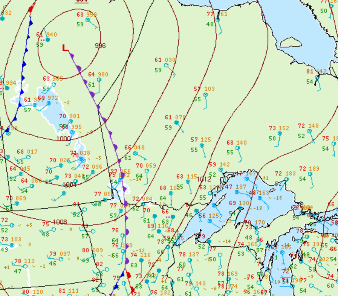
Figure 1 depicts the surface observations at 7:00 pm CDT, which shows a trowal and an occluding low pressure into Manitoba. This trowal became the focus for intense thunderstorms in northwestern Ontario in the evening hours of July 9th, which ultimately led to an outbreak of F2 tornadoes.
According to Environment and Climate Change Canada (2018), an F2 tornado touched down at 10:25 pm near Ear Falls, ON. The tornado travelled for 21.7 km and had a maximum width of 100 metres. The tornado caused no fatalities, injuries or property damage.
Sources
NWS Weather Prediction Center Surface Analysis Archive. (2017). Surface analysis 00Z Fri Jul 10 2009. Retrieved from: https://www.wpc.ncep.noaa.gov/archives/web_pages/sfc/sfc_archive.php
Environment and Climate Change Canada Data. (2018). Canadian National Tornado Database: Verified Events (1980-2009) – Public. Retrieved from: http://donnees.ec.gc.ca/data/weather/products/canadian-national-tornado-database-verified-events-1980-2009-public/