

Eyewitnesses in the Espanola area reported watching this tornado as it snapped and uprooted several trees on a path that was 1.2 kilometres in length.
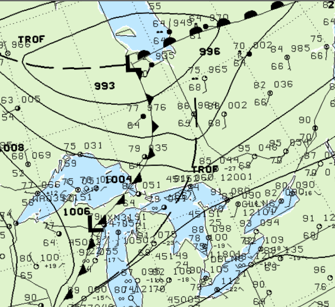
Figure 1 depicts the surface observations at 2:00 pm EDT, which shows a cold front advancing east and a pre-frontal trough in central Ontario. As the cold front moved east, it triggered thunderstorms, which ultimately led to this F0 tornado.
According to Environment and Climate Change Canada (2018), an F0 tornado touched down at 4:30 pm EDT near Espanola, ON. The tornado travelled for 1.2 km, but the width was not documented by ECCC. The tornado caused no fatalities, injuries or property damage.
Sources
NWS Weather Prediction Center Surface Analysis Archive. (2017). Surface analysis 18Z Thu Aug 9 2001. Retrieved from: https://www.wpc.ncep.noaa.gov/archives/web_pages/sfc/sfc_archive.php
Environment and Climate Change Canada Data. (2018). Canadian National Tornado Database: Verified Events (1980-2009) – Public. Retrieved from: http://donnees.ec.gc.ca/data/weather/products/canadian-national-tornado-database-verified-events-1980-2009-public/