


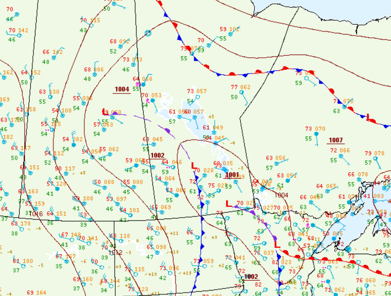
Figure 1 depicts the surface observations at 1:00 pm CDT, which shows an occluding low pressure in Southeastern Manitoba, an occluding low pressure in Saskatchewan and a low pressure over Lake Manitoba with a cold front extending southward across North Dakota. The complex interaction between all the surface features triggered thunderstorms across Southern Manitoba in the afternoon hours of June 27th, which ultimately led to this tornado.
According to Environment and Climate Change Canada (2018), an F1 tornado touched down at 2:17 pm CDT south of Gladstone, MB. The tornado travelled for 22.9 km with a maximum width of 400 metres. No property damage or injuries were documented for this tornado.
Sources
NWS Weather Prediction Center Surface Analysis Archive. (2017). Surface analysis 18Z Fri Jun 27 2008. Retrieved from: https://www.wpc.ncep.noaa.gov/archives/web_pages/sfc/sfc_archive.php
Environment and Climate Change Canada Data. (2018). Canadian National Tornado Database: Verified Events (1980-2009) – Public. Retrieved from: http://donnees.ec.gc.ca/data/weather/products/canadian-national-tornado-database-verified-events-1980-2009-public/