

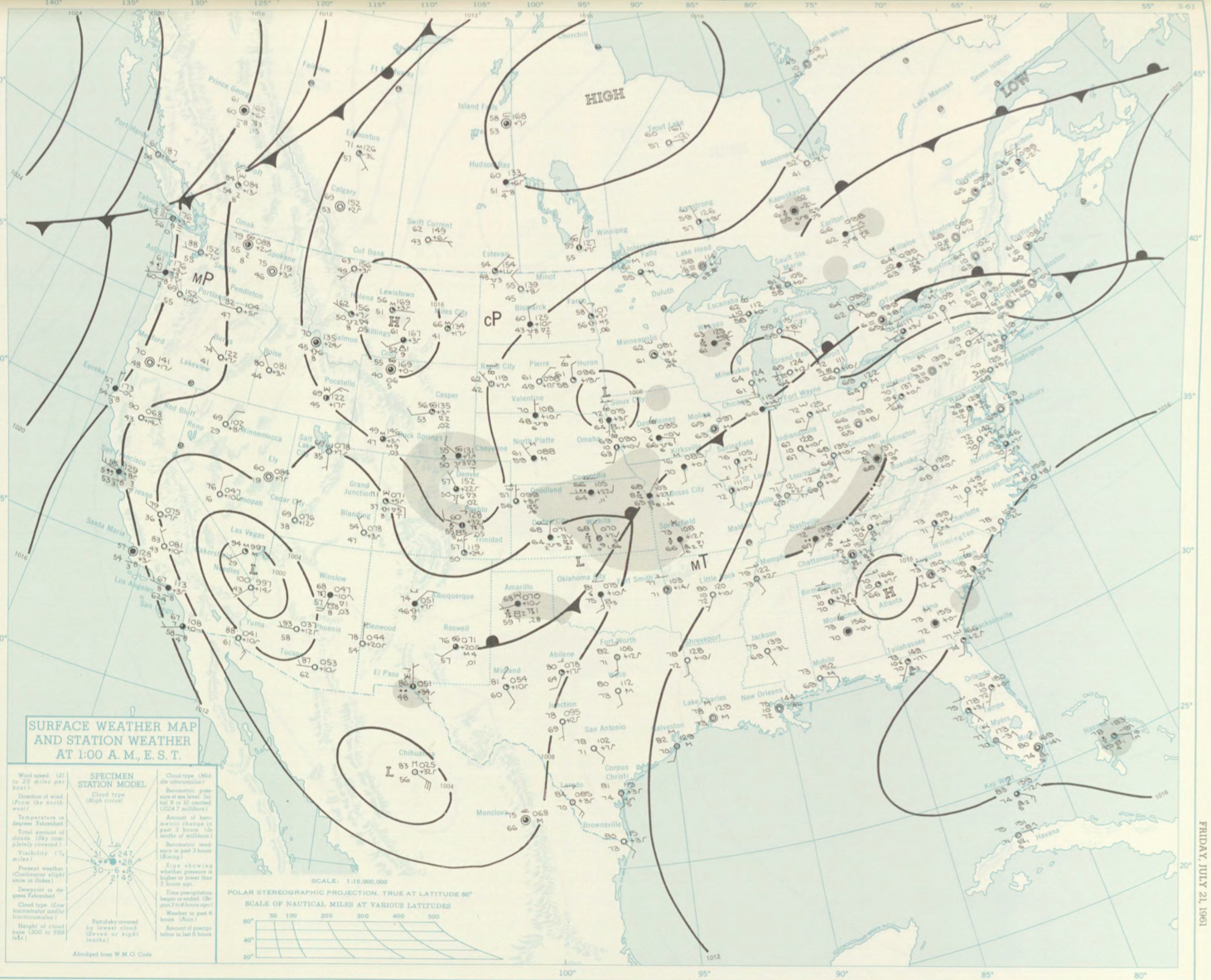
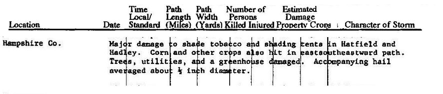
The Hadley, MA F2 tornado of July 21, 1961 impacted Hampshire County in Massachusetts. According to NOAA (2019), the F2 tornado caused no fatalities or injuries, but caused $25 thousand dollars in property damage. The tornado touched down in Hampshire County south of Bridge Street at 5:15 pm EDT. The tornado travelled for 4.9 miles and had a maximum width of 167 yards.
Sources
NOAA Central Library. (2019). U.S. Daily Weather Maps. Friday July 21, 1961 [PDF]. Retrieved from https://library.noaa.gov/Collections/Digital-Collections/US-Daily-Weather-Maps
NOAA National Centers for Environmental Information (2019). Storm Events Database. Retrieved from: https://www.ncdc.noaa.gov/stormevents/
U.S. Department of Commerce. (July, 1961). Storm Data (Volume 3, No. 7) [PDF]. Asheville, NC: U.S. Retrieved from http://www1.ncdc.noaa.gov/pub/data/swdi/stormevents/pub-pdf/storm_1961_07.pdf