

Below is a detailed event summary by NOAA’s National Centers for Environmental Information (2019).
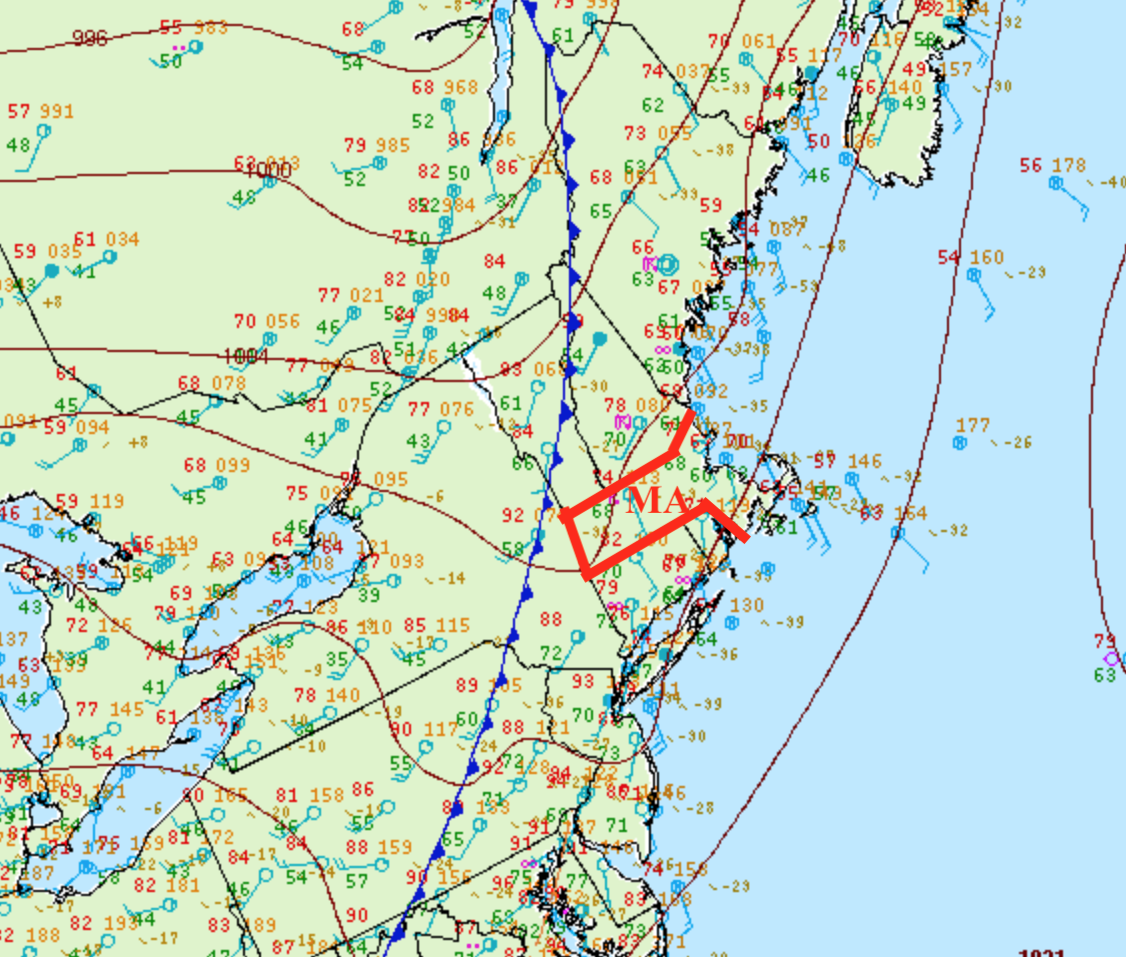
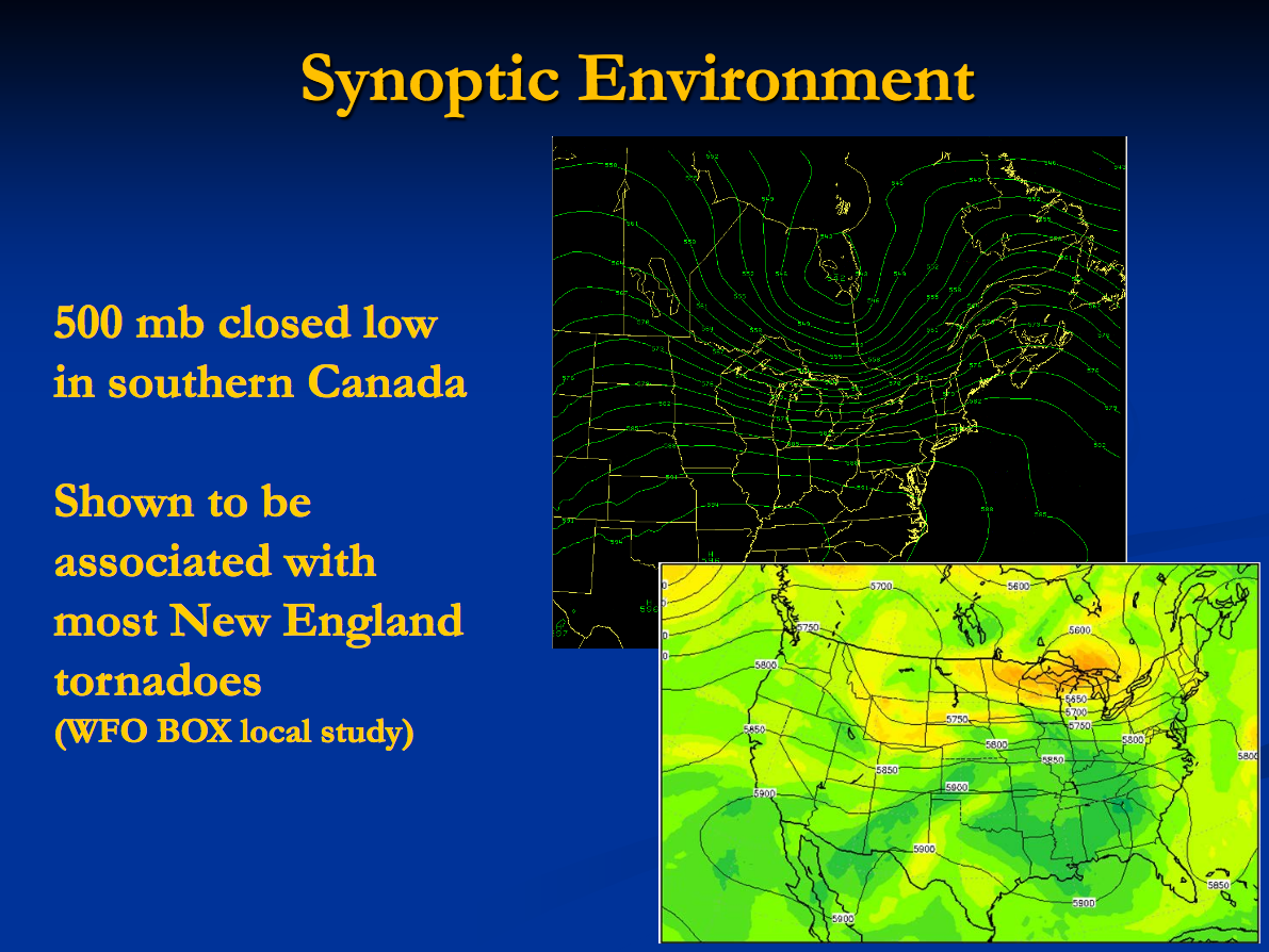
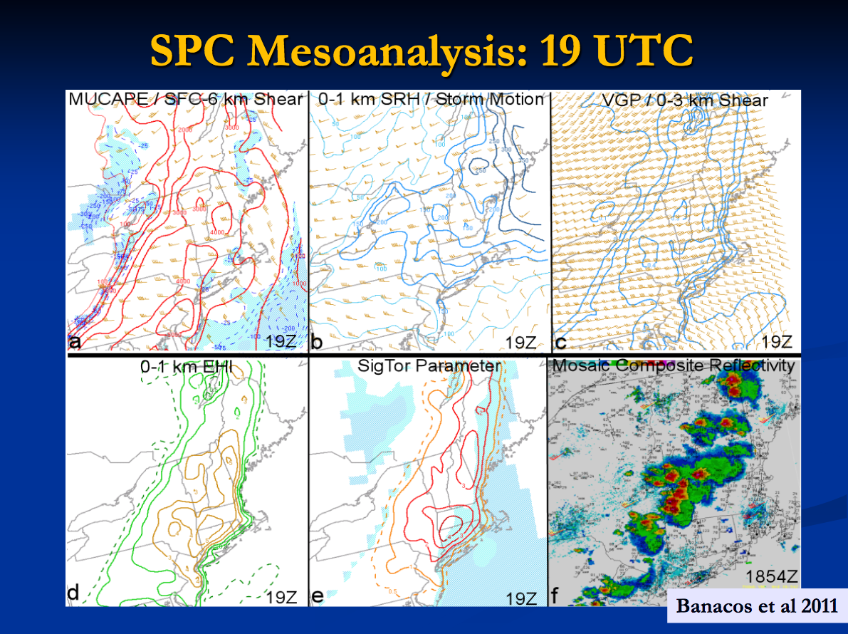
An upper level closed low over southern Ontario tracked across Quebec while at the surface, a cold front over western New York crossed southern New England in the evening of June 1. An environment characterized by high CAPE (2000-3000 J/kg) and high shear (greater than 200 m2/s2) was in place across western Massachusetts. In addition, mid level lapse rates were an impressive 7 to 8 C/km (Figure 7).
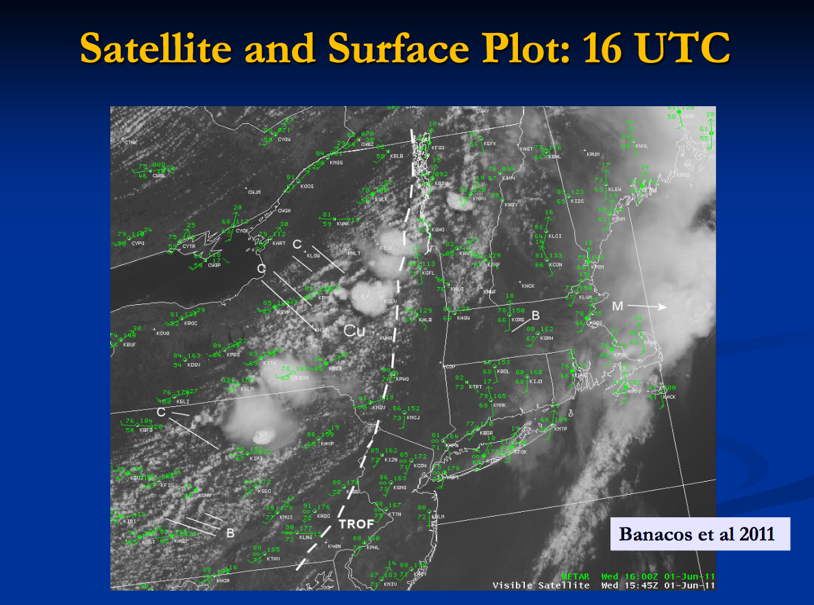
Thunderstorms forming ahead of the front organized into discrete supercells in an environment highly favorable for tornado formation. While convection fired early in the day along a weak low level theta-e ridge across north central Massachusetts and southern New Hampshire (Figure 3), clearing allowed for rapid destabilization in the afternoon.
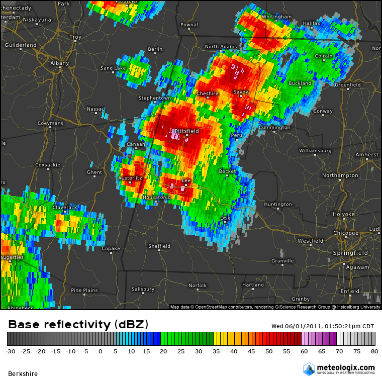
Thunderstorms developed during the morning ahead of the cold front from eastern Pennsylvania into southeast New York and Vermont. By about 3 pm, the storms entered western Massachusetts and were in the form of discrete supercells (Figure 4).
By 4 pm, several supercells had developed across southern Vermont, southwest New Hampshire, and western Massachusetts. At that time, the supercell which eventually produced the most significant tornado entered Hampden County from the Berkshires (Figure 5 & 6). This cell produced what was evaluated to be an EF-3 tornado touching down in Westfield and continuing on a 38 mile long trek through West Springfield, Springfield, Wilbraham, Monson, Brimfield, and Sturbridge. This tornado was on the ground for an estimated 70 minutes.
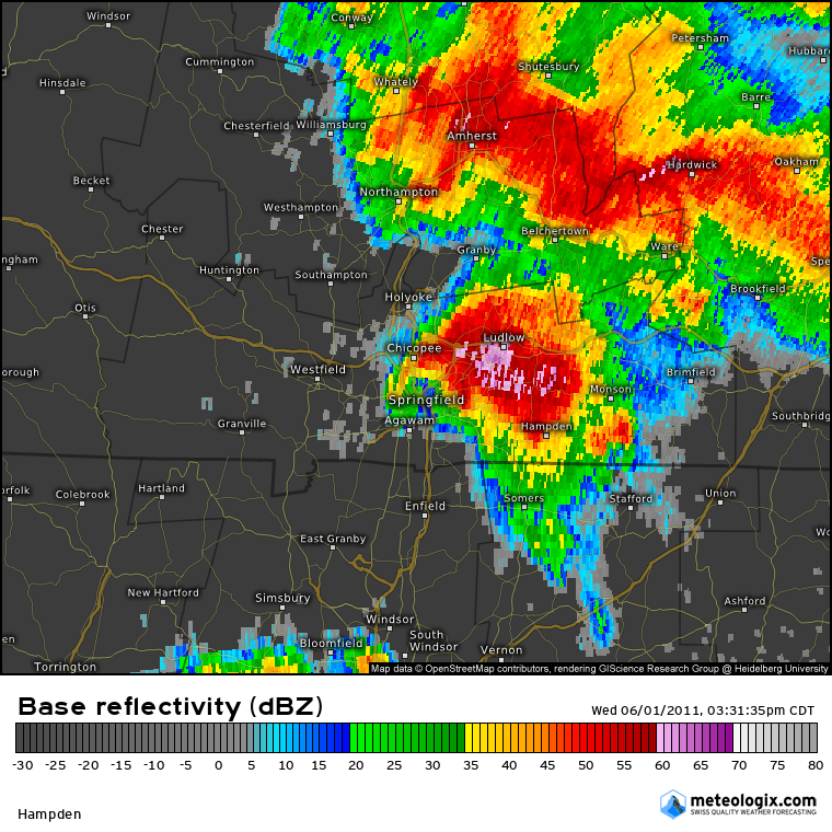
Figure 5. Doppler radar base reflectivity at 4:31 pm EDT on June 1, 2011 showing a significant hook echo over Springfield, MA (Source: Meteologix). 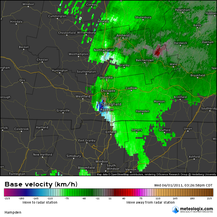
Figure 6. Doppler radar base velocity at 4:26 pm EDT on June 1, 2011 showing a significant debris ball over Springfield, MA (Source: Meteologix).
About two hours later, another supercell tracked just to the north of the storm track of the EF3 tornado. While its rotation was not as strong, it produced brief tornadoes in Wilbraham (EF1), North Brimfield (EF1), and Sturbridge (EF0). While the focus was certainly on the tornadoes and their damage, damaging winds, large hail up to two inches in diameter, and some flash flooding also occurred across southern New England.
Recap
The Indian Orchard, MA EF1 tornado of June 1, 2011 impacted Hampden County in Massachusetts. According to NOAA (2019), the EF1 tornado caused no fatalities, injuries or property damage. The tornado touched down in Hampden County south of Ludlow at 5:32 pm EDT and travelled 4.16 miles to lift just south of Butlerville. This EF1 had a maximum width of 200 yards.
Sources
NOAA National Centers for Environmental Information (2019). Storm Events Database. Retrieved from: https://www.ncdc.noaa.gov/stormevents/
DelliCarpini, J. (n.d.). The Massachusetts Tornado Outbreak of June 1, 2011 [PDF]. Retrieved from https://www.weather.gov/media/box/science/Springfield_Tornado_June_01_2011.pdf
NWS Weather Prediction Center Surface Analysis Archive. (2017). Surface analysis 21Z Wed Jun 1 2011. Retrieved from: https://www.wpc.ncep.noaa.gov/archives/web_pages/sfc/sfc_archive.php