

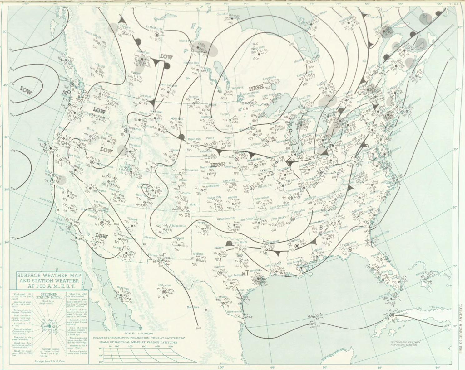
Figure 1 depicts the surface observations at 2:00 am EDT, which shows a complex scenario. The key features are a large area of high pressure over northwestern Ontario and the cold front over Ontario. This likely moved east-southeast throughout the day and triggered thunderstorms in Massachusetts, which ultimately led to this tornado.
The Little Neck, MA F1 tornado of August 10, 1965 impacted Essex County in Massachusetts. According to NOAA (2019), the F1 tornado caused no fatalities, injuries or property damage. The tornado touched down in Essex County near Hillside Road at 6:30 pm EDT. The tornado travelled for 3.6 miles and had a maximum width of 33 yards.
Sources
NOAA Central Library. (2019). U.S. Daily Weather Maps. Tuesday August 10, 1965 [PDF]. Retrieved from https://library.noaa.gov/Collections/Digital-Collections/US-Daily-Weather-Maps
NOAA National Centers for Environmental Information (2019). Storm Events Database. Retrieved from: https://www.ncdc.noaa.gov/stormevents/