

Figure 1 shows the surface observations at 7:00 am CDT, which shows a low pressure across northern Saskatchewan with a trough extending to a second low pressure on the Saskatchewan/North Dakota border. A cold front is seen extending south across western North Dakota from that low pressure as well. A warm front is observed across south-central South Dakota and central Nebraska.
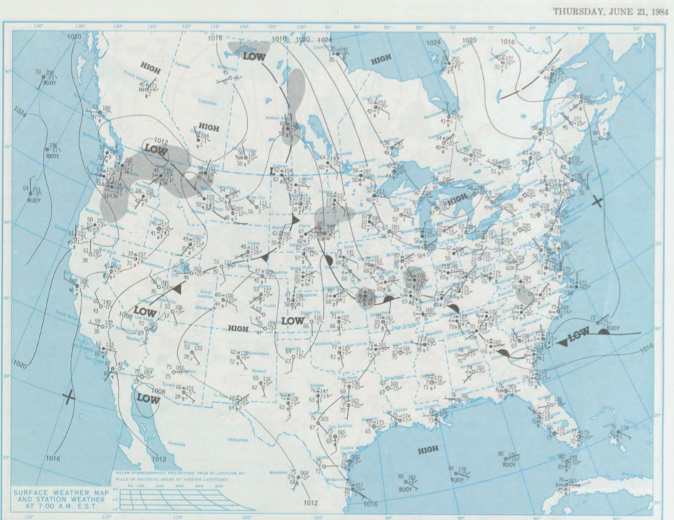
The warm front likely lifted north throughout the morning hours of June 21st. The interaction between the trough of low pressure, the cold front and warm front likely put southern Manitoba in a “triple-point” scenario. This triple-point became a favourable environment for rotating supercells in the afternoon hours of June 21st, which ultimately led to three tornadoes across Manitoba on this day.
According to Environment and Climate Change Canada (2018), an F0 tornado touched down at 6:00 pm CDT near Lundar, MB. The track and width of this tornado was not documented by ECCC. The tornado caused no injuries, fatalities or property damage.
Sources
NOAA Central Library. (2020). U.S. Daily Weather Maps. Thursday June 21, 1984 [PDF]. Retrieved from https://library.noaa.gov/Collections/Digital-Collections/US-Daily-Weather-Maps
Environment and Climate Change Canada Data. (2018). Canadian National Tornado Database: Verified Events (1980-2009) – Public. Retrieved from: http://donnees.ec.gc.ca/data/weather/products/canadian-national-tornado-database-verified-events-1980-2009-public/