At around 2:40pm, a pilot observed and reported a probable tornado touching the ground not far from the regional airport. No damage was done.
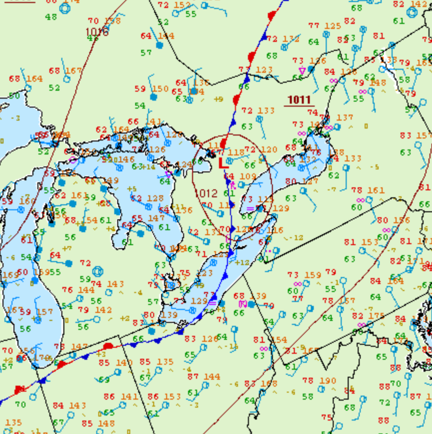
Figure 1 depicts the surface observations at 2:00 pm EDT, which shows a low pressure system over Barrie with a cold front extending across southern Ontario and Lake Erie. Therefore, Owen Sound is behind the cold front and within a northwesterly flow regime at the time of Figure 1. This leads us to believe that thunderstorm initiation was caused by lake-breeze boundaries from Lake Huron, which ultimately led to this weak F0 tornado.

According to Environment and Climate Change Canada (2018), an F0 tornado touched down at 2:38 pm near Owen Sound, ON. The path and width of the tornado was not documented by ECCC. The tornado caused no fatalities, injuries or property damage.
Sources
NWS Weather Prediction Center Surface Analysis Archive. (2017). Surface analysis 18Z Mon Jul 10 2006. Retrieved from: https://www.wpc.ncep.noaa.gov/archives/web_pages/sfc/sfc_archive.php
Environment and Climate Change Canada Data. (2018). Canadian National Tornado Database: Verified Events (1980-2009) – Public. Retrieved from: http://donnees.ec.gc.ca/data/weather/products/canadian-national-tornado-database-verified-events-1980-2009-public/

