

Witnesses observed the tornado touch down at 8:45 pm, a long tube of swirling dust that was rotating in an anticyclonic direction. Trees were snapped, crops damaged and lawn furniture thrown around. It was on the ground for 5 kilometres and had a width of 30 metres.
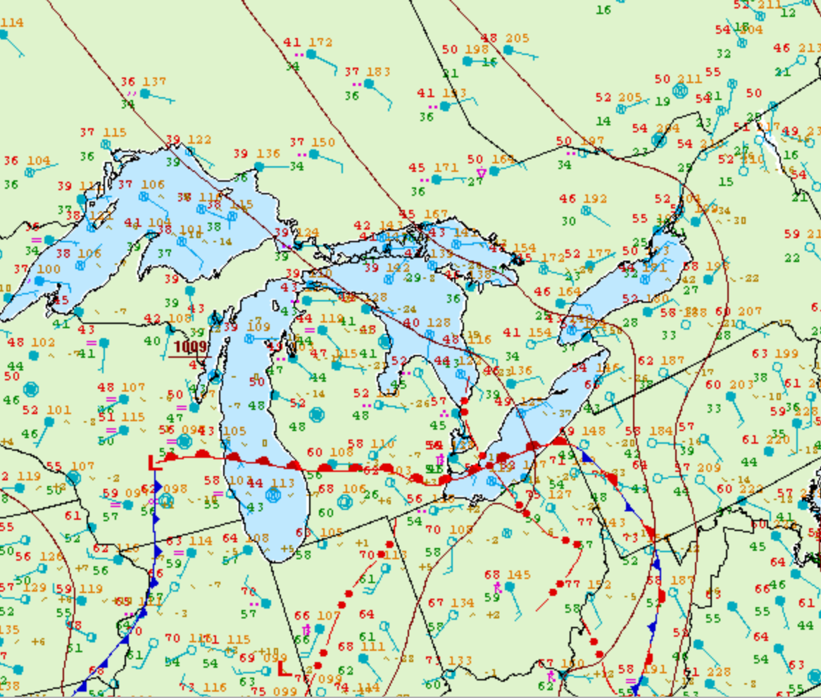
Figure 1 depicts the surface observations at 8:00 pm EDT, which shows a warm front advecting into southwestern Ontario. This brought southeasterly winds, which moved over the open waters of Lake Erie. Interactions with this warm front and possibly with lake-breeze boundaries led to thunderstorm development in the evening hours of May 13th, which ultimately led to this F0 tornado.
According to Environment and Climate Change Canada (2018), an F0 tornado touched down at 8:45 pm near Rodney, ON. The tornado travelled for 5 km and had a maximum width of 30 metres. The tornado caused no fatalities, injuries or property damage.
Sources
NWS Weather Prediction Center Surface Analysis Archive. (2017). Surface analysis 00Z Sat May 14 2005. Retrieved from: https://www.wpc.ncep.noaa.gov/archives/web_pages/sfc/sfc_archive.php
Environment and Climate Change Canada Data. (2018). Canadian National Tornado Database: Verified Events (1980-2009) – Public. Retrieved from: http://donnees.ec.gc.ca/data/weather/products/canadian-national-tornado-database-verified-events-1980-2009-public/