

Figure 1 depicts the surface observations at 8:00 am EDT, which shows a low pressure system developing over southern Ontario with a warm front extending into Massachusetts and a cold front across the Midwest. The cold front eventually moved east and triggered thunderstorms, which ultimately led to this tornado.

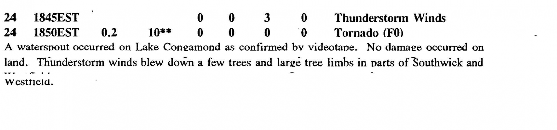
The Southwick, MA F0 tornado of June 24, 1992 impacted Hampden County in Massachusetts. According to NOAA (2019), the F0 tornado caused no fatalities, injuries or property damage. The tornado touched down near Sheep Pasture Road at 7:50 pm EDT. The tornado travelled for 0.2 miles and had a maximum width of 10 yards.
Sources
NOAA Central Library. (2020). U.S. Daily Weather Maps. Wednesday June 24, 1992 [PDF]. Retrieved from https://library.noaa.gov/Collections/Digital-Collections/US-Daily-Weather-Maps
NOAA National Centers for Environmental Information (2020). Storm Events Database. Retrieved from: https://www.ncdc.noaa.gov/stormevents/