

Striking at 6:21 pm, this tornado was caught on video by a local resident. Video showed a classic cone tornado touch down beneath a large wall cloud. It then widened and became a wedge, before wrapping in rain and disappearing into the core of the storm. It had been visible and on the ground for several minutes but caused no notable damage.
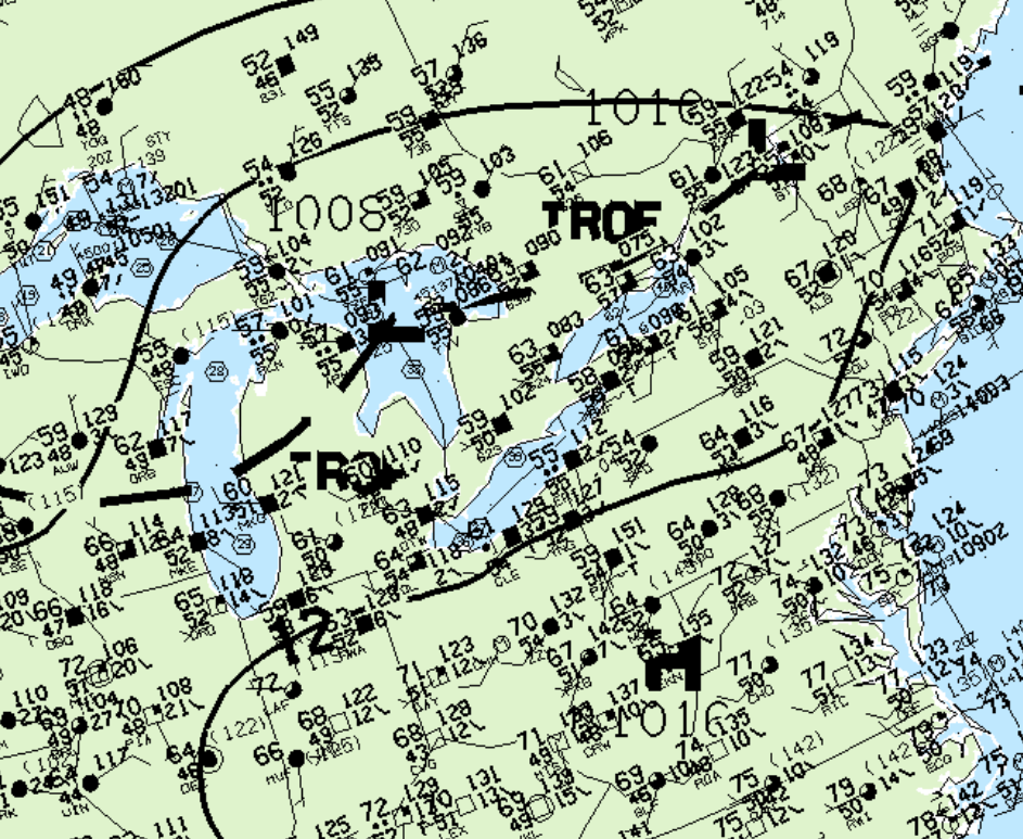
Figure 1 depicts the surface observations at 5:00 pm, which depicts a low pressure system over Lake Huron with a trough of low pressure extending into eastern Ontario. Southerly winds blowing over Lake Ontario possibly contributed to lake-breeze enhancement and localized convergence near the trough, which eventually lead to rapid development of thunderstorms throughout the afternoon. Local areas of enhanced vorticity caused by lake-breeze interactions with low pressure convergence likely contributed to this tornado ‘wedging out”, as depicted by an eye witness.
According to Environment and Climate Change Canada (2018), an F0 tornado touched down at 6:21 pm EDT near Tottenham, ON. The path and width of the tornado was not documented by ECCC. The tornado caused no fatalities, injuries or property damage.
Sources
NWS Weather Prediction Center Surface Analysis Archive. (2017). Surface analysis 21Z Sun Sep 15 1996. Retrieved from: https://www.wpc.ncep.noaa.gov/archives/web_pages/sfc/sfc_archive.php
Environment and Climate Change Canada Data. (2018). Canadian National Tornado Database: Verified Events (1980-2009) – Public. Retrieved from: http://donnees.ec.gc.ca/data/weather/products/canadian-national-tornado-database-verified-events-1980-2009-public/