

At 6:30 pm, this tornado touched down only briefly; it’s path was 230 metres long and 60 metres wide. Nevertheless, a large portion of a barn roof was torn off and thrown, a livestock wagon was spun around and trees were knocked down.
Figure 1 depicts the surface observations at 5:00 pm EDT, which shows a cold front over Michigan and northern Ontario. Thunderstorms in southern Ontario were likely the result of lake-breeze interactions.
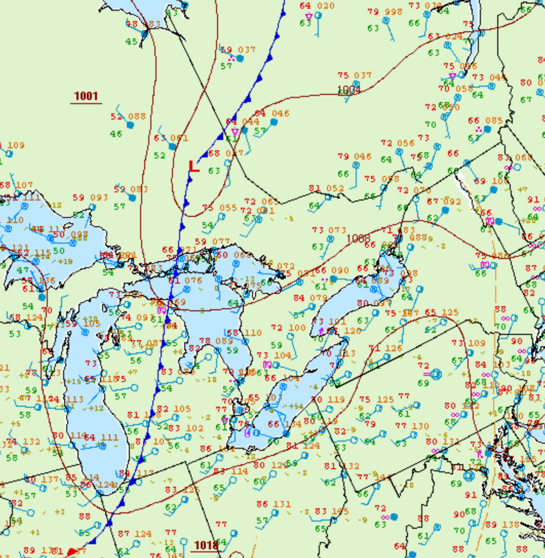
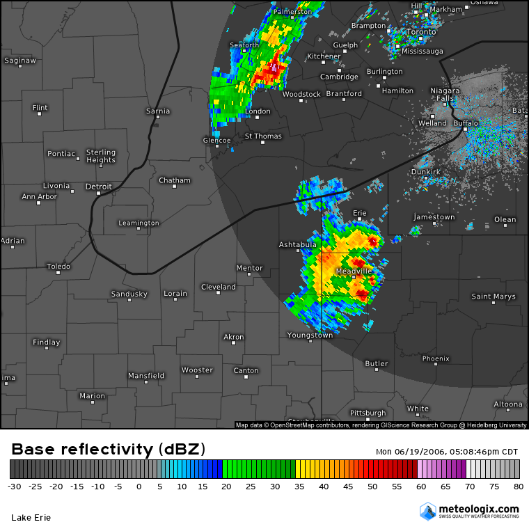
Figure 2 depicts the Doppler radar depiction at 6:08 pm, roughly 22 minutes prior to the tornado. In Figure 2, we can see a severe storm complex northwest of Woodstock, ON. This storm was responsible for this F1 tornado.
According to Environment and Climate Change Canada (2018), an F1 tornado touched down at 6:30 pm near Wartburg, ON. The tornado travelled for 230 metres with a maximum width of 60 metres. The tornado caused no fatalities, injuries or property damage.
Sources
NWS Weather Prediction Center Surface Analysis Archive. (2017). Surface analysis 21Z Mon Jun 19 2006. Retrieved from: https://www.wpc.ncep.noaa.gov/archives/web_pages/sfc/sfc_archive.php
Environment and Climate Change Canada Data. (2018). Canadian National Tornado Database: Verified Events (1980-2009) – Public. Retrieved from: http://donnees.ec.gc.ca/data/weather/products/canadian-national-tornado-database-verified-events-1980-2009-public/