Woods Hole, MA EF0 Tornado of October 29, 2018


Figure 1 depicts the surface observations at 8:00 am EDT, which shows an occluding front across New York state, which helped trigger thunderstorms across Massachusetts and ultimately led to this tornado.
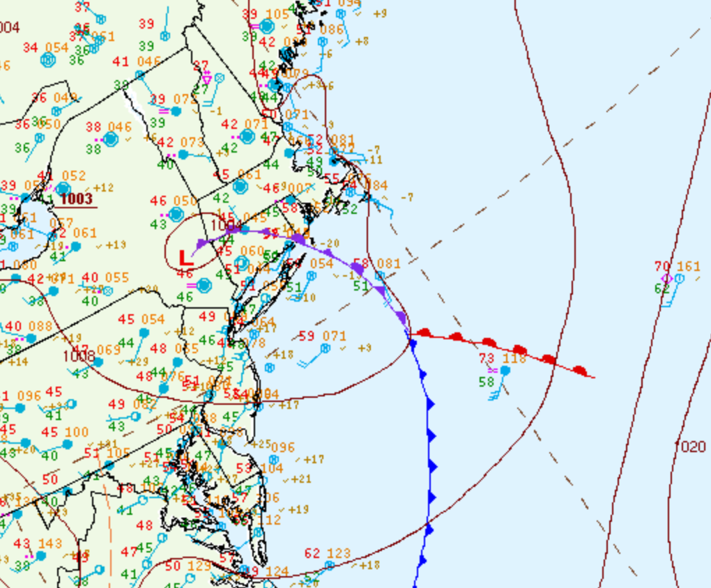
Figure 1. Surface analysis at 12Z on October 29, 2018 showing mean sea-level pressure (MSLP) contours, surface observations, fronts and pressure centers (WPC, 2017)

The Woods Hole, MA EF0 tornado of October 29, 2018 impacted Barnstable County in Massachusetts. According to NOAA (2020), the EF0 tornado caused no fatalities or injuries, but caused $300 dollars in property damage. The tornado touched down near Gansett Road at 9:58 am EDT. The tornado travelled for 0.1 mile and had a maximum width of 10 yards.

Figure 2. Episode narrative for October 23, 2018 (NOAA NCEI, 2020).

Sources

NWS Weather Prediction Center Surface Analysis Archive. (2017). Surface analysis 21Z Mon Oct 29 2018. Retrieved from: https://www.wpc.ncep.noaa.gov/archives/web_pages/sfc/sfc_archive.php

NOAA National Centers for Environmental Information (2020). Storm Events Database. Retrieved from: https://www.ncdc.noaa.gov/stormevents/

National Centers for Environmental Information reports:

A waterspout in Vineyard Sound came ashore in Woods Hole, MA then quickly dissipated. Eyewitness reports at the Woods Hole Golf Club described a swirling mass that lofted four wooden Adirondack chairs into the air and deposited them 500 feet away onto a tennis court. There was no other damage. At the same time, two nearby weather stations reported wind gusts of 56 (Woods Hole Yacht Club) and 65 mph (Mesonet site at Woods Hole Passage Light). There was also a report that a workman's circular saw was blown away by strong winds on Penzance Road in Falmouth, but the survey team was unable to find any evidence of the tornado there.