

This EF1 tornado touched down in a forested area north of the CN railway on the east side of Dryden. It cut through trees on a path to the northeast, then sliced across the south side of the Boyer Truck Sales yard. Next the tornado caused minor damage as it hit several homes and an OPP detachment facility while crossing Kahn Avenue and the Trans Canada Highway. On the north side of the highway the tornado blasted through another cluster of homes on Parr Avenue, uprooting and snapping scores of trees and causing extensive property damage. It dissipated in a field northeast of there. The tornado tracked for 1.7 kilometres with a path that was up to 450 metres wide, along which more than 50% of trees were snapped or uprooted.
This probable tornado was identified and documented as part of the Northern Tornadoes Flyover Project Year 1 Pilot. The study was conducted by a research team from The University of Western Ontario, in partnership with scientists from Environment Canada. Over the course of the summer, several previously unknown or undocumented tornadoes were identified through the program.
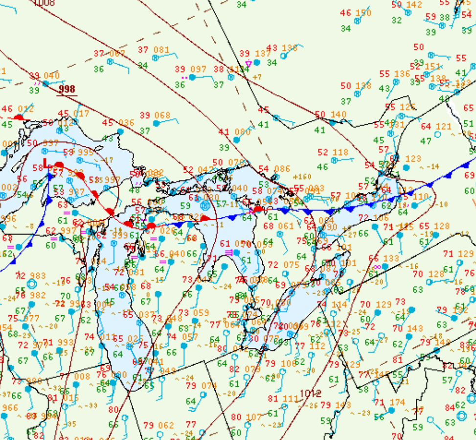
Figure 1 depicts the surface observations at 7:00 pm CDT, which shows a strong occluding low pressure system over Manitoba with an occluding front across northwestern Ontario. A thunderstorm (marked as a red ‘R’) was also observed over Dryden at this time. This front was the focus for thunderstorm activity in the late afternoon hours of June 14th, which ultimately led to this tornado.
Sources
NWS Weather Prediction Center Surface Analysis Archive. (2017). Surface analysis 00Z Thu Jun 15 2017. Retrieved from: https://www.wpc.ncep.noaa.gov/archives/web_pages/sfc/sfc_archive.php