

After developing and producing an earlier tornado near Lucan, this small low-topped supercell continued eastward just to the north of Highway 401. It maintained a rapidly-rotating wall cloud for its duration and produced funnel clouds near Granton and Embro. It then passed north of Woodstock and produced this second tornado near Drumbo. Like the Lucan tornado, this one appeared as a white tapered cone that briefly became fully condensed to the ground. Witnesses captured photos and videos as it spun harmlessly by, without producing any known damage.
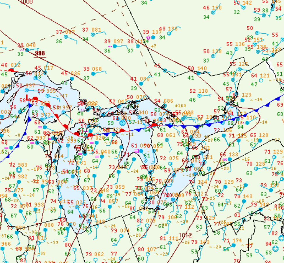
Figure 1 depicts the surface observations at 2:00 pm EDT, which shows a stationary front across southern Ontario. This front became the focus for thunderstorm activity throughout the afternoon hours of July 12th, which ultimately led to three tornadoes across southern Ontario on this day.
Sources
NWS Weather Prediction Center Surface Analysis Archive. (2017). Surface analysis 18Z Wed Jul 12 2017. Retrieved from: https://www.wpc.ncep.noaa.gov/archives/web_pages/sfc/sfc_archive.php