

This spectacular tornadic waterspout was spawned as a cluster of high-precipitation storms moved eastward through Southern Ontario during the mid-afternoon. As one storm in particular passed through Barrie, it exhibited very low cloud bases and – reportedly – considerable motion. Somewhere over the lake the tornado developed at around 4:20 pm. It was a long serpentine tube that snaked to the surface with a ring of spray at its base. One family caught the spout on video, filming in awe and debating how to react as it moved across the water near Georgina Island.
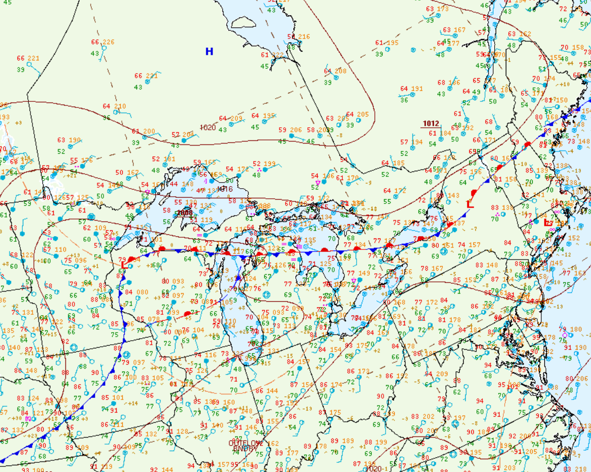
Figure 1 depicts the surface observations at 2:00 pm EDT, which shows a stationary front across southern Ontario. This front became the focus for thunderstorm activity throughout the afternoon hours of July 12th, which ultimately led to three tornadoes across southern Ontario on this day.
Sources
NWS Weather Prediction Center Surface Analysis Archive. (2017). Surface analysis 18Z Wed Jul 12 2017. Retrieved from: https://www.wpc.ncep.noaa.gov/archives/web_pages/sfc/sfc_archive.php