

This EF1 tornado left a long track of intermittent but heavy damage through area forests. It was the strongest of three tornadoes that ripped through the remote region of Northern Ontario. The tornado was identified and documented as part of the Northern Tornadoes Flyover Project Year 1 Pilot. The study was conducted by a research team from The University of Western Ontario, in partnership with scientists from Environment Canada. This was one of several previously unknown or undocumented tornadoes that were identified through the program over the course of the 2017 storm season.
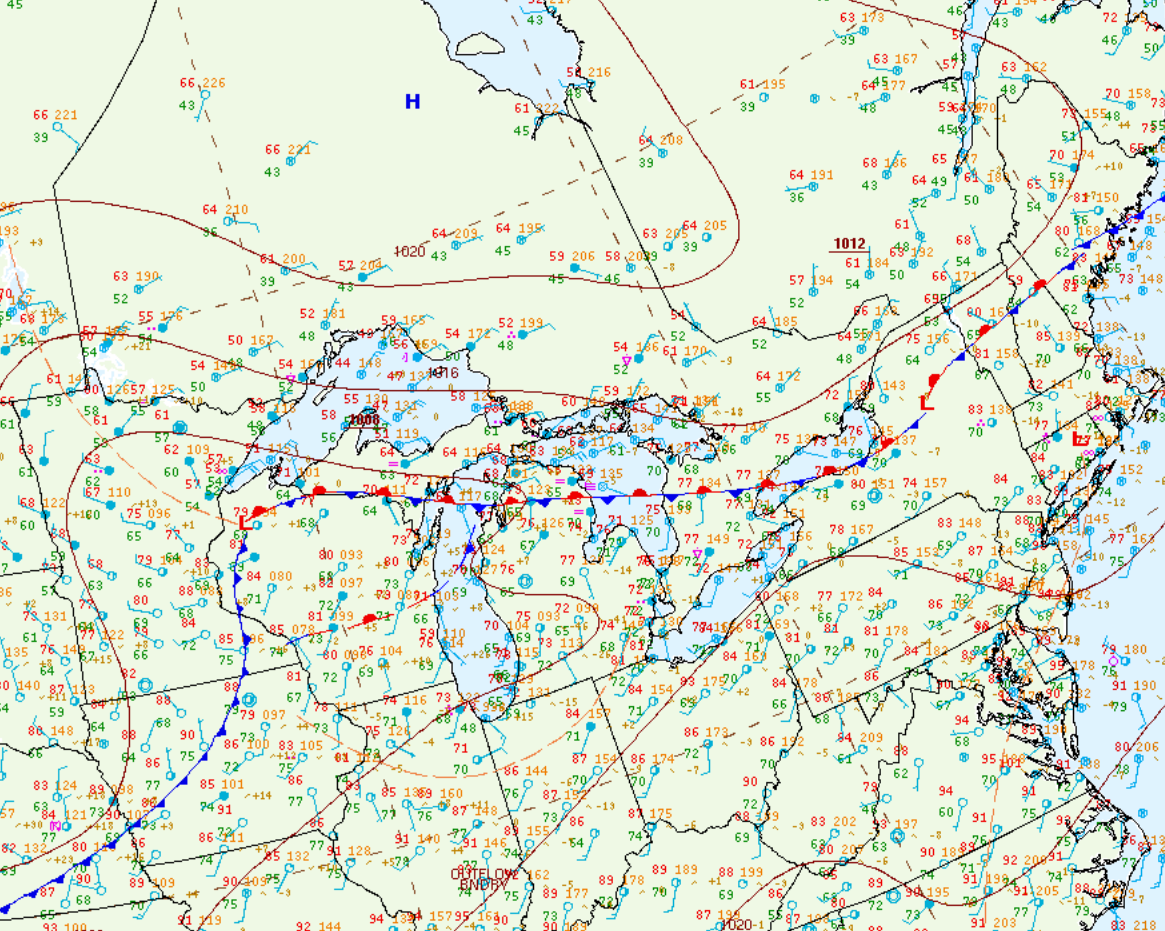
Figure 1 depicts the surface observations at 10:00 am CDT, which shows a strong cold front moving across northwestern Ontario. This front became the focus for intense thunderstorms, which ultimately led to three tornadoes across Ontario.
Sources
NWS Weather Prediction Center Surface Analysis Archive. (2017). Surface analysis 15Z Fri Sep 22 2017. Retrieved from: https://www.wpc.ncep.noaa.gov/archives/web_pages/sfc/sfc_archive.php