

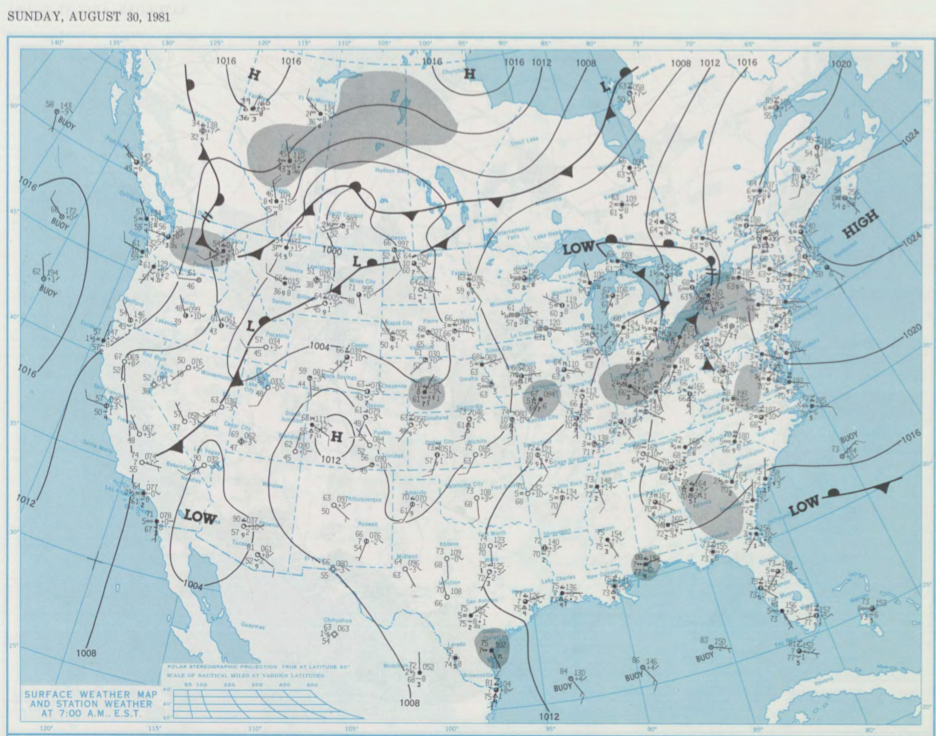
Figure 1 shows the surface observations at 7:00 am CDT, which shows a cold front moving across central Manitoba and a warm front across south-central Saskatchewan. A new area of low pressure developed in southern Saskatchewan with a cold front extending south into the United States and warm front across south-central Manitoba. This warm front likely triggered thunderstorms in the evening hours of August 30th, which ultimately led to this tornado.
According to Environment and Climate Change Canada (2018), an F0 tornado touched down at 6:00 pm CDT near Plumas, MB. The track and width of this tornado was not documented by ECCC. The tornado caused no injuries, fatalities or property damage.
Sources
NOAA Central Library. (2020). U.S. Daily Weather Maps. Sunday August 30, 1981 [PDF]. Retrieved from https://library.noaa.gov/Collections/Digital-Collections/US-Daily-Weather-Maps
Environment and Climate Change Canada Data. (2018). Canadian National Tornado Database: Verified Events (1980-2009) – Public. Retrieved from: http://donnees.ec.gc.ca/data/weather/products/canadian-national-tornado-database-verified-events-1980-2009-public/