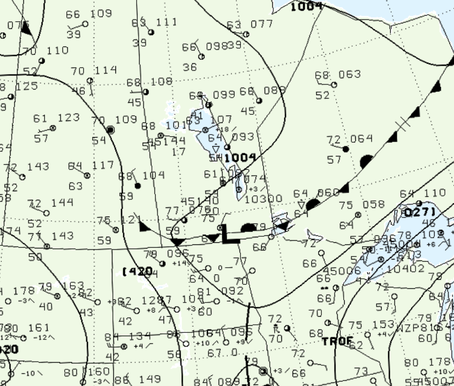
Figure 1 depicts the surface observations at 1:00 pm CDT, which shows a low pressure system on the Manitoba/North Dakota border with a cold front extending west across Manitoba and a stationary front extending east across northwestern Ontario. The interaction between these fronts and the low pressure led to three tornadoes across southern Manitoba on this day:
“Powerful thunderstorms with hail and heavy rain blew through Winnipeg on July 13 and 14, knocking out power to thousands of people and prompting forecasters to issue tornado warnings across southern Manitoba. On July 14, a medium-strength tornado struck Gretna, MB leveling fields of crops, blowing down equipment sheds and garages, and knocking down hydro poles. A dozen trees, some close to a metre in diameter, were uprooted by the sheer power of the twister. The storm also brought a massive hailstorm with softball-size hailstones farther north near Altona. The 10-minute hailer pummeled the town and surrounding area, causing millions of dollars in damage to crops, buildings and vehicles” (Environment Canada, 2017).

According to Environment and Climate Change Canada (2018), an F1 tornado touched down at 2:50 pm CDT near Gretna, MB. The path of the tornado was not documented by ECCC, but its maximum width was 200 metres. The tornado caused no fatalities, injuries or documented property damage.
Sources
NWS Weather Prediction Center Surface Analysis Archive. (2017). Surface analysis 18Z Mon Jul 14 2003. Retrieved from: https://www.wpc.ncep.noaa.gov/archives/web_pages/sfc/sfc_archive.php
Environment and Climate Change Canada. (2017). Runner-up stories and regional highlights for 2003. Retrieved from https://ec.gc.ca/meteo-weather/default.asp?lang=En&n=C11F81B4-1#wb-cont
Environment and Climate Change Canada Data. (2018). Canadian National Tornado Database: Verified Events (1980-2009) – Public. Retrieved from: http://donnees.ec.gc.ca/data/weather/products/canadian-national-tornado-database-verified-events-1980-2009-public/

