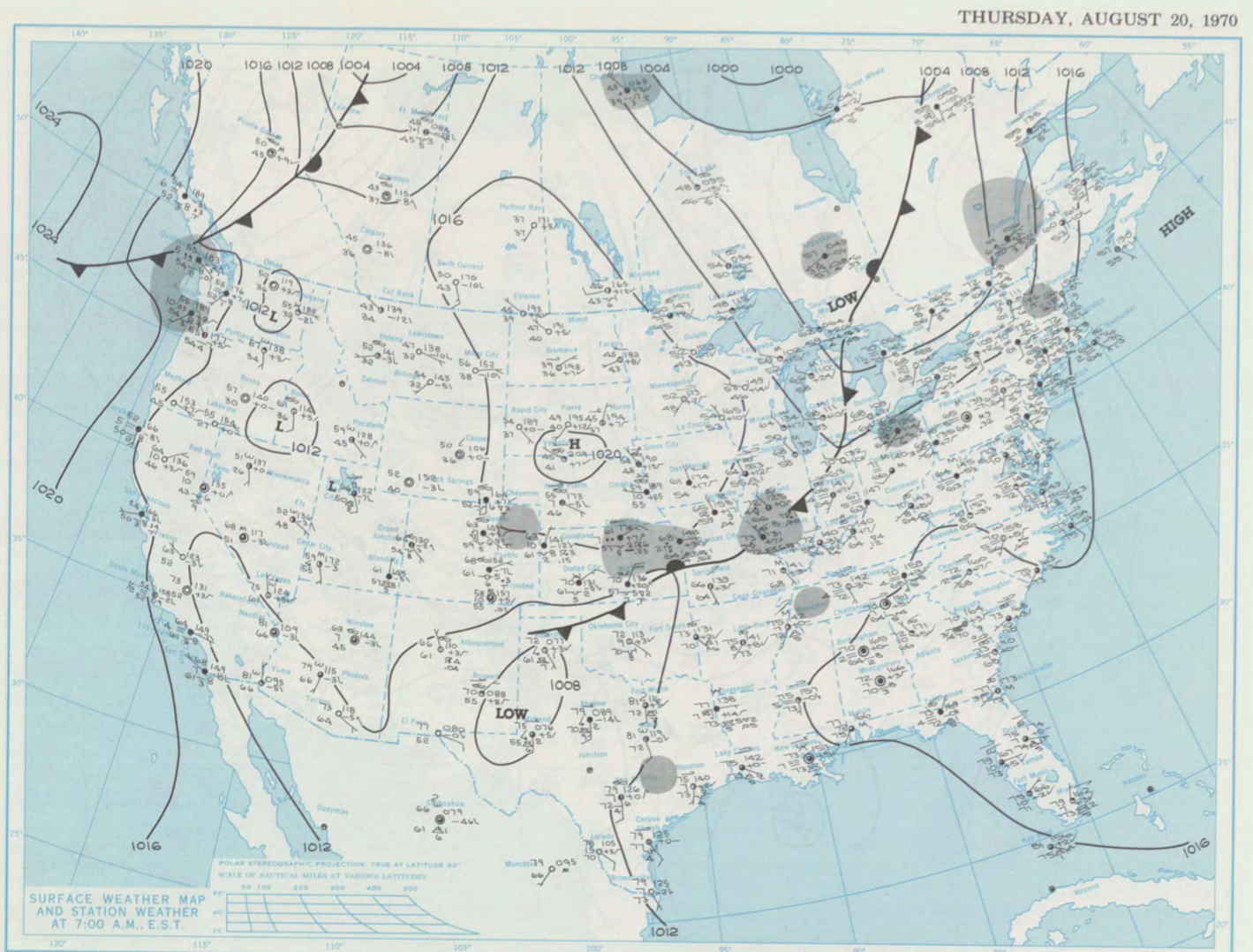
Figure 1 depicts the surface observations at 7:00 am EST, which shows an area of low pressure over the Great Lakes in Ontario with a cold front extending south across Michigan and a stationary front extending across Northern Ontario and Northern Quebec. The stationary front became the focus for intense storms near Sudbury, which ultimately led to this strong tornado.

According to Public Safety Canada (2019), “an F3 tornado (wind speeds of 252-330 km/h) caused the loss of six lives, 200 injuries, and extensive damage to property”.
Sources
NOAA Central Library. (2019). U.S. Daily Weather Maps. Thursday August 20, 1970 [PDF]. Retrieved from https://library.noaa.gov/Collections/Digital-Collections/US-Daily-Weather-Maps
Public Safety Canada. (2019). The Canadian Disaster Database. Retrieved from https://www.publicsafety.gc.ca/cnt/rsrcs/cndn-dsstr-dtbs/index-en.aspx
Environment and Climate Change Canada. (2017). Top weather events of the 20th century. Retrieved from https://ec.gc.ca/meteo-weather/default.asp?lang=En&n=6A4A3AC5-1#1921-1940

