

Published on
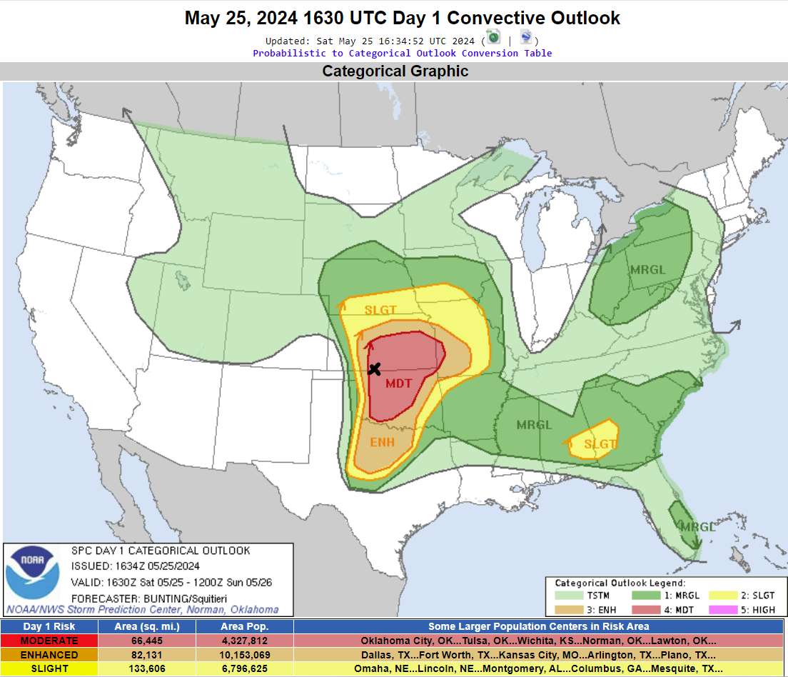
The Storm Prediction Center painted a Moderate Risk over much of Kansas and Oklahoma. Storms were expected to develop across North Texas, Southwest Oklahoma, Central/Northern Oklahoma and possibly Southern Kansas. We opted to play the Northern Oklahoma/Southern Kansas region. Our target is noted by the black X.
Storms quickly developed near Beaver Oklahoma and moved east northeast.
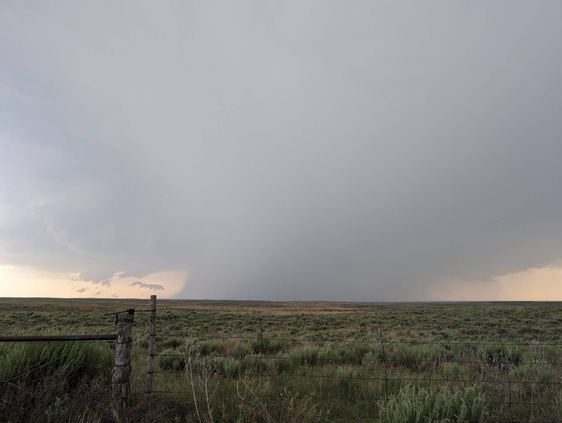
The storm happened to develop in an area with limited road options. We had a view for a bit north of Buffalo, Oklahoma / south of Sitka, Kansas. Once we lost view, we had to jump back south to US64 – going clear back east to Alva, Oklahoma before jumping back north. With storm motion east/northeast at 45 mph, it took us a bit to catch up. Finally caught back up by running north of Alva, up to Hardtner and Kiowa, Kansas.
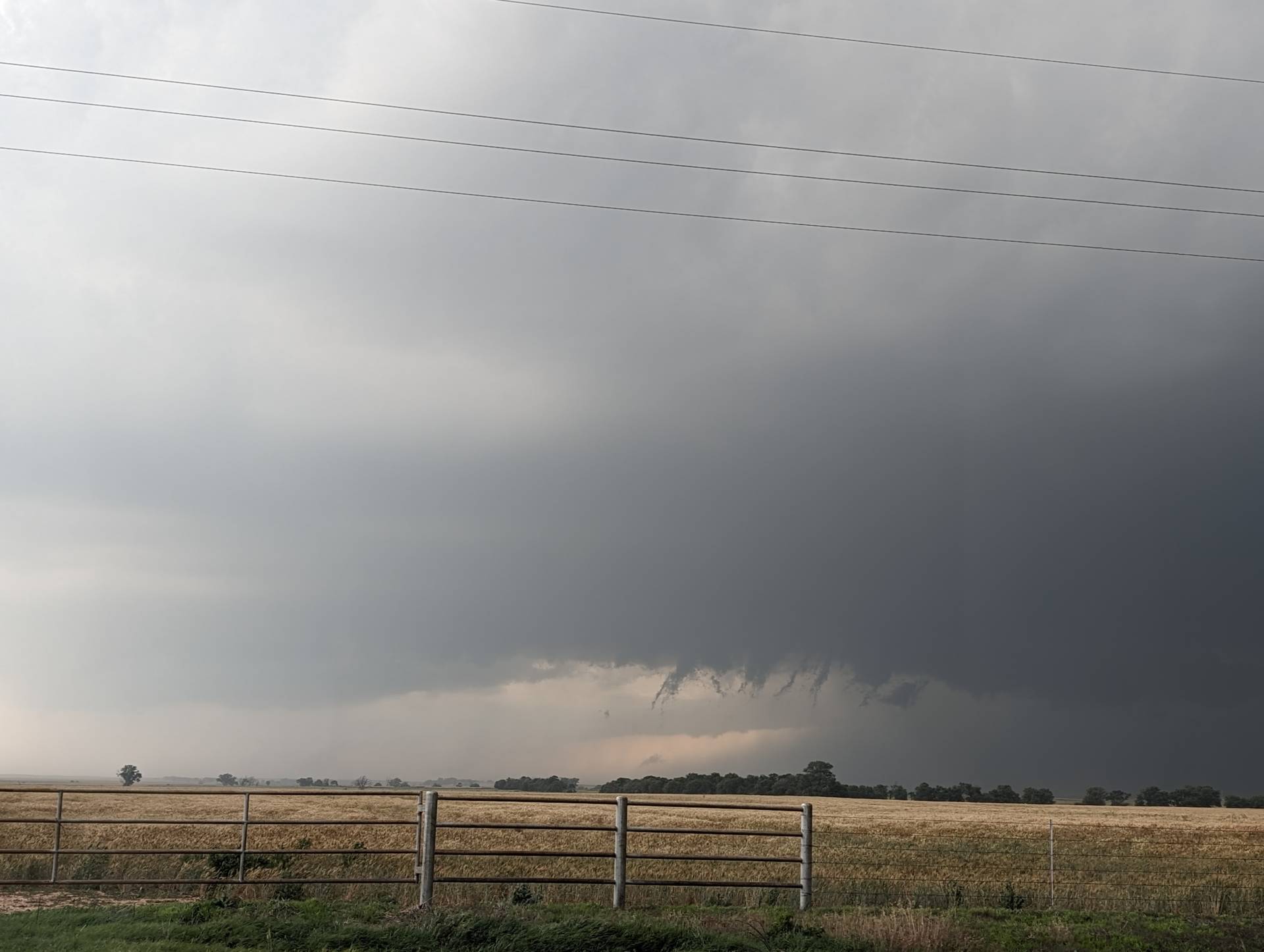
The storm went tornado-warned after a cell merger – producing a brief tornado just north of Hazelton, Kansas.
We went east of Kiowa, and then north to K2 highway – jetting east to Anthony. We did see a brief tornado near Hazelton, which was rated EF-0 – but did not see the EF-2 tornado that developed just behind us. We were in blinding rain and just wanted to stay ahead of the circulation.
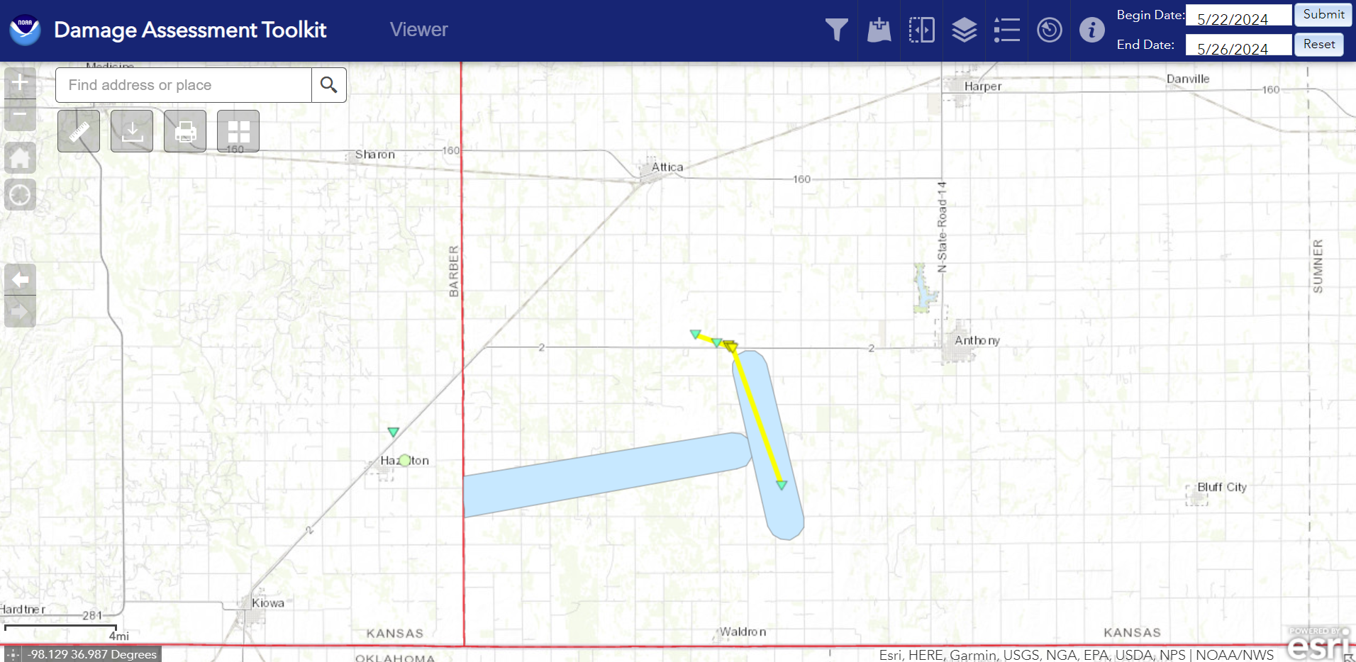
The damage survey showed the two tornadoes – a deviant motion EF-2 developed south of K2 and moved northwest and then west before dissipation.
Being a high-precipitation supercell – cell mergers kept the storm from really producing long, prolific tornadoes. Had the mergers not been an issue, this supercell likely would have produced a major tornado.
Community Comments
There are no comments on this post
Want to leave a comment? Join our community → OR Login →