

Published on
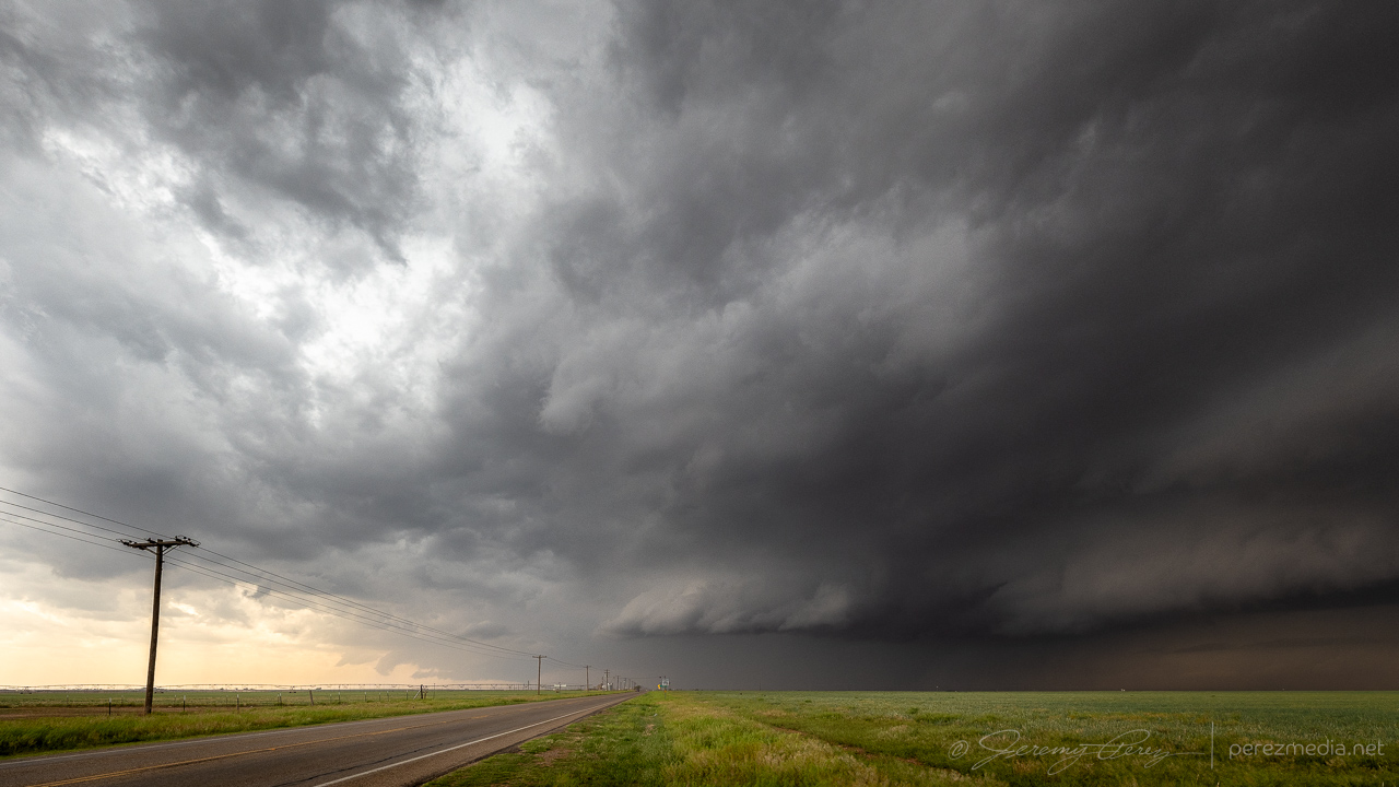
Another day of modest 25-30kt H5 flow over the Texas Panhandle this day serving up 40-50kt of effective bulk shear and MLCAPE reaching 2000-2500 j/kg by late afternoon. There was an outflow boundary drifting across Lubbock and arcing to the northwest that would be great for storms to latch onto.
I got another late start, this time because I wanted to stop by an excellent Lubbock camera store, Armadillo Camera, to pick up a new ball head mount to improve on the messed up situation I had with tornado video the day before. I got just what I needed, but was now running late.
If I had gotten to the target area sooner, I might not gave gotten distracted by a competing storm. A big cell got rolling near Sudan as I moved in. As I got closer, another one formed off its forward flank to the east. In my haste to figure out the best option, I figured that the outflow boundary was in play for both cells, and with new thoughts about storm nudgers helping the downstream storm out, I opted to hang out with the eastern storm near Amherst.
It wasn’t the right call. The eastern storm did not hang out on the boundary, but gradually moved deeper under the anvil of the Sudan storm’s forward flank. By this time, I was far out of position for the western cell and just hoping that some sort of nudge magic would still happen for my eastern storm.
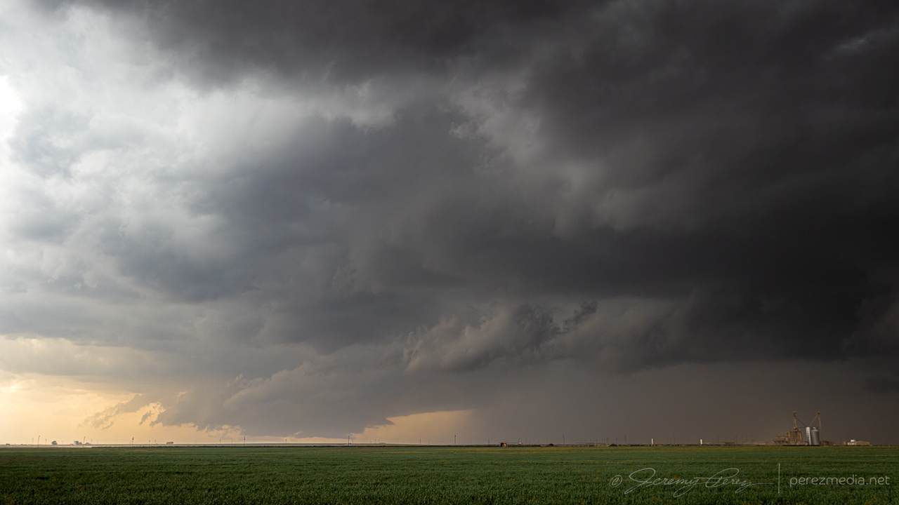
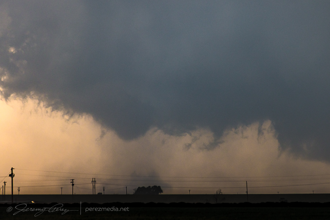
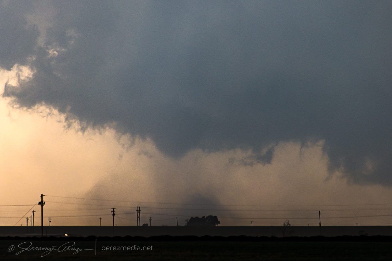
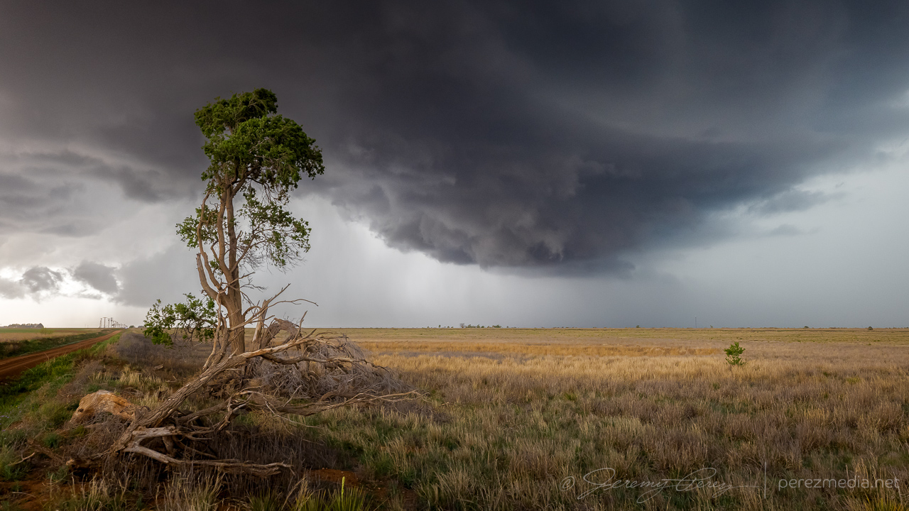
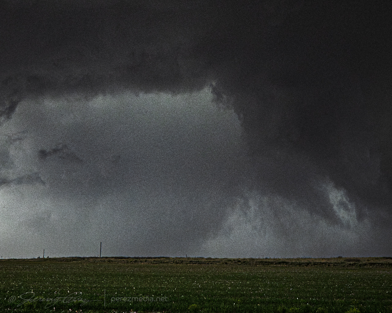
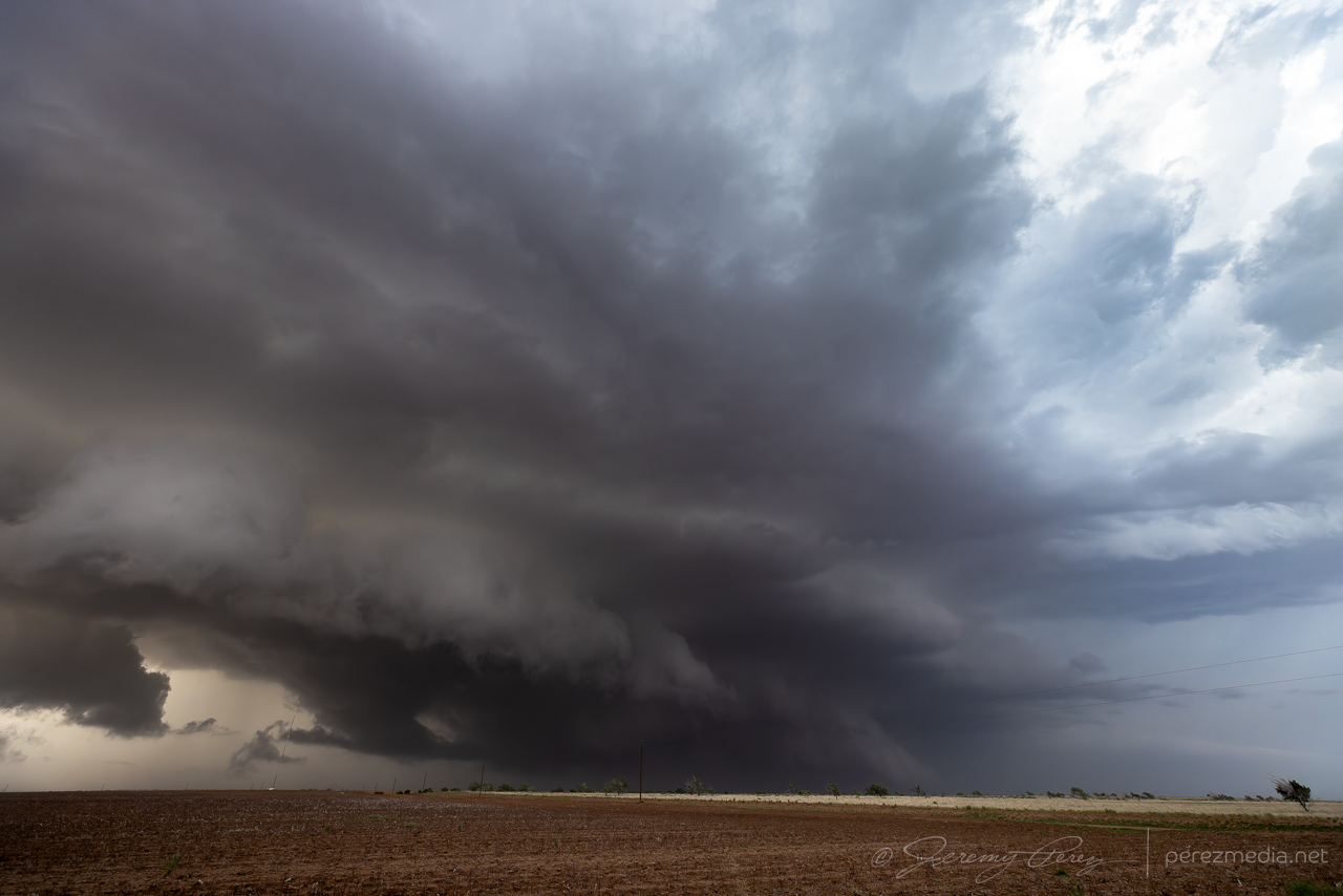
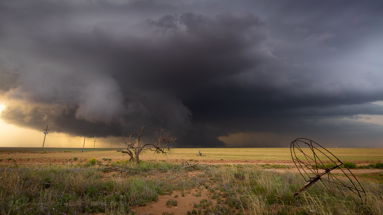
The silhouette of the Sudan storm kept getting better and was now hinting at dust beneath the base. RFD surge or something more interesting?
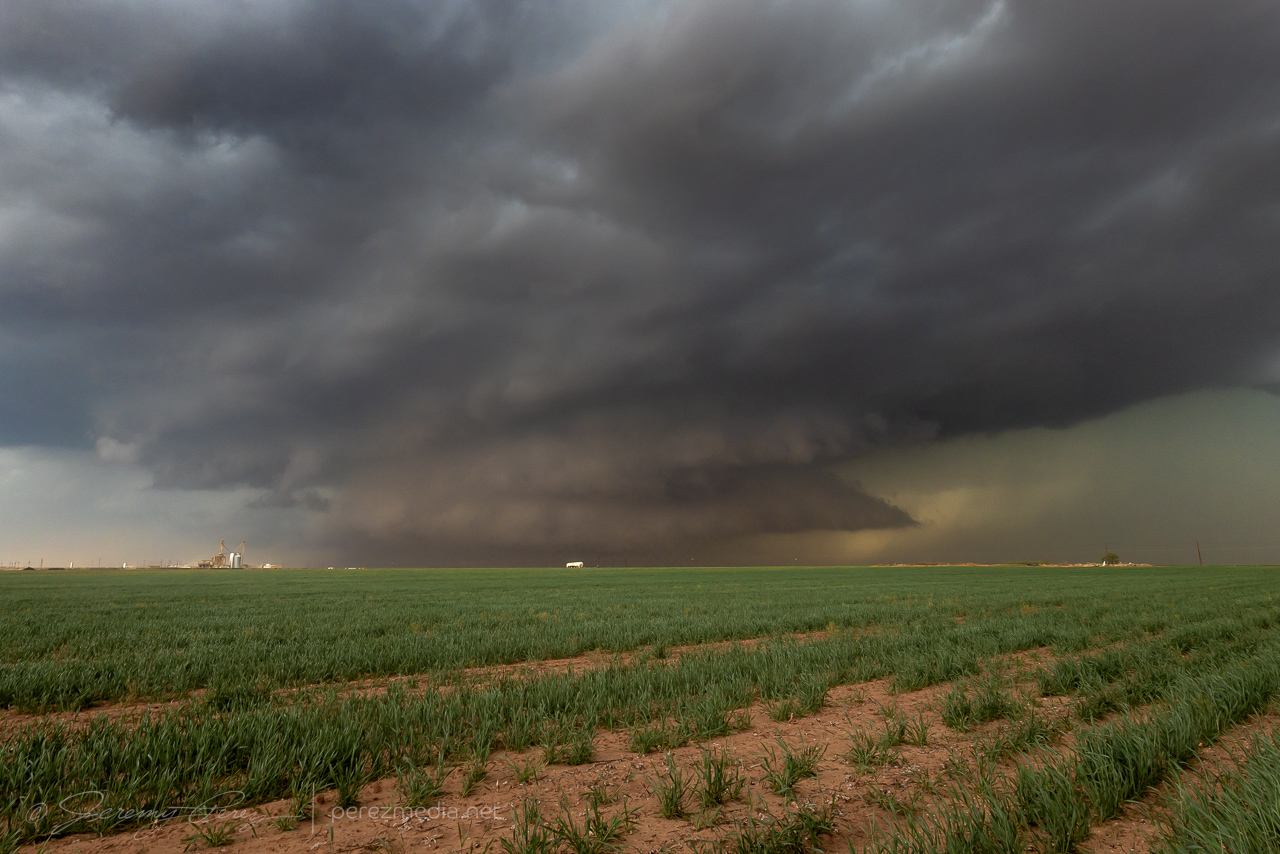
Within a minute the dustup had consolidated as a funnel descended above it. All in distant silhouette while I tried to figure out which camera to quickly swap on a telephoto lens.
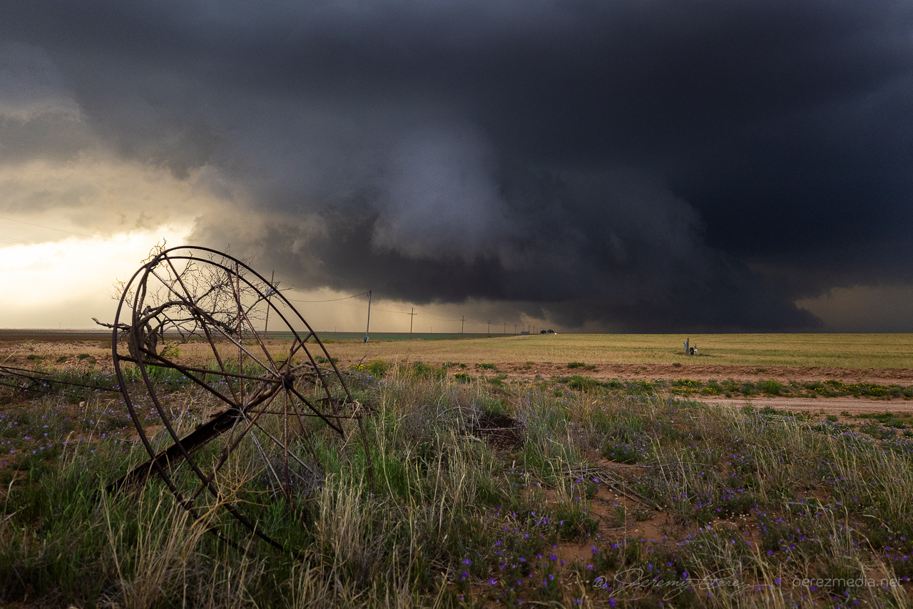
With the 70-300 lens finally in place, I managed a few shots as the tornado churned up the landscape. Only later did I realize how amazing that would have looked closer in with good light. But it was still a catch.
As that distant event faded away, my failed storm continued to drift into the forward flank of its buddy and get all the outflow feels to it. So what happened to my storm nudger hopes? Task saturation for one. Which led to not noticing how fast the downstream storm was surging north of the boundary. As it moved north, it got buried further and further in the forward flank of its upstream partner. Still noting that a tornado was reported on this downstream storm while it was tucked in there, but a fail mode is that this is an area with terrible contrast and increasingly getting seeded by the other storm’s forward flank. Visibility is just not at all good in that configuration.
The other issue, I think is that this downstream storm formed AFTER the main upstream cell, so I think that setup just wants to overwhelm the downstream cell rather than help balance its rear flank. The other thing worth noting is that the original upstream storm did not get nudged by another cell prior to forming its tornado. It got everything it needed from the outflow boundary it was latched onto. So hopefully I get some pattern recognition on that situation for next time around and not get fooled into targeting a doomed cell.
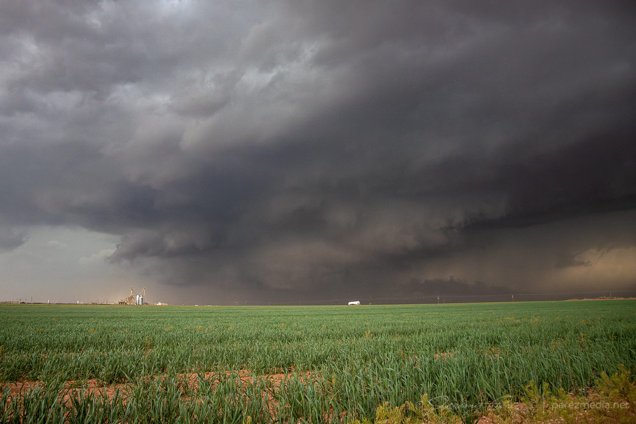
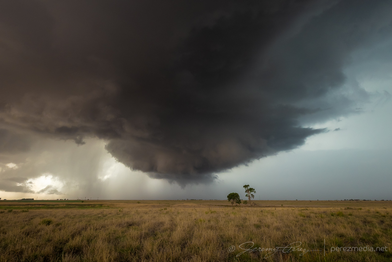
With both storms merging, some reorganization had to take place as I drifted south of Littlefield to see what it would do next.
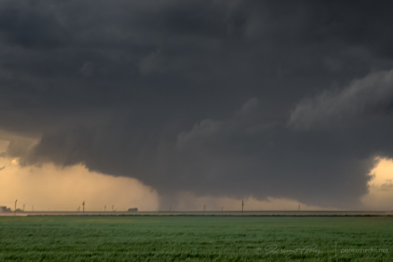
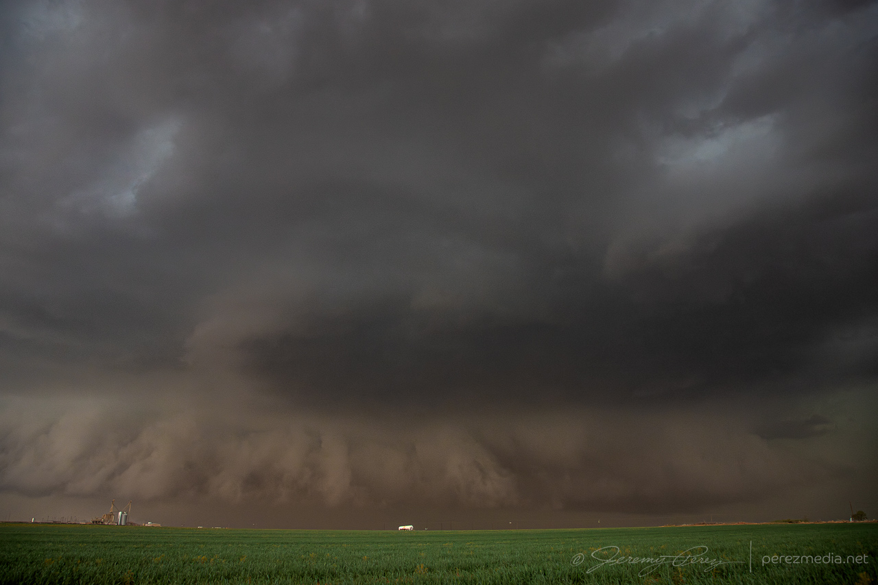
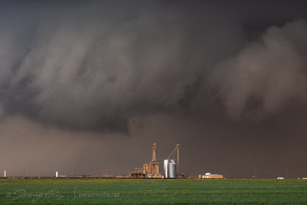
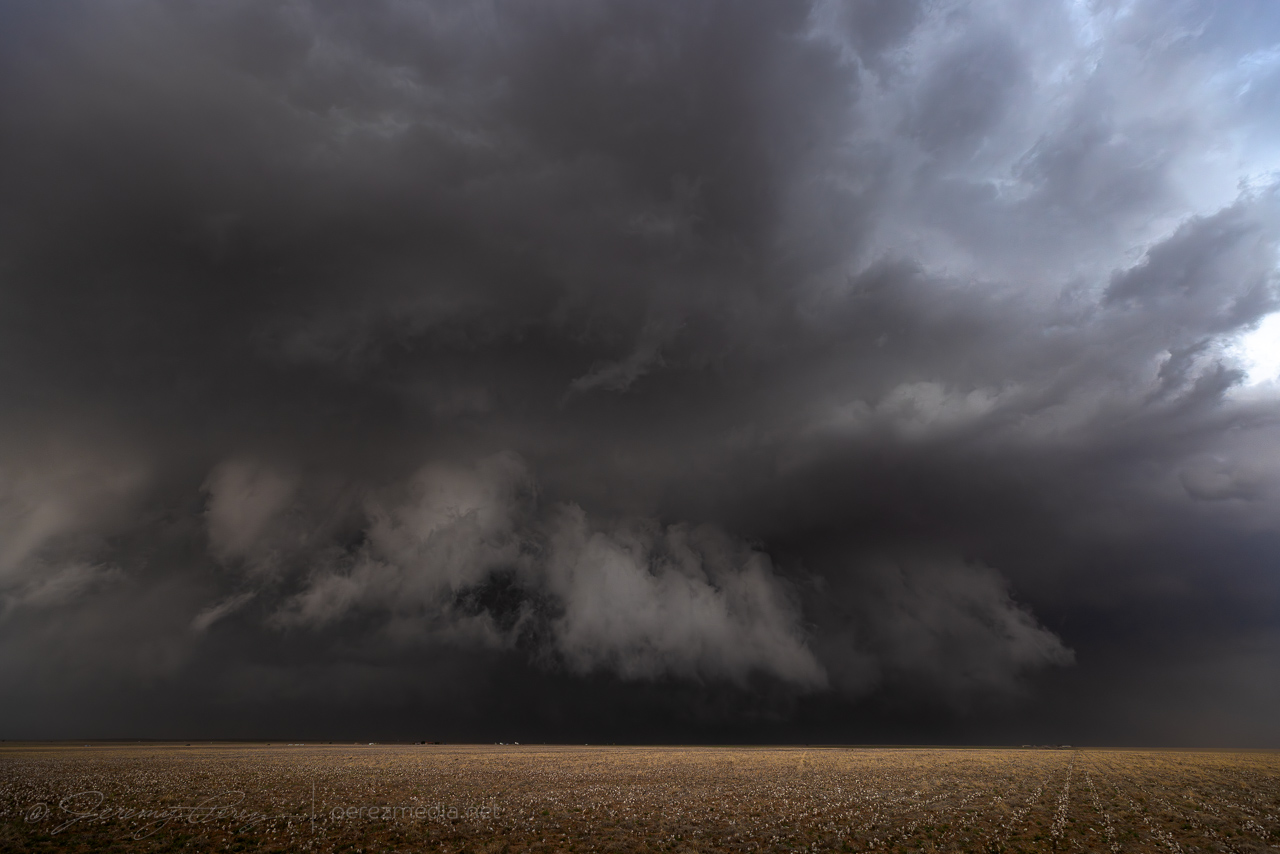
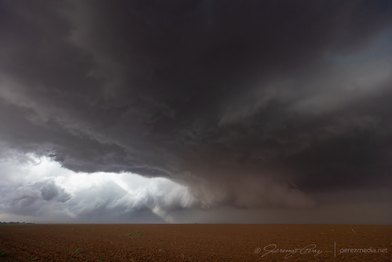
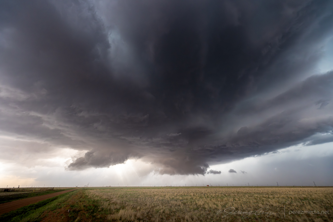
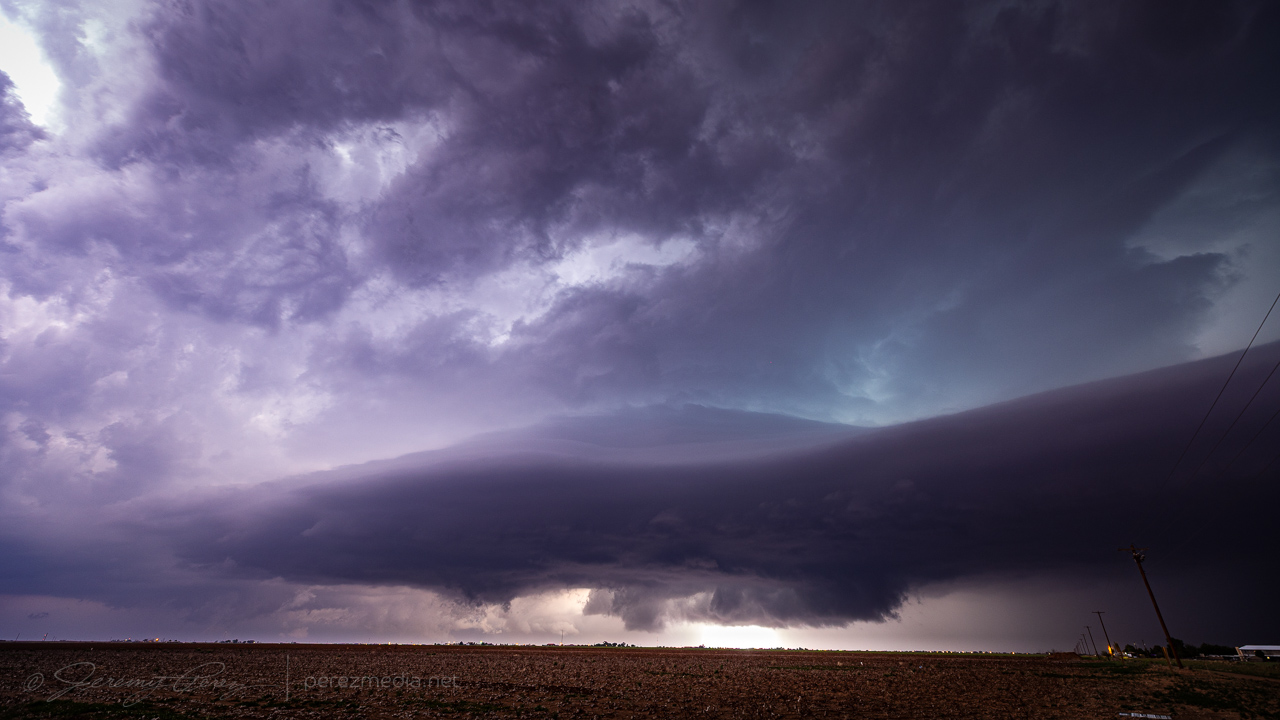
As the new cell consolidated, the rear flank made a quick surge to the east and got reorganized. The base and vault lofted spectacularly overhead with ominous green color and tight focus for the RFD. Radar and NWS damage survey indicated a tornado wrapped up inside the rain as that happened. But nothing that I could pick out even after torturing my images for contrast.
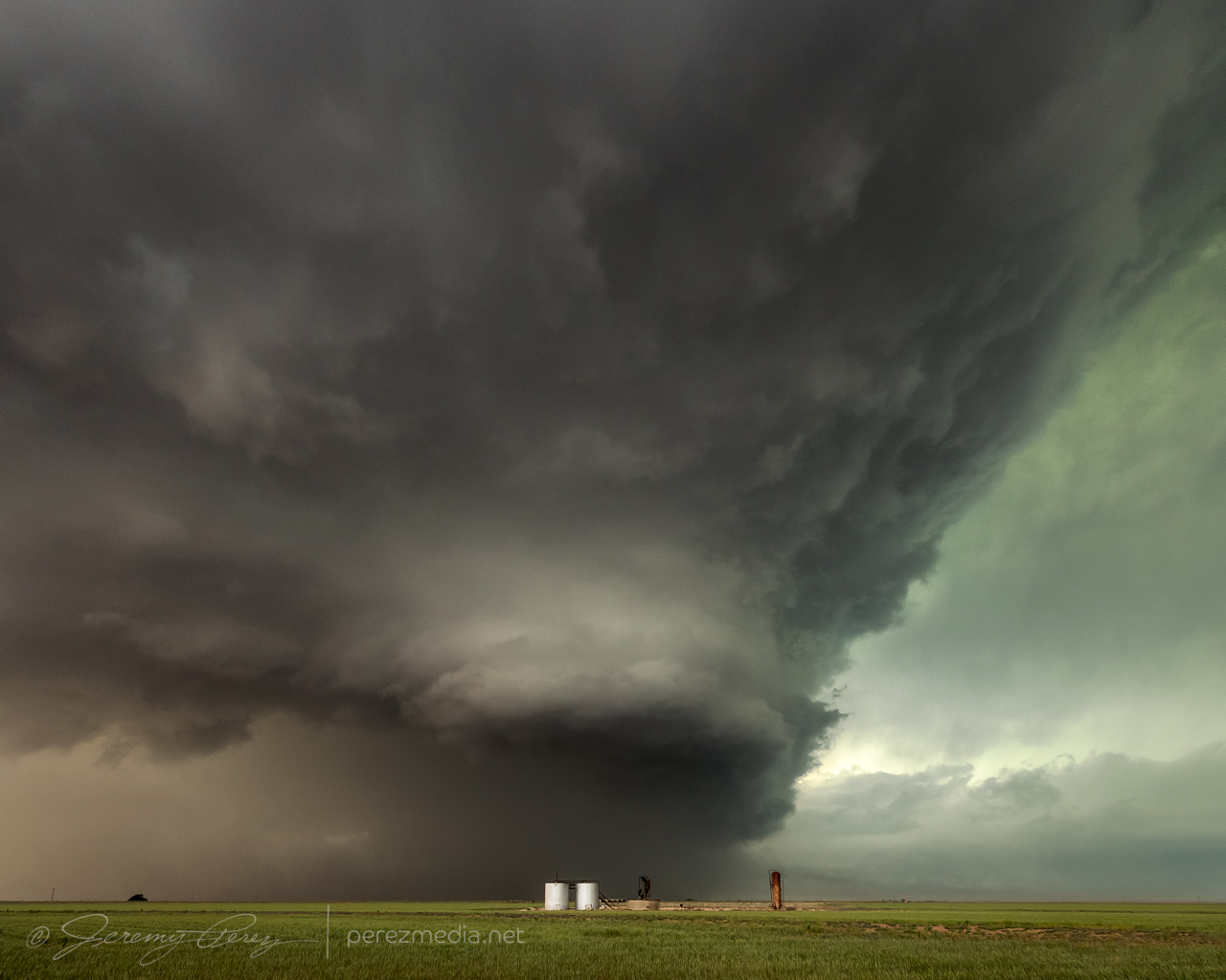
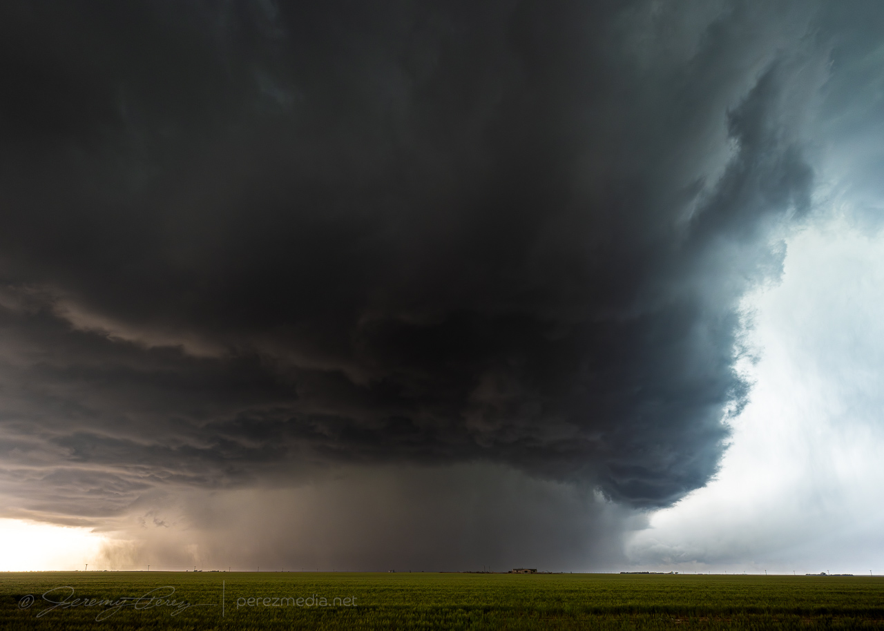
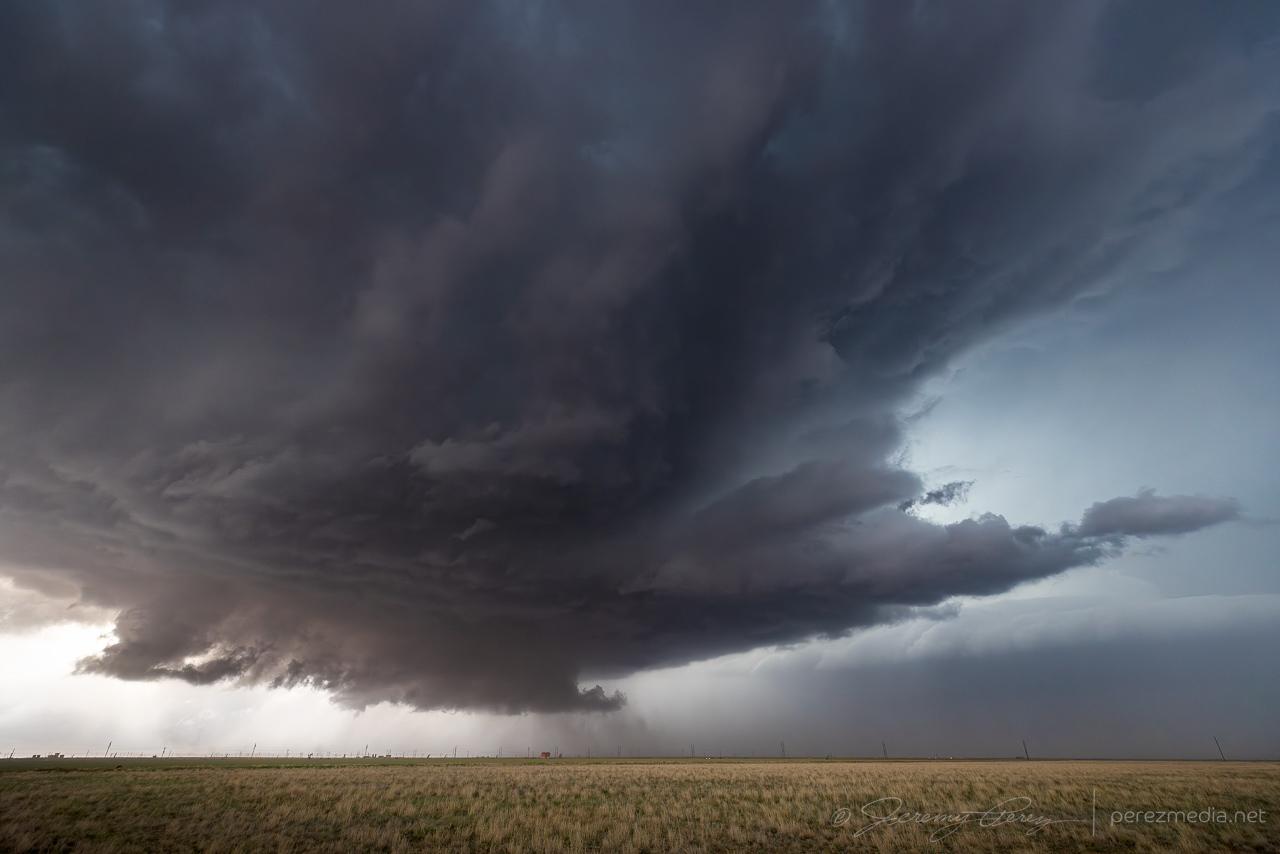
After that burst, the storm seemed to drift north of the boundary and go elevated for a bit as I wound up west of Anton.
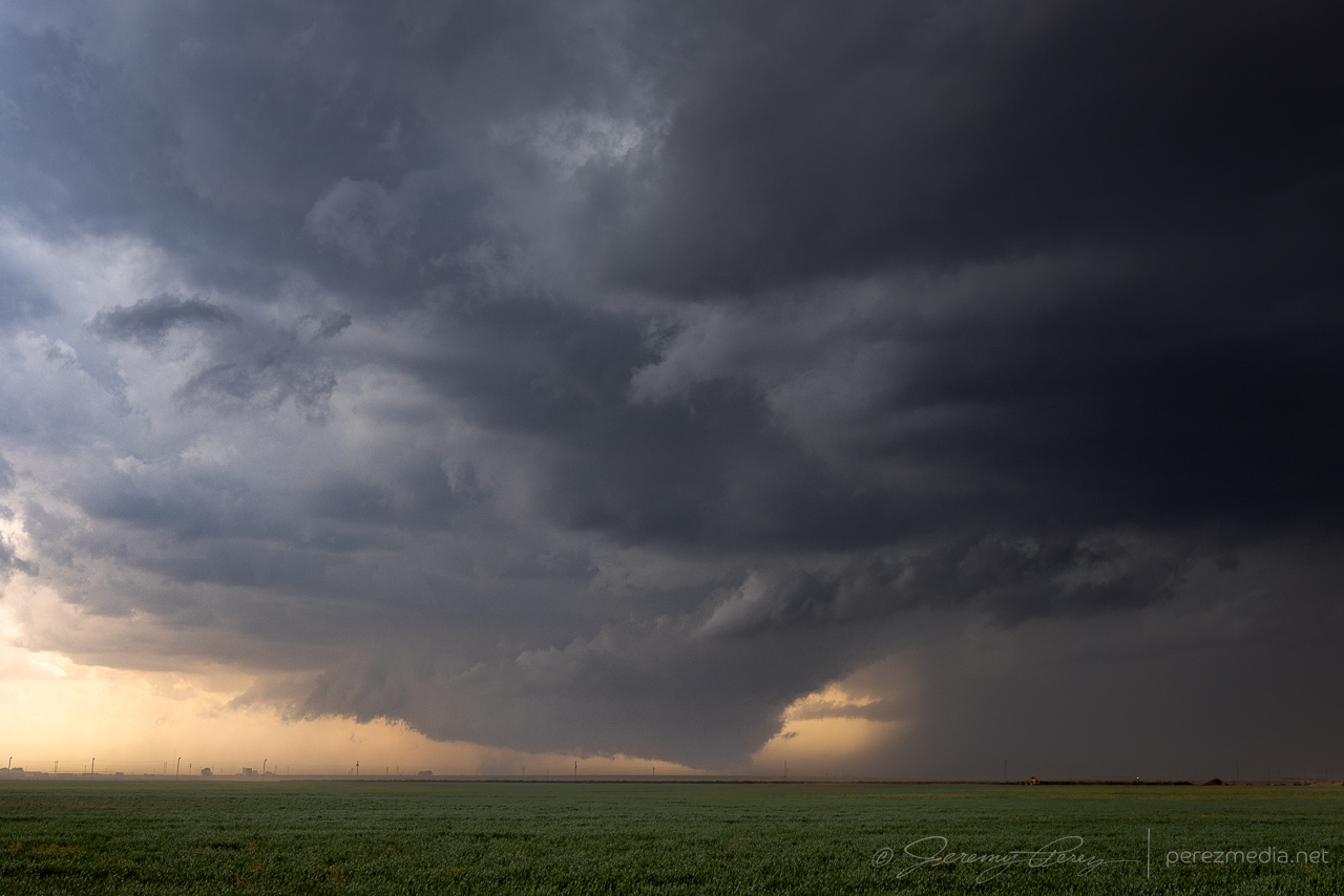
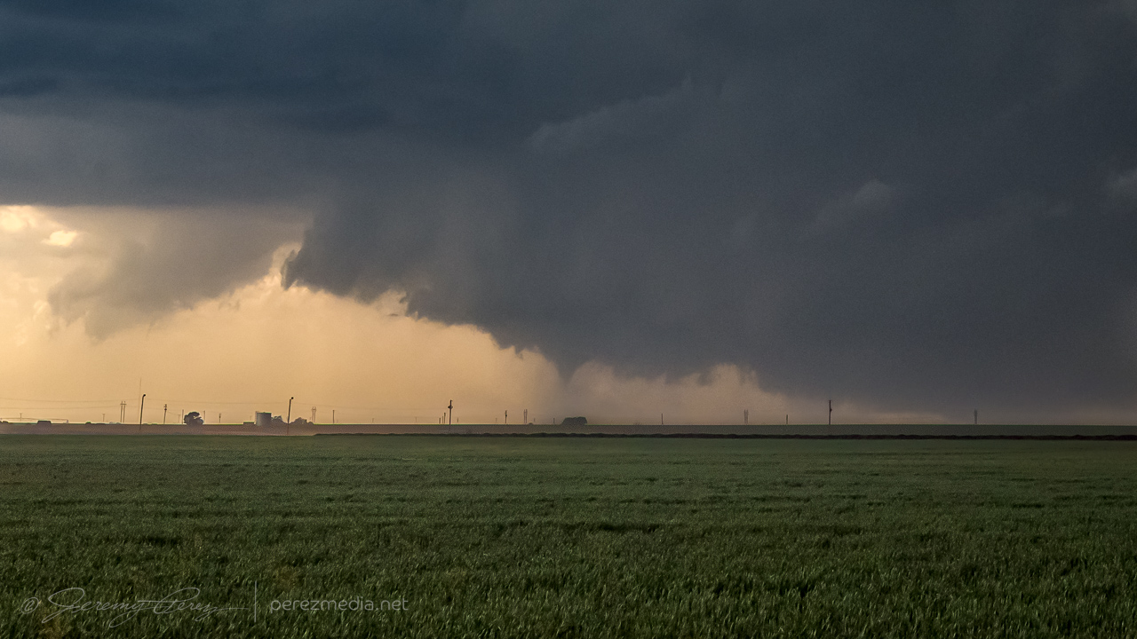
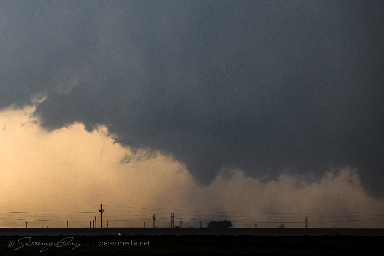
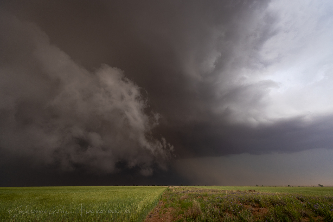
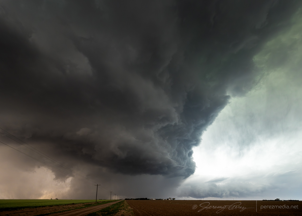
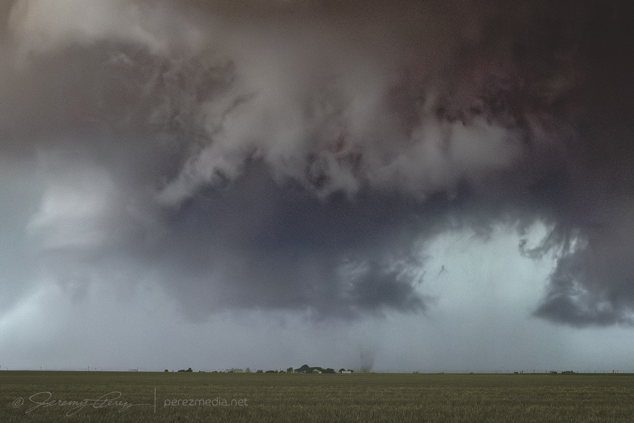
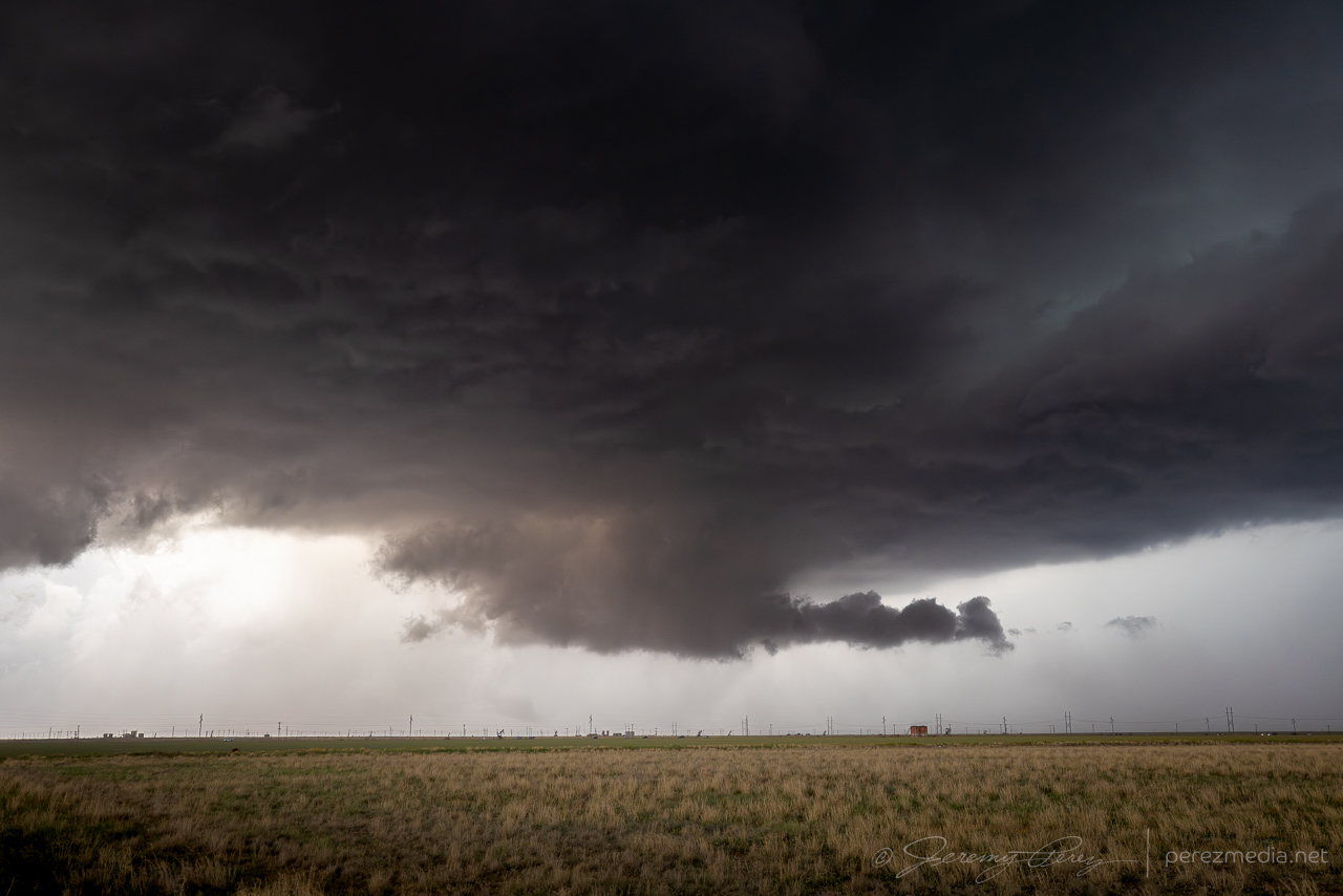
After about 15 minutes, it managed to hop back south far enough to tap into fresh air and go surface based again with some fun, drilled down structure.
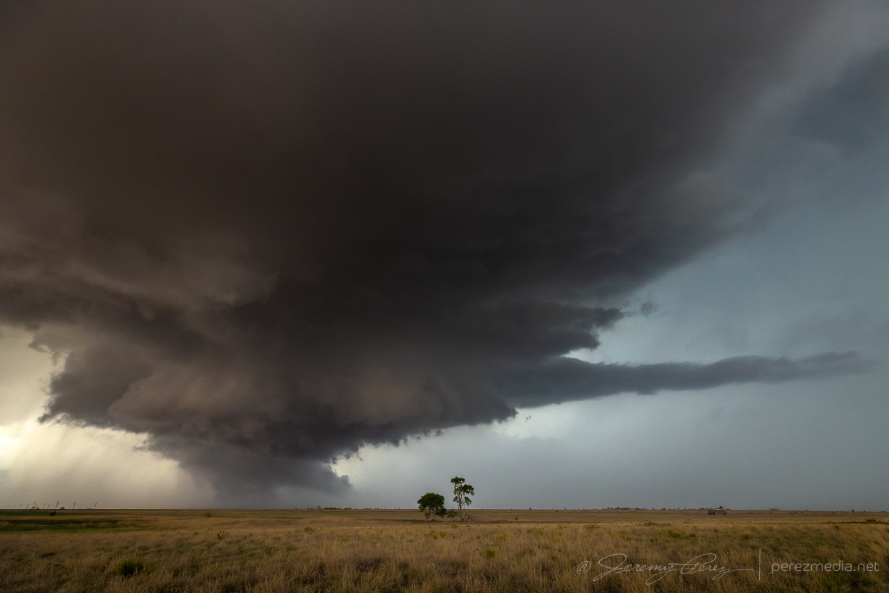
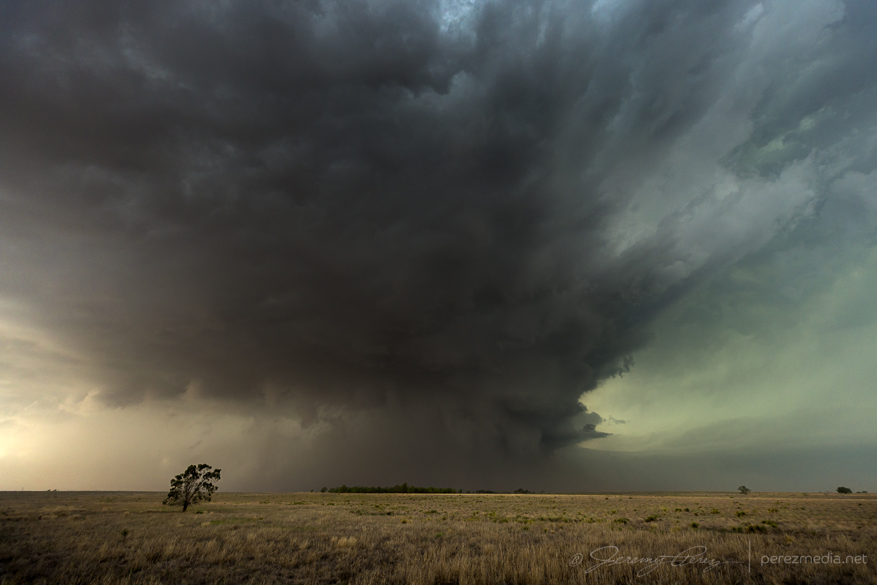
Not long after that, the RFD filled in, developed a tighter couplet, and then opened back up, revealing some faint, thin needles in the circulation, followed by dusty spinups beneath as it surged southward. NWS Damage Assessment Toolkit plots a radar indicated tornadic circulation at that point and time.
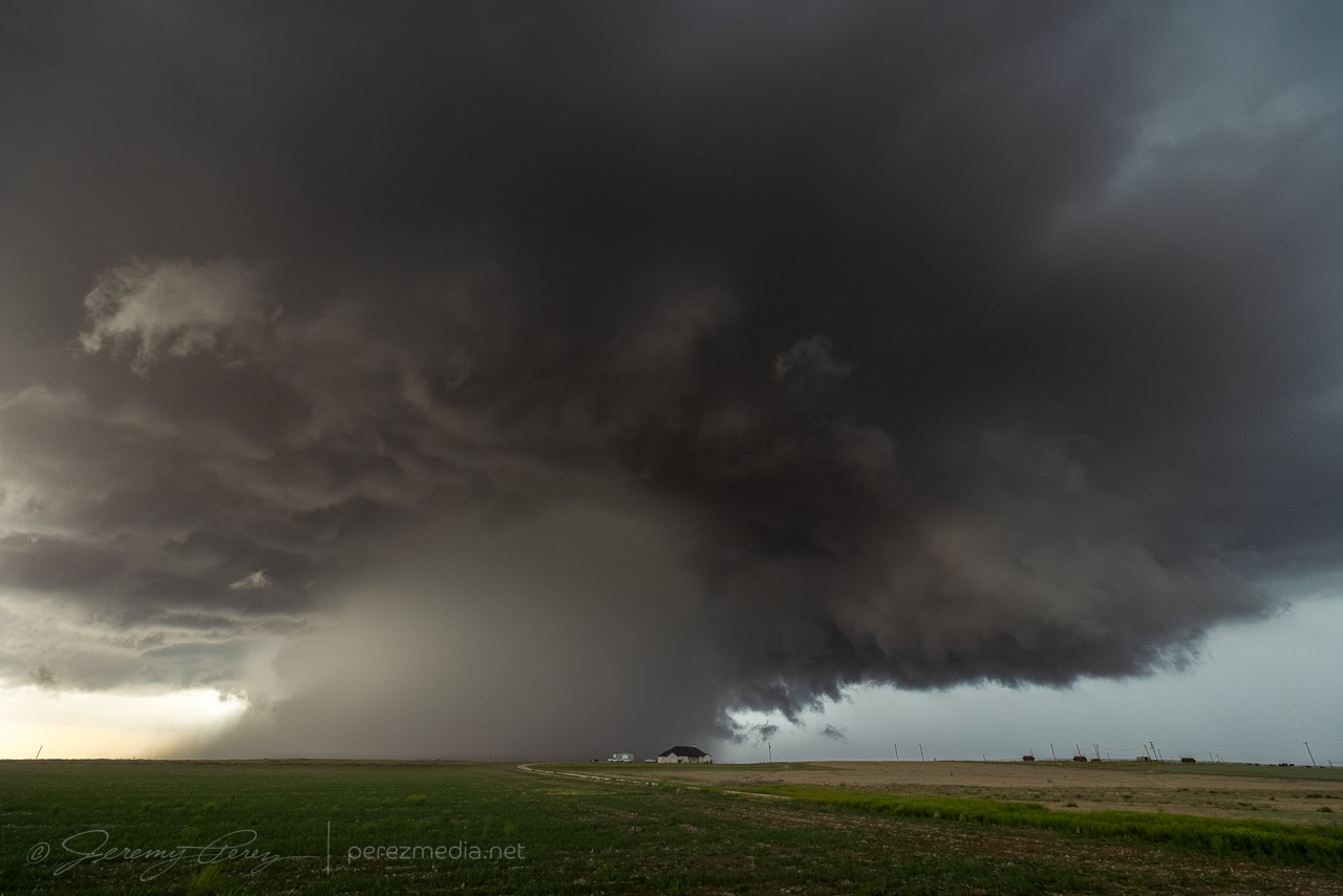
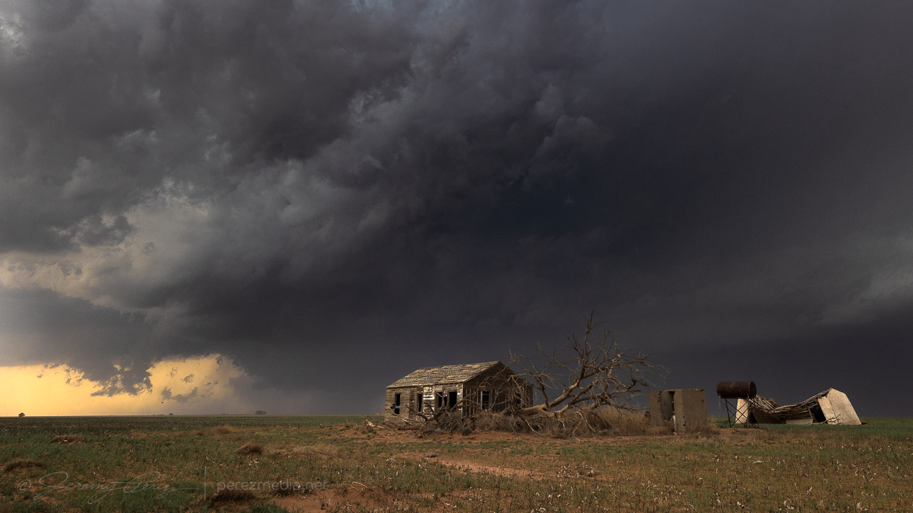
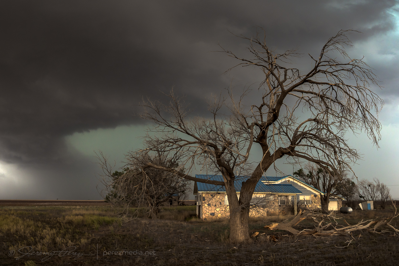
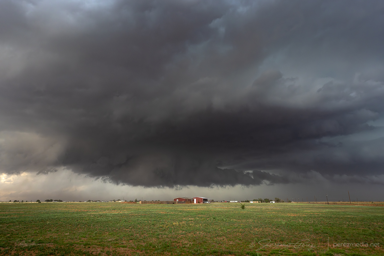
The storm had been pushing me south and east, but at this point, it was starting to go back elevated and hold position north of Smyer. Structure and light across the landscape were an enjoyable descent from the earlier excitement and gradually transitioned to an evening lightning & structure display.
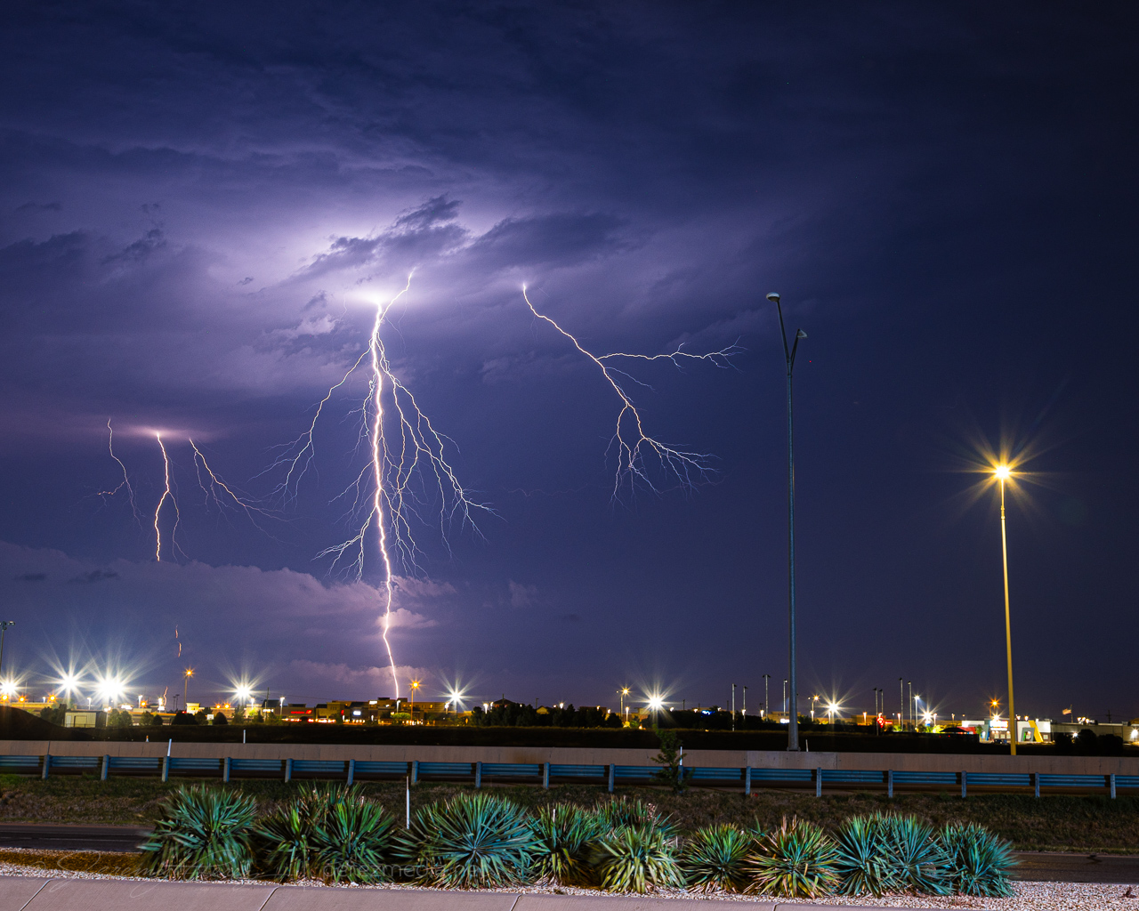
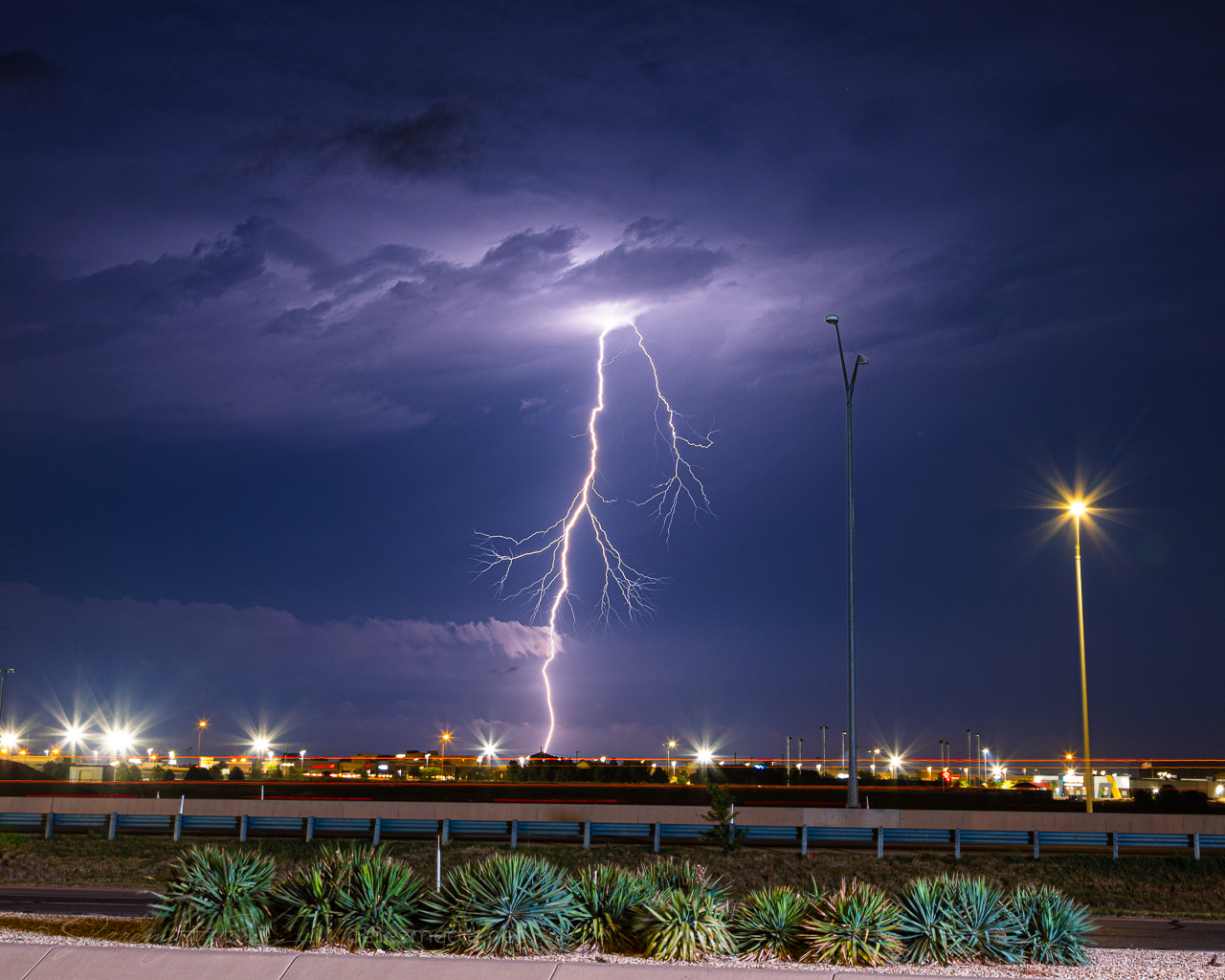
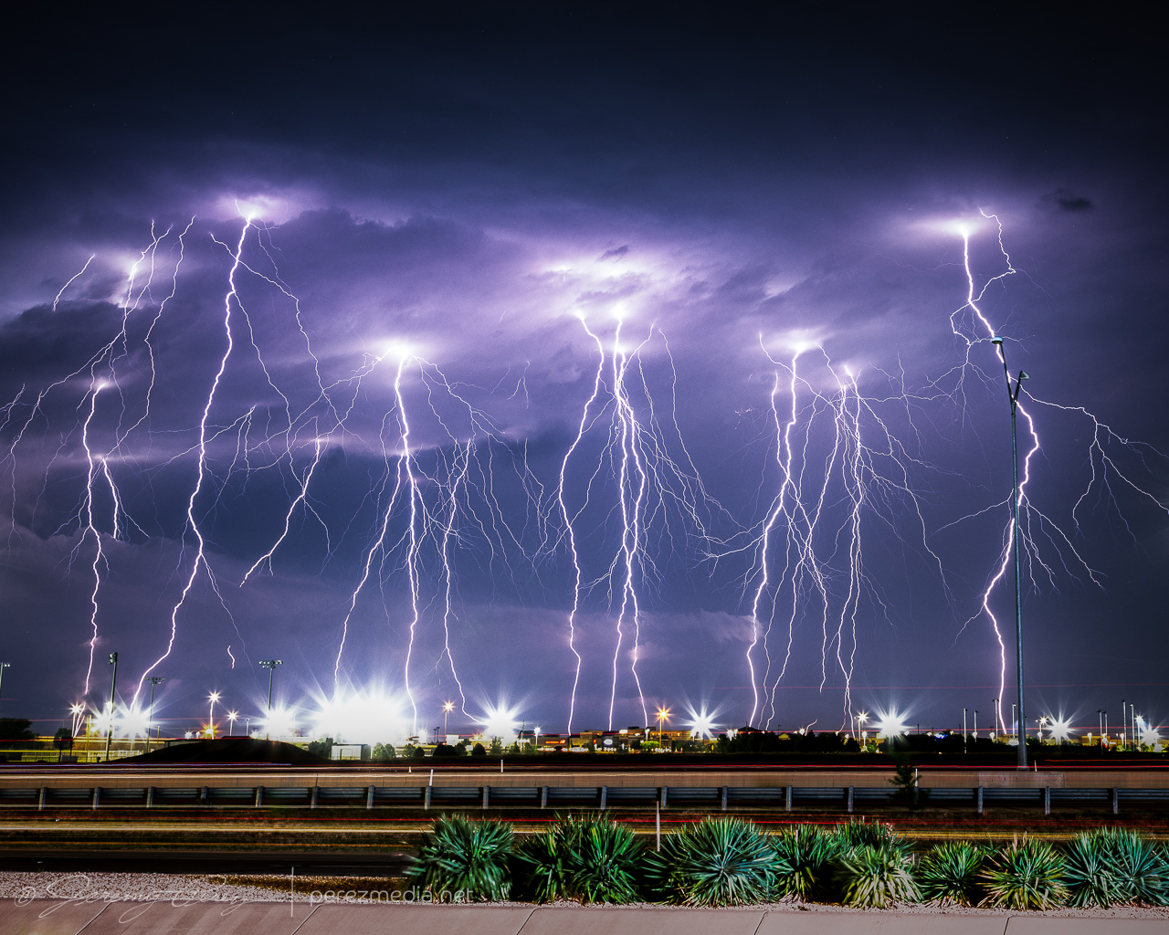
After shooting structure and lightning for a couple hours, I was wiped out and booked a hotel on the southwest side of Lubbock. After grabbing a Subway sandwich and heading for the hotel, I saw that CG strikes were now starting to hop out of the storm. By a great coincidence, a bank parking lot near the hotel had a good view of the storm and I took that chance for 15 minutes of relaxed shooting from the window mount with new, sturdy ball head.
Community Comments
There are no comments on this post
Want to leave a comment? Join our community → OR Login →