

Published on
The day looked like a no-go for the Kansas region, with a Moderate Risk issued for parts of Minnesota and Iowa. The dryline looked to have capping inversion issues further south, but as the saying goes in April, “it’s April, you chase.”
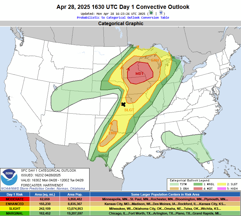
The Storm Prediction Center’s Day 1 Outlook – X marks the chase target for April 28, 2025.
As I hit the road – towering cumulus clouds were noted near Salina, Kansas. With storm motions expected to be east/northeasterly at a fairly quick clip – I buzzed up to Newton, Kansas from Wichita – and jumped on US-50 to get positioned a bit further east. Jumped up US-77 to Herington and just watched as storms continued to develop and roll my way.
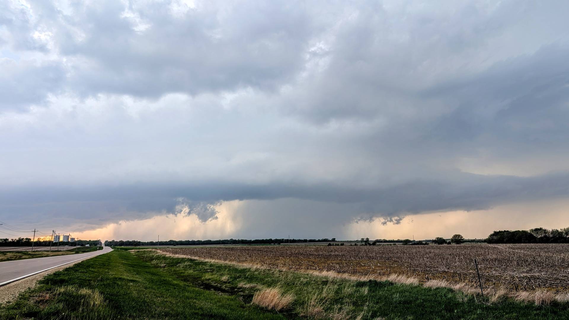
Lo and behold – this elongated, mostly linear storm exhibited some rotation at times, prompting a tornado warning just east of Abilene, Kansas.
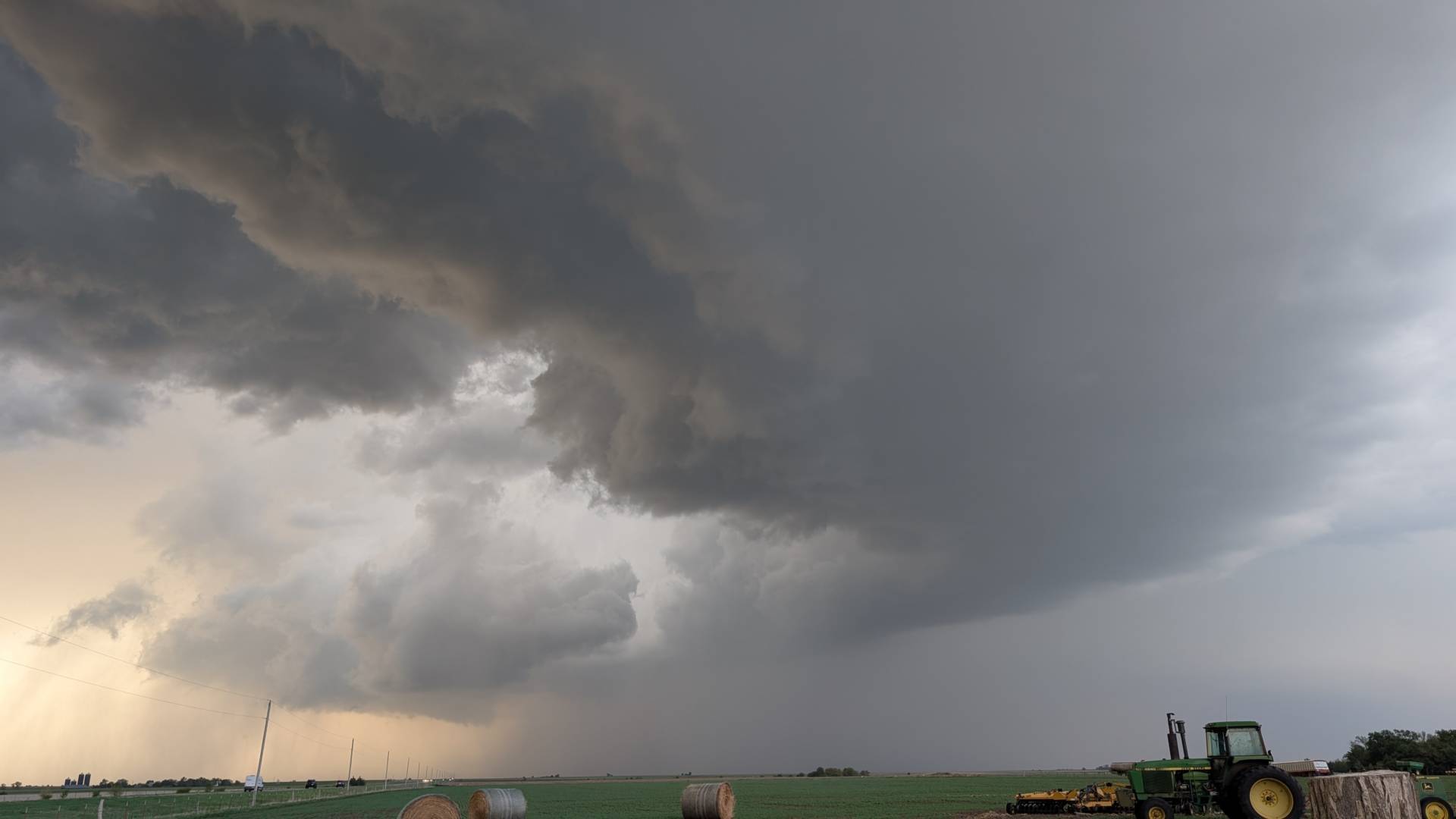
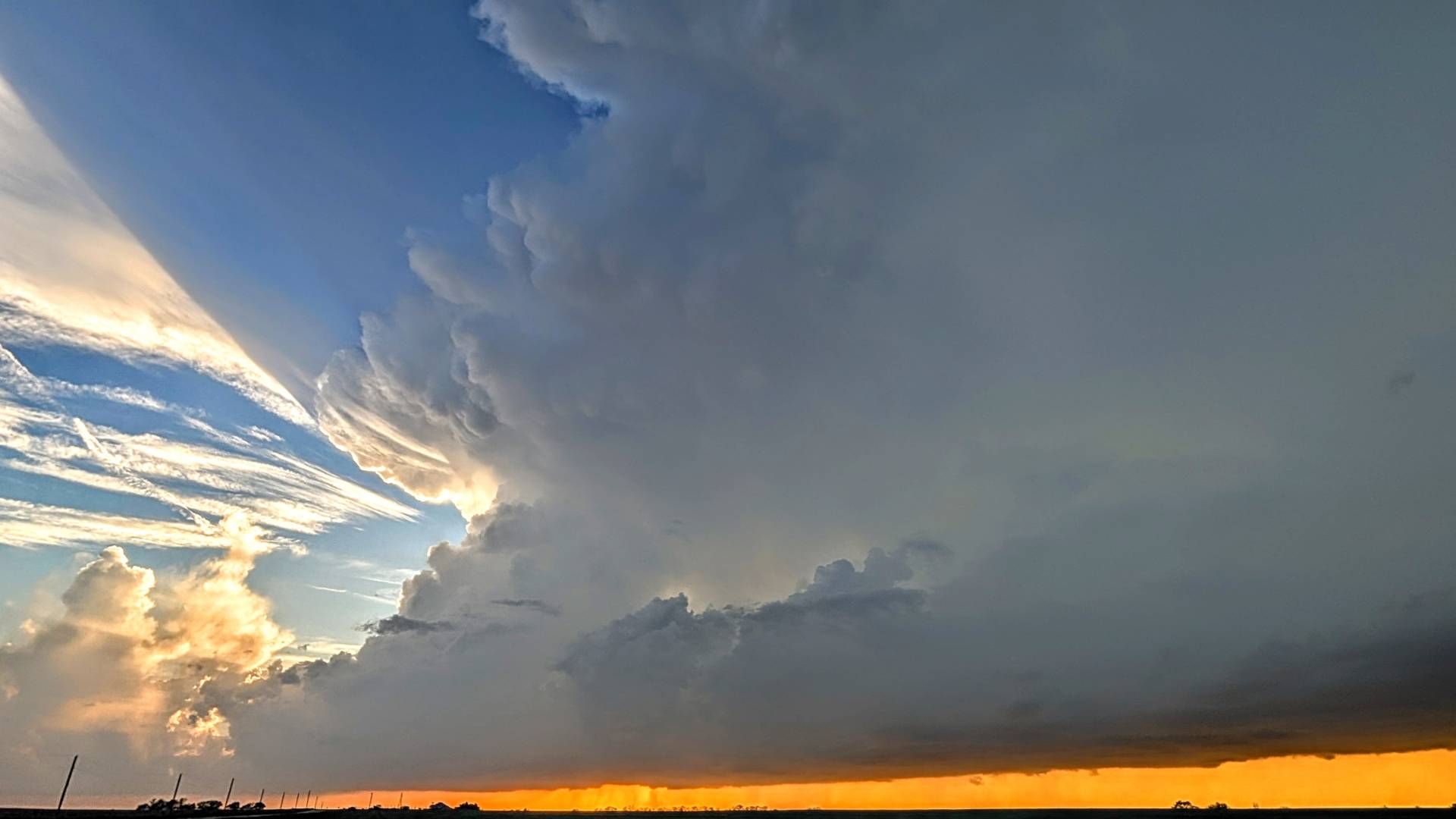
It was a low-confidence, high reward type of day. A tornado was not spotted, and I didn’t get into the tennis ball sized hail that was inundating many areas near Abilene, but the structure shots were beautiful.
Community Comments
There are no comments on this post
Want to leave a comment? Join our community → OR Login →