

This tornado touched down at 10:00 pm. It destroyed two barns and threw their debris hundreds of metres, some of which ended up dangling from trees. Crops were flattened and trees snapped and uprooted. Witnesses reported observing a funnel that was backlit by lightning.
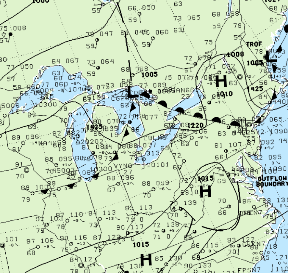
Figure 1 depicts the surface observations at 8:00 pm, which shows a low pressure system over Georgian Bay with a warm front extending into southern Ontario and a cold front extending into Michigan. This cold front eventually moved into southwestern Ontario and triggered thunderstorms, which ultimately led to this F1 tornado.
According to Environment and Climate Change Canada (2018), an F0 tornado touched down at 10:00 pm EDT near Blenheim, ON. The path and width of the tornado was not documented by ECCC. The tornado caused no fatalities, injuries or property damage.
Sources
NWS Weather Prediction Center Surface Analysis Archive. (2017). Surface analysis 00Z Sat Jul 29 1999. Retrieved from: https://www.wpc.ncep.noaa.gov/archives/web_pages/sfc/sfc_archive.php
Environment and Climate Change Canada Data. (2018). Canadian National Tornado Database: Verified Events (1980-2009) – Public. Retrieved from: http://donnees.ec.gc.ca/data/weather/products/canadian-national-tornado-database-verified-events-1980-2009-public/