

Near Mallorytown, the tornado snapped and knocked over trees, levelled two barns, and damaged one house. The home sustained damage to its roof, and had its garage torn from the foundation and scattered. The tornado was 100 to 200 metres wide and travelled a total of 5 kilometres. Not far from the tornado’s path, downburst winds sent a tree crashing through the porch of a farmhouse and killing a man.
Figure 1 depicts the surface observations at 2:00 pm, which shows a large cold front slicing through southern Ontario. This front became the focus for thunderstorms in southeastern Ontario, which ultimately led to this F1 tornado.
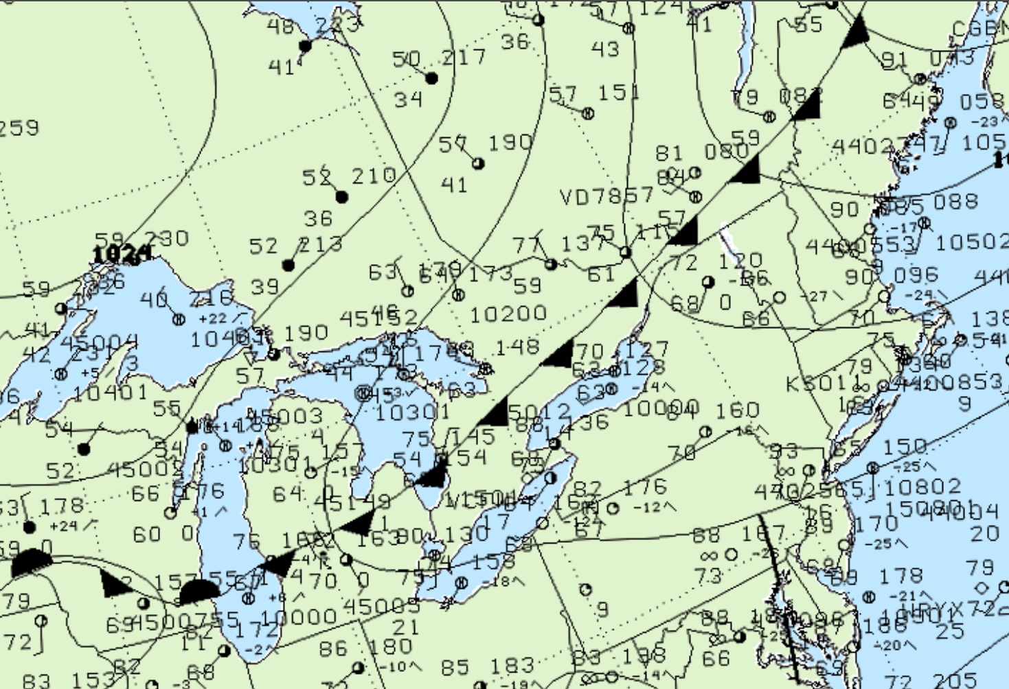
According to Environment and Climate Change Canada (2018), an F1 tornado touched down at 4:10 pm near Mallorytown, ON. The tornado travelled for 5 km and had a maximum width of 200 metres. The tornado caused no fatalities or injuries, but caused $100 thousand dollars in property damage.
Sources
NWS Weather Prediction Center Surface Analysis Archive. (2017). Surface analysis 18Z Wed Jun 9 2004. Retrieved from: https://www.wpc.ncep.noaa.gov/archives/web_pages/sfc/sfc_archive.php
Environment and Climate Change Canada Data. (2018). Canadian National Tornado Database: Verified Events (1980-2009) – Public. Retrieved from: http://donnees.ec.gc.ca/data/weather/products/canadian-national-tornado-database-verified-events-1980-2009-public/