

Touching down at 7:40 pm, the tornado struck the small community of Myers Cave on Georgia Lake. It uprooted and snapped dozens of trees which caused subsequent damage to cottages and vehicles. In addition, a shed was demolished and a boathouse was shifted off of its footings. The event was witnessed by cottagers who captured photos of the tornado, a ragged funnel which, from a distance, had the appearance of smoke from a fire.
This was one of seventeen tornadoes that touched down in Southern and Eastern Ontario during the evening hours of August 2, 2006. Until it was surpassed in 2009, the tornado outbreak set a record as the largest tornado outbreak ever recorded in Ontario.
Dozens of trees, mostly pines and hemlocks, were knocked down by this tornado that struck the south side of Big Gull lake, just to the east of Cloyne, Ontario. It touched down at 7:40pm, impacting a resort area at Kirk Cove, with a path that was 1.2 kilometres long and 100 metres wide.
This was one of 17 tornadoes that touched down in Southern and Eastern Ontario during the evening hours of August 2, 2006. Until it was surpassed in 2009, the tornado outbreak set a record as the largest tornado outbreak ever recorded in Ontario.
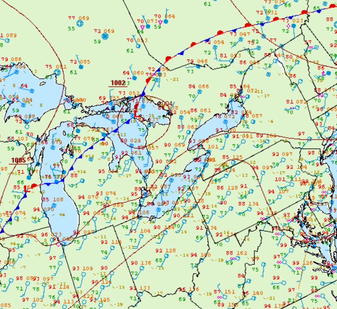
Figure 1 depicts the surface observations at 5:00 pm EDT, which shows a low pressure over Georgian Bay with a cold front stretching into Michigan. This cold front became the focus for intense thunderstorms in the evening hours of August 2nd, which ultimately led to a tornado outbreak across southern Ontario.
According to Environment and Climate Change Canada (2018), an F0 tornado touched down at 7:40 pm near Kashwakamak Lake, ON. The tornado travelled for 6.86 km with a maximum width of 100 metres. The tornado caused no fatalities, injuries or property damage.
Sources
NWS Weather Prediction Center Surface Analysis Archive. (2017). Surface analysis 21Z Wed Aug 2 2006. Retrieved from: https://www.wpc.ncep.noaa.gov/archives/web_pages/sfc/sfc_archive.php
Environment and Climate Change Canada Data. (2018). Canadian National Tornado Database: Verified Events (1980-2009) – Public. Retrieved from: http://donnees.ec.gc.ca/data/weather/products/canadian-national-tornado-database-verified-events-1980-2009-public/