

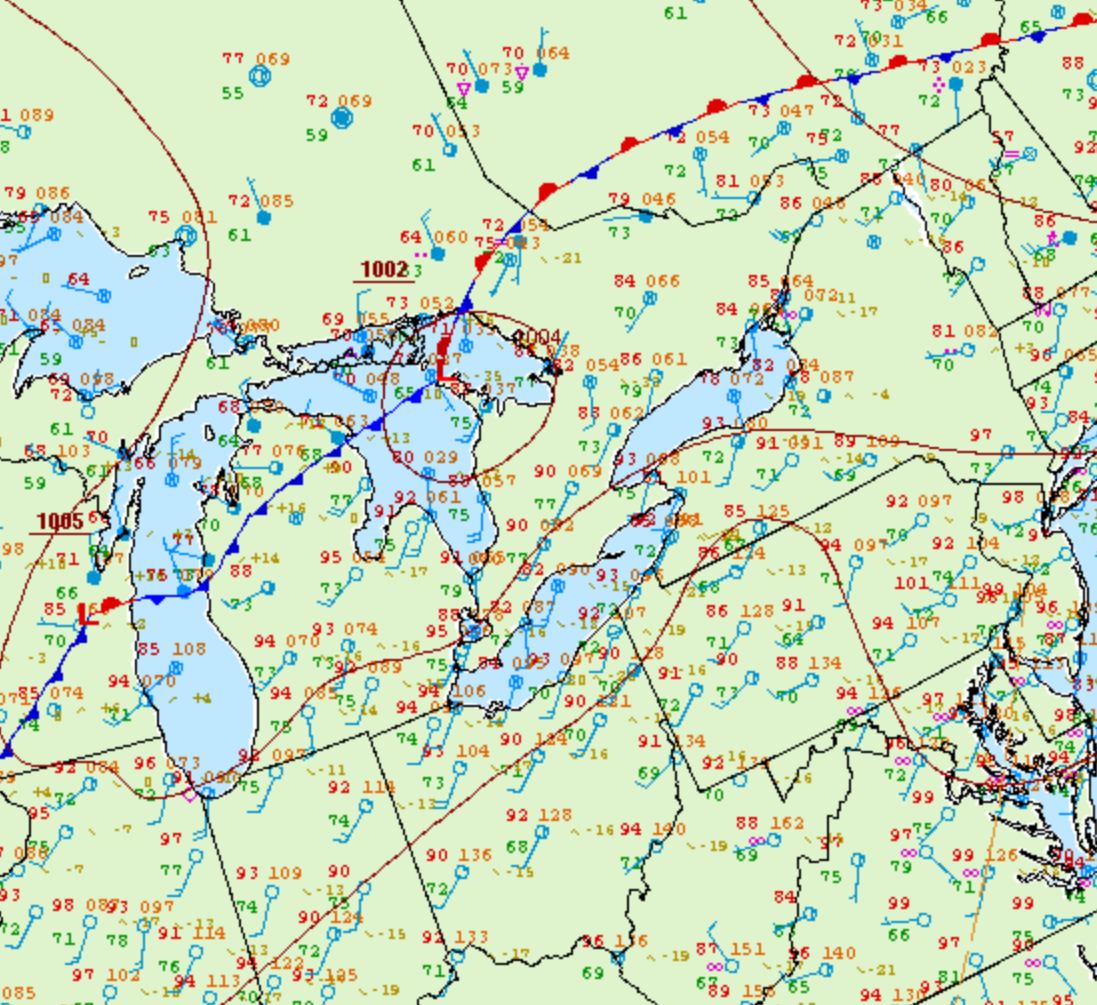
Figure 1 depicts the surface observations at 5:00 pm EDT, which shows a low pressure over Georgian Bay with a cold front stretching into Michigan. This cold front became the focus for intense thunderstorms in the evening hours of August 2nd, which ultimately led to a tornado outbreak across southern Ontario.
According to Environment and Climate Change Canada (2018), an F0 tornado touched down at 3:25 pm near Morriston, ON. The path and width of the tornado was not documented by ECCC. The tornado caused no fatalities, injuries or property damage.
Sources
NWS Weather Prediction Center Surface Analysis Archive. (2017). Surface analysis 21Z Wed Aug 2 2006. Retrieved from: https://www.wpc.ncep.noaa.gov/archives/web_pages/sfc/sfc_archive.php
Environment and Climate Change Canada Data. (2018). Canadian National Tornado Database: Verified Events (1980-2009) – Public. Retrieved from: http://donnees.ec.gc.ca/data/weather/products/canadian-national-tornado-database-verified-events-1980-2009-public/