

The first of four tornadoes to strike Northwest Ontario, this twister touched down north of Ear Falls at 7:30 pm and tracked across Wenesaga Lake through sparsely populated areas.
Along its 23 km path, entire tracts of forest were decimated, trees snapped, uprooted and shorn off at their tops. At one property that was hit, a house sustained significant damage, a garage and sheds were destroyed and debris scattered.
This tornado was likely more powerful than F1, and no doubt have earned a higher rating had more buildings and structures been directly impacted. The other tornado was a deadly and damaging F2 tornado that killed three fishermen at a resort on Lac Seul.
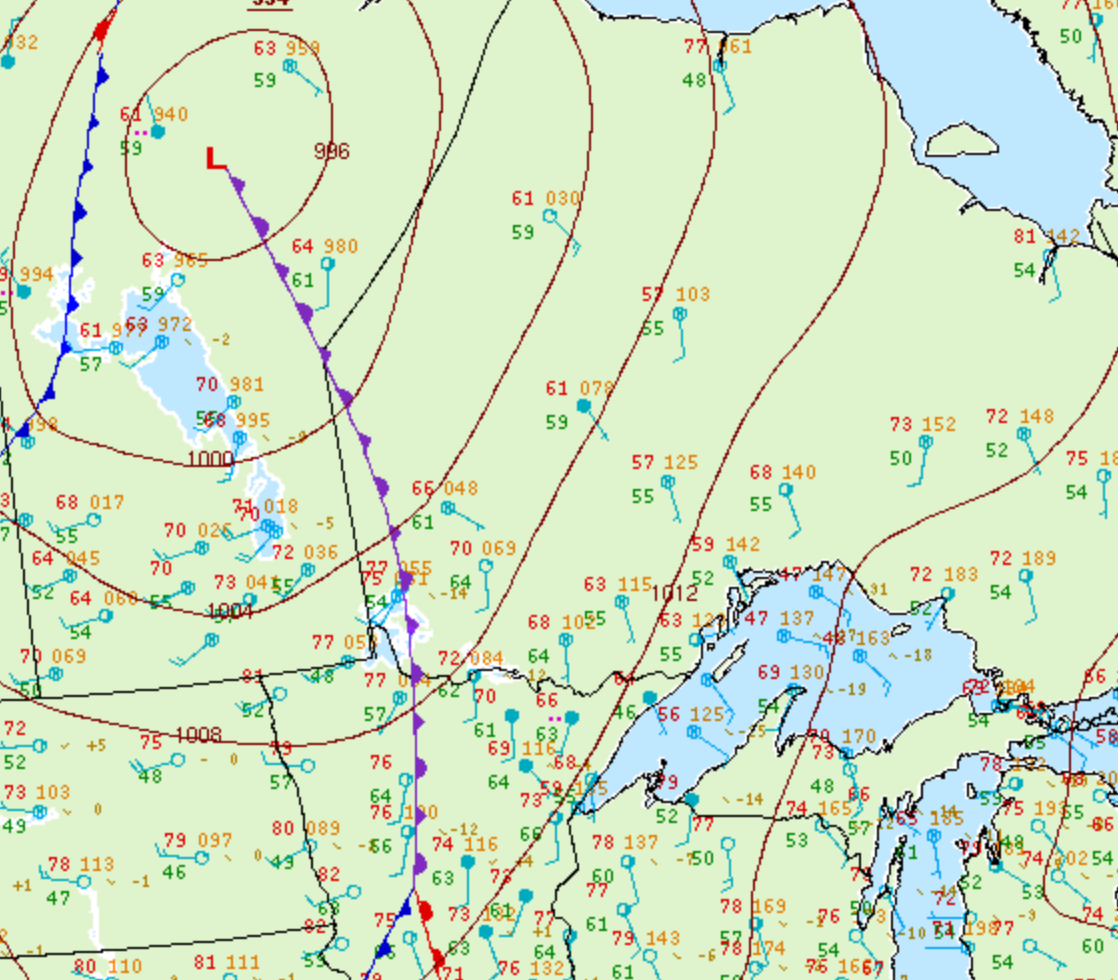
Figure 1 depicts the surface observations at 7:00 pm CDT, which shows a trowal and an occluding low pressure into Manitoba. This trowal became the focus for intense thunderstorms in northwestern Ontario in the evening hours of July 9th, which ultimately led to an outbreak of F2 tornadoes.
According to Environment and Climate Change Canada (2018), an F2 tornado touched down at 7:30 pm near Ear Falls, ON. The tornado travelled for 22.7 km and had a maximum width of 260 metres. The tornado caused no fatalities, injuries or property damage.
Sources
NWS Weather Prediction Center Surface Analysis Archive. (2017). Surface analysis 00Z Fri Jul 10 2009. Retrieved from: https://www.wpc.ncep.noaa.gov/archives/web_pages/sfc/sfc_archive.php
Environment and Climate Change Canada Data. (2018). Canadian National Tornado Database: Verified Events (1980-2009) – Public. Retrieved from: http://donnees.ec.gc.ca/data/weather/products/canadian-national-tornado-database-verified-events-1980-2009-public/