

Figure 1 depicts the surface observations at 2:30 am EDT, which shows precipitation ongoing in parts of Massachusetts. Although not drawn on Figure 1, a mesolow was possibly observed near Buffalo, NY with a warm front potentially stretching into New York and Connecticut. This front would have been the focus for thunderstorms, which ultimately led to this F1 tornado.
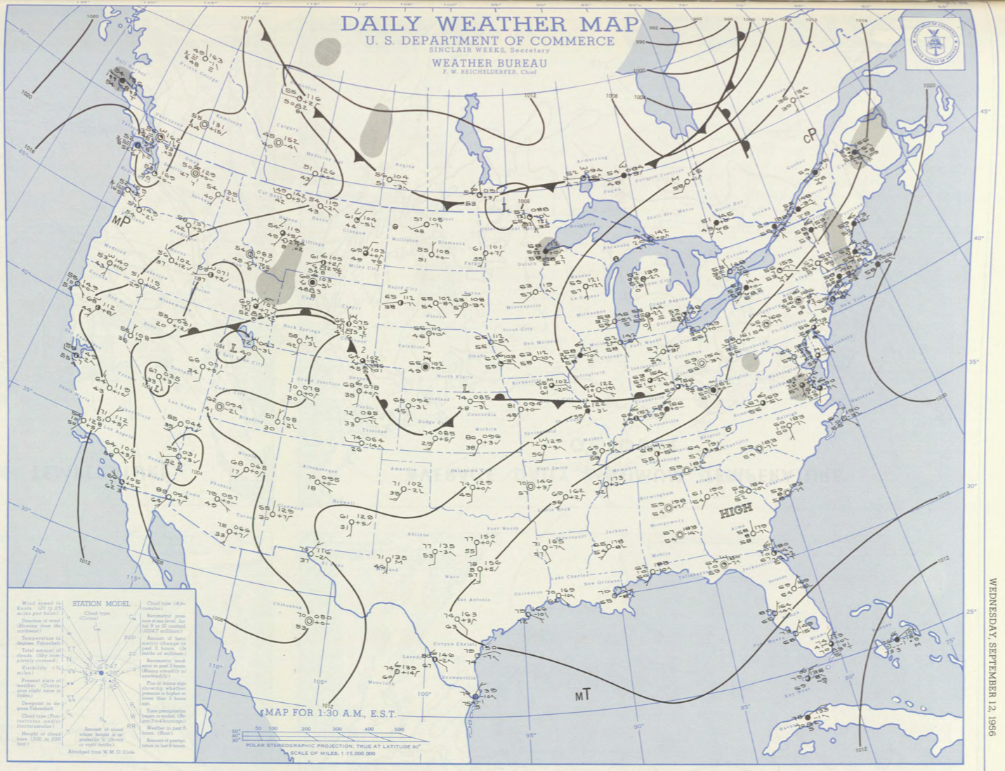
The Wilbraham, MA F1 tornado of September 12, 1956 impacted Hampden County in Massachusetts. According to NOAA (2019), the F1 tornado caused no fatalities or injuries, but caused $250 dollars in property damage. The tornado touched down in Hampden County south of Wilbraham at 2:30 pm EDT. The tornado travelled for 2 mile and had a maximum width of 33 yards.
Sources
NOAA Central Library. (2019). U.S. Daily Weather Maps. Wednesday September 12, 1956 [PDF]. Retrieved from https://library.noaa.gov/Collections/Digital-Collections/US-Daily-Weather-Maps
NOAA National Centers for Environmental Information (2019). Storm Events Database. Retrieved from: https://www.ncdc.noaa.gov/stormevents/