

Figure 1 depicts the surface observations at 8:00 am EDT, which shows a stationary front across southern Ontario and southerly winds across Massachusetts. Interactions with this front and possible sea-breeze could have helped trigger thunderstorms and ultimately, this tornado.

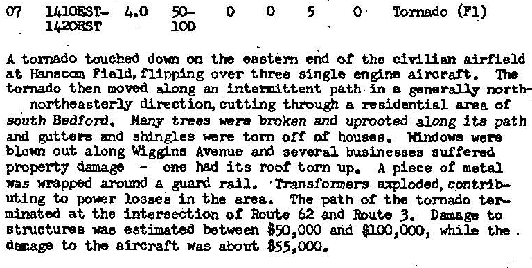
The Hanscom Air Force Base F1 tornado of August 7, 1986 impacted Middlesex County in Massachusetts. According to NOAA (2019), the F1 tornado caused no fatalities or injuries, but caused $250 thousand dollars in property damage. The tornado touched down over Airport Road at 3:10 pm EDT. The tornado travelled for 4 miles and had a maximum width of 73 yards.
Sources
NOAA Central Library. (2020). U.S. Daily Weather Maps. Thursday August 7, 1986 [PDF]. Retrieved from https://library.noaa.gov/Collections/Digital-Collections/US-Daily-Weather-Maps
NOAA National Centers for Environmental Information (2020). Storm Events Database. Retrieved from: https://www.ncdc.noaa.gov/stormevents/