

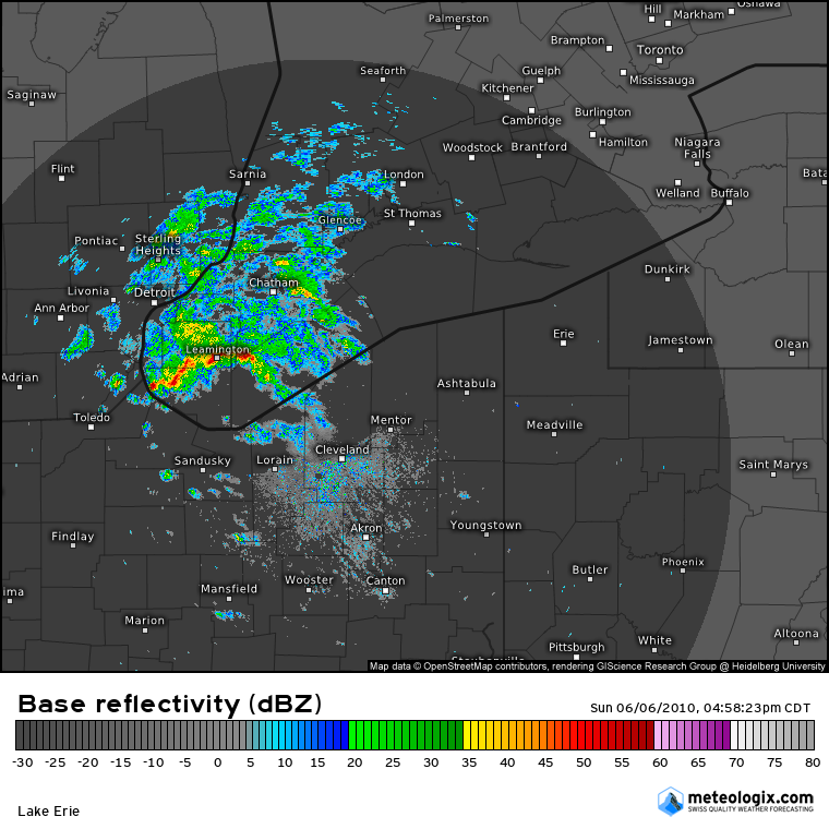
Figure 1 shows the Doppler radar and the thunderstorms responsible for the F1 tornado south of Harrow (west of Leamington, ON).
This tornado, the second of four, touched down in a rural area between the towns of Harrow and Colchester. Early in its path it swept across Dunn Road where trees were uprooted and snapped at their bases, and one mature hickory tree was twisted and toppled. It travelled to the southeast through adjacent fields and then caused extensive F1 damage to a property as it crossed Erie Road South. There, a barn collapsed and a large steel machine shed was picked up and deposited over 100m away, with lumber and debris from the destroyed buildings scattered through the property. The tornado dissipated in a field southeast of there, having travelled for nearly 2km along a path that was 190m wide.
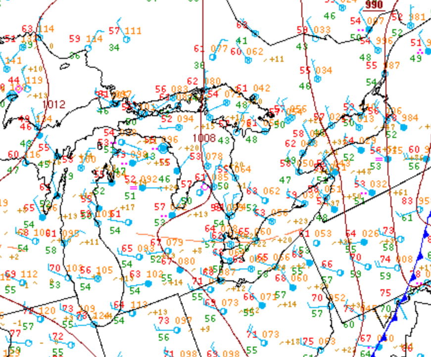
Figure 2 depicts the surface observations at 2:00 pm EDT, which shows a trough of low pressure moving across extreme southwestern Ontario in the early afternoon hours of June 6th. This front promoted thunderstorm development by destabilizing the environment, possibly aided by lake-breeze interactions, which ultimately led to this strong F1 tornado.
Sources
NWS Weather Prediction Center Surface Analysis Archive. (2017). Surface analysis 18Z Sun Jun 6 2010. Retrieved from: https://www.wpc.ncep.noaa.gov/archives/web_pages/sfc/sfc_archive.php