

During the mid afternoon, supercell thunderstorms formed over Northwest Ontario. One produced this tornado that touched down and moved for 1.5 km near the lake, which is about 35 km east-northeast of Sioux Lookout. The tornado was up to 300 metres wide and caused extensive tree damage. This F1 tornado decimated forest as it tracked through an area near Bread Lake. Photos provided by a local pilot led to this tornado’s confirmation, as Environment Canada assessed the swirling pattern of the blowdown and determined it to be tornadic.
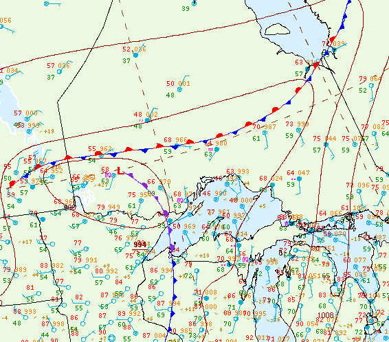
Figure 1 depicts the surface observations at 4:00 pm CDT, which shows a stationary front across northwestern Ontario and an occluding front/low pressure in extreme northwestern Ontario. The interactions between these frontal boundaries initiated thunderstorms in the afternoon hours of June 18th, which ultimately led to this F1 tornado.
Sources
NWS Weather Prediction Center Surface Analysis Archive. (2017).Surface analysis 21Z Mon Jun 18 2012. Retrieved from: https://www.wpc.ncep.noaa.gov/archives/web_pages/sfc/sfc_archive.php