

Published on
Well, this ended up being one of the wilder chases I’ve had in awhile. Leading up to Thursday, I was already interested in the severe potential with a front that was racing southward and plenty of moisture at the surface. Question was always going to be where the front was when storm initiation happened. SPC put out the enhanced risk area a little later in the day, probably waited to get a better idea of where the front would be. Then about 3pm, I started noticing the boundary on radar with a little bulge around Smyer, TX. Figured that would be where we would see the first bit of convection, and sure enough, we saw it fire off around Levelland.
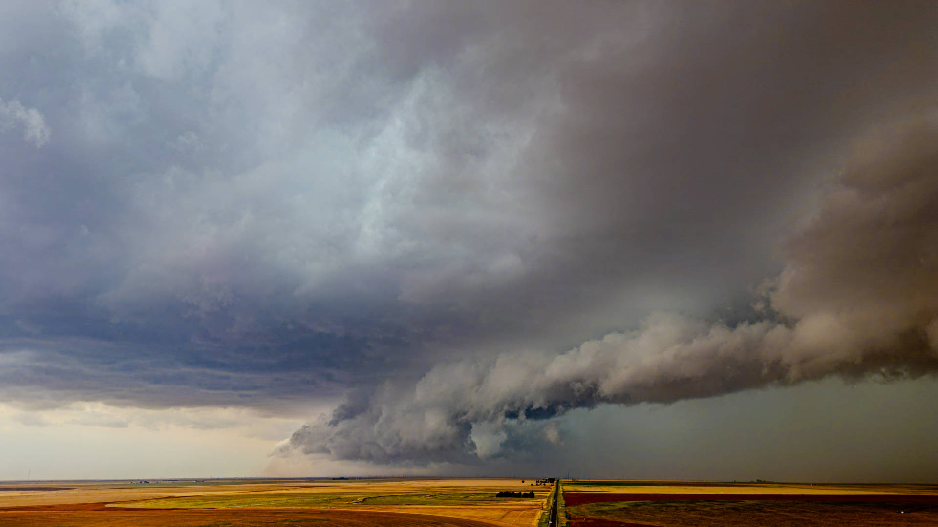
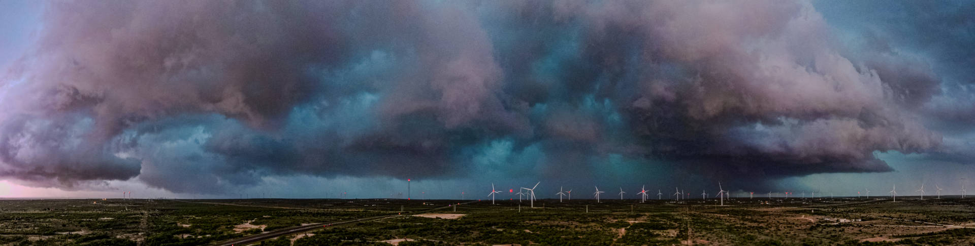
We arrived onto the storm around Ropesville, already showing supercell characteristics. It was latched onto the front still, and it’s base was somewhat high, but not high enough to not have some landspouts. It was this phase of the storm that I saw the most landspout reports. As the supercell strengthened, I could see the base lower, it became rooted, and finally started to move. These would have been taken outside of Meadow, TX.
It wasn’t long after this that another cell had formed on the outflow, just a little bit to the west. It quickly became dominant and an efficient hail producer. Another “problem” with how this chase was about to go is evident in this time lapse if you look on the left.
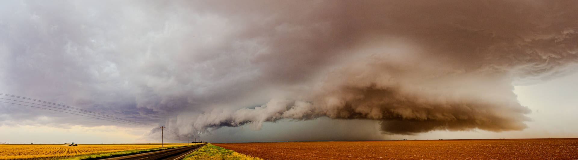
If you saw the tractor, you are right on. It’s planting season out here. Everyone is trying to get cotton in the ground, some have already wrapped up. But that means A LOT of freshly plowed fields and a lot of loose dirt. So from there, we raced down to Brownfield and on the west side of town, was able to grab this time lapse.
From Brownfield, we dived south a little bit to get ahead of the storm. We turned and got live angles of the storm for TV cut-ins a few times as we made our way southeast while staying ahead of the storm. But I’ll be honest, most of that video isn’t worth sharing. You can’t see much through the dust!
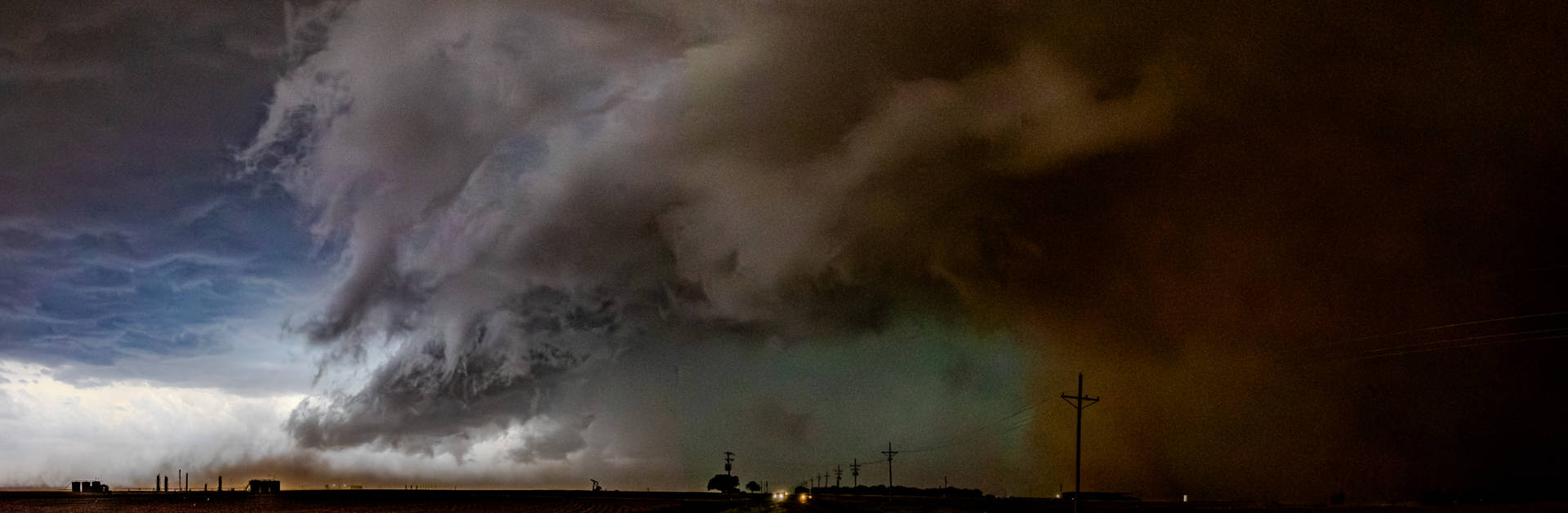
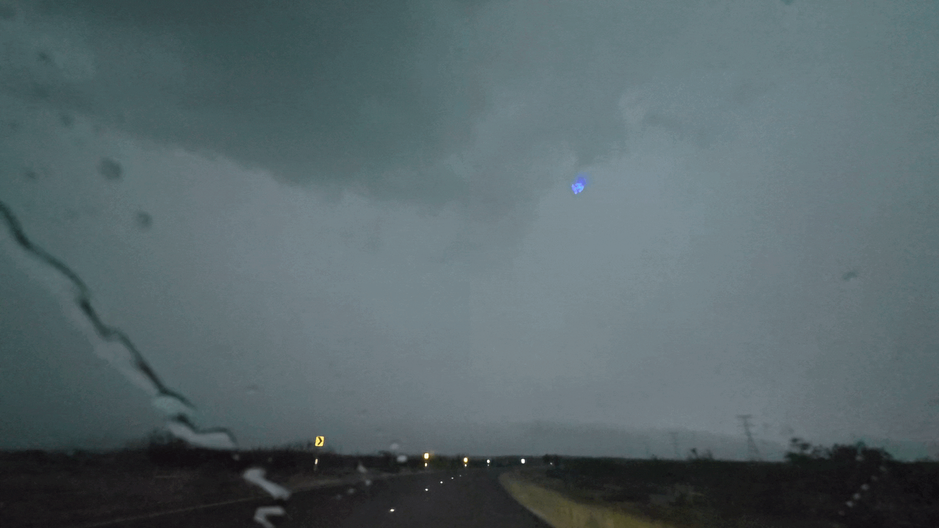
Then we got into Lamesa and the dynamic of the chase changed. We got word of the tornado on the ground from other chasers, we tried to turn into it again to get video, but you couldn’t see much. I did however pull over real quick to get a quick series with my still camera to stitch together a panoramic later. I believe that is the tornado on the right side of the image, and it matches up well with other pictures and video I’ve seen. There are two other pictures that won’t stitch together properly and I’ll work on those if I find the time, and I believe that once I get them together, you’ll just be able to make out the whole funnel… just barely through all the dust. A true dust-wrapped tornado. NWS Midland has found EF-1 damage.
Now, if you could have seen more, I would have gotten into a better position, but if something was there, it was enveloped in dust. We did eventually move a mile or so over, and the perspective didn’t change much. Just got super dark.
Once we moved from that position, the race was on. We were now being chased. I tried to find cover for the truck to ride out the inbound hail, but couldn’t, so it was a mad dash to get out of Lamesa before I got hail damage.
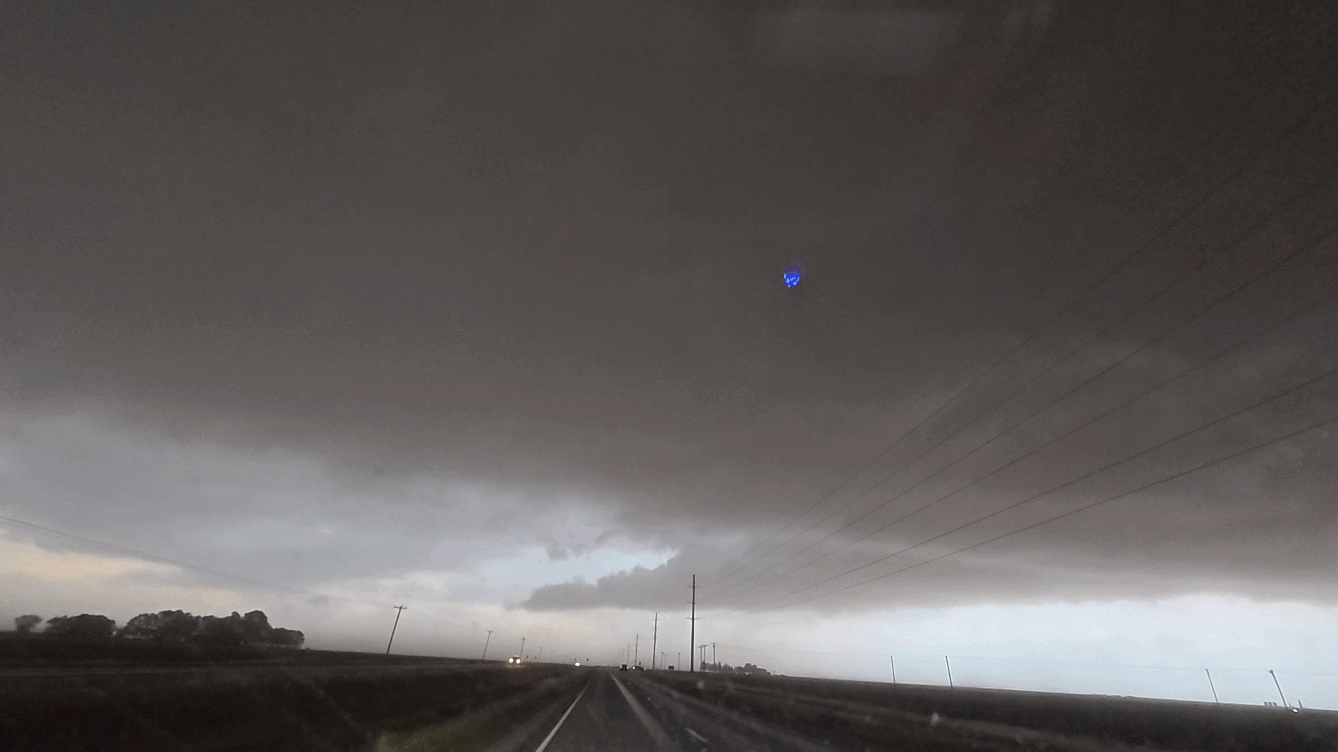
Running down the highway, I could see the Sparenberg tornado over my shoulder, but it wasn’t safe to stop and it lifted by the time I could. I decided at that point to get off the highway and try to get back in a position to get more video. I probably should have just kept going down Highway 87, haha! The cell kicked out a powerful outflow boundary, and the dust was some of the most intense of my life. And this is my part of the country, I’ve seen some dust. But with the freshly moved and loose dirt, this was special.
One thing about this chase is a I probably was visibly able to see more CG lightning strike impacts then I’ve ever seen before. It was pretty cool. Here’s one!
By now we were out of our viewing area. Normally, I’d wrap it up and head on home. But this storm was still on my tailpipe, we were already seeing flooding rains to the east with FFW’s in place, and at the time strengthening storms out west. So I ended up keeping going until Big Spring. Figured there was more places to either ride it out, or more roads to do an end-run around everything and head home. Plus, if we had the chance… somewhere for me and the family to get dinner. Well the storm accelerated so I went south a little bit more, and had time to put the drone back up out by Forsan.
We looped around back to the east and got out of Forsan before they got hit, and eventually back up to I-20. Mother Nature gave us one more CG strike on the way.
With the storm now gradually weaking and on it’s way to Sterling City and San Angelo, we were on our way back north. Another successful chase day with the family. Big thanks to John, Matt, Shania, Tony and the rest of the crew at KCBD, and to all the familiar faces on the road. Now to find time to give my truck a bath!
Community Comments
There are no comments on this post
Want to leave a comment? Join our community → OR Login →