

Published on
We went into this day with a very similar set-up to the day before and the Morton-Lubbock storm, with a touch more of a cap. Figuring initiation would be close to the state line again, we loaded up the family and headed west.
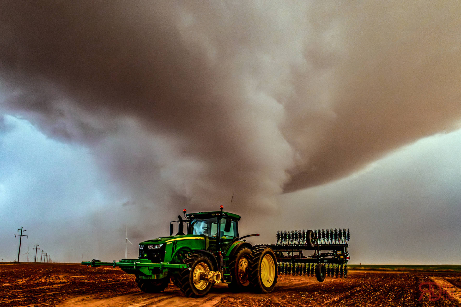
By the time we got close to Sundown, we already had two, struggling cluster storms, somewhat close together. One up by Dora, NM, and the other a little closer to the Lea and Roosevelt County Line. Now while these storms were really struggling with the increased inhibition compared to yesterday, they were still pushing on. But you knew the energy was there. Just look at how the winds increased about 200ft off the ground in the drone timelapse (they were nearly still at the surface) and then the striations in the Anvil before morphing into Mammatus from the truck.
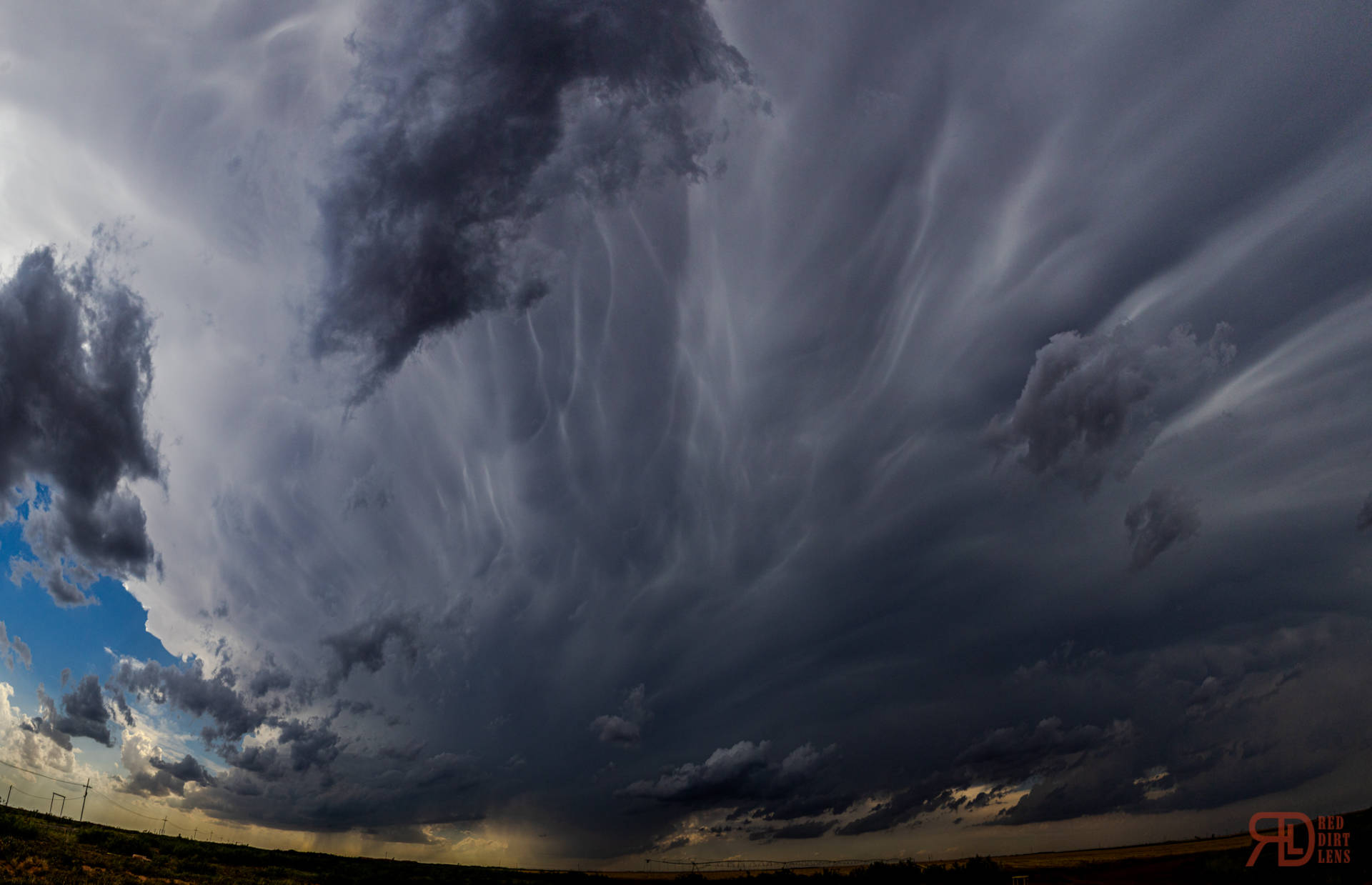
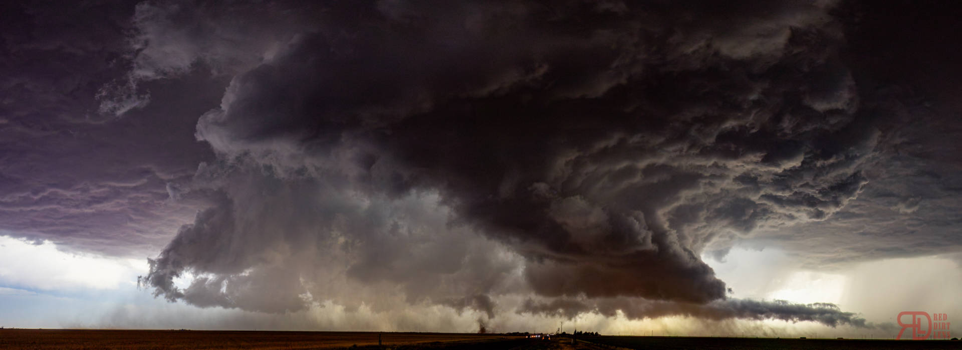
So we gave it time, knowing that once this thing surpassed the CINH, it was going to explode. While this was going on, the storm on the north side of Lubbock explosively developed on the northside of the boundary. My first thought was “How elevated is that thing?!?”. But it quickly became rooted and caused problems out by Idalou and Acuff. We sent another chaser out that way, and I won’t lie, I thought about bailing and heading back east with how much this storm was struggling. But I stayed the course. After a little bit and falling back to just west of Sundown. While there, we finally see the storm starting to take on more supercellular characteristics. You can almost see the beginning of a wall cloud here, but we definitely started to see the mid-levels start to run more on velocities.
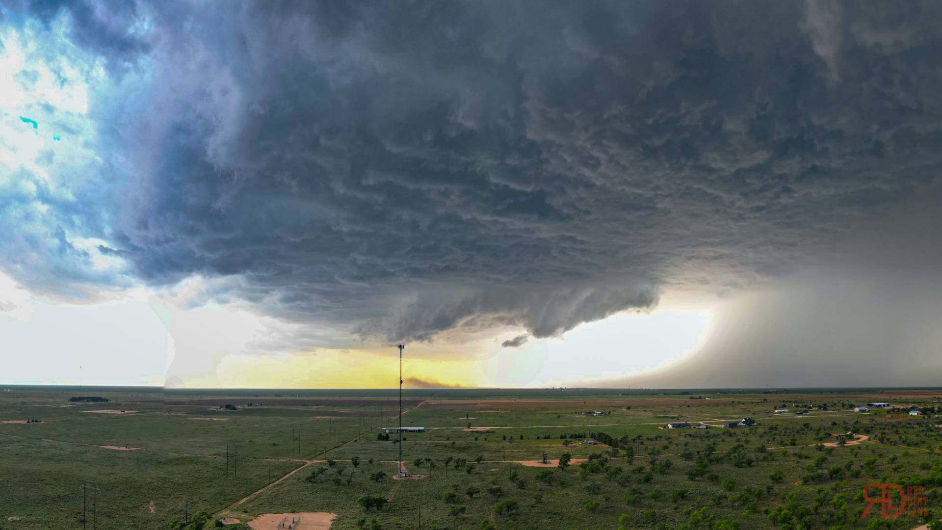
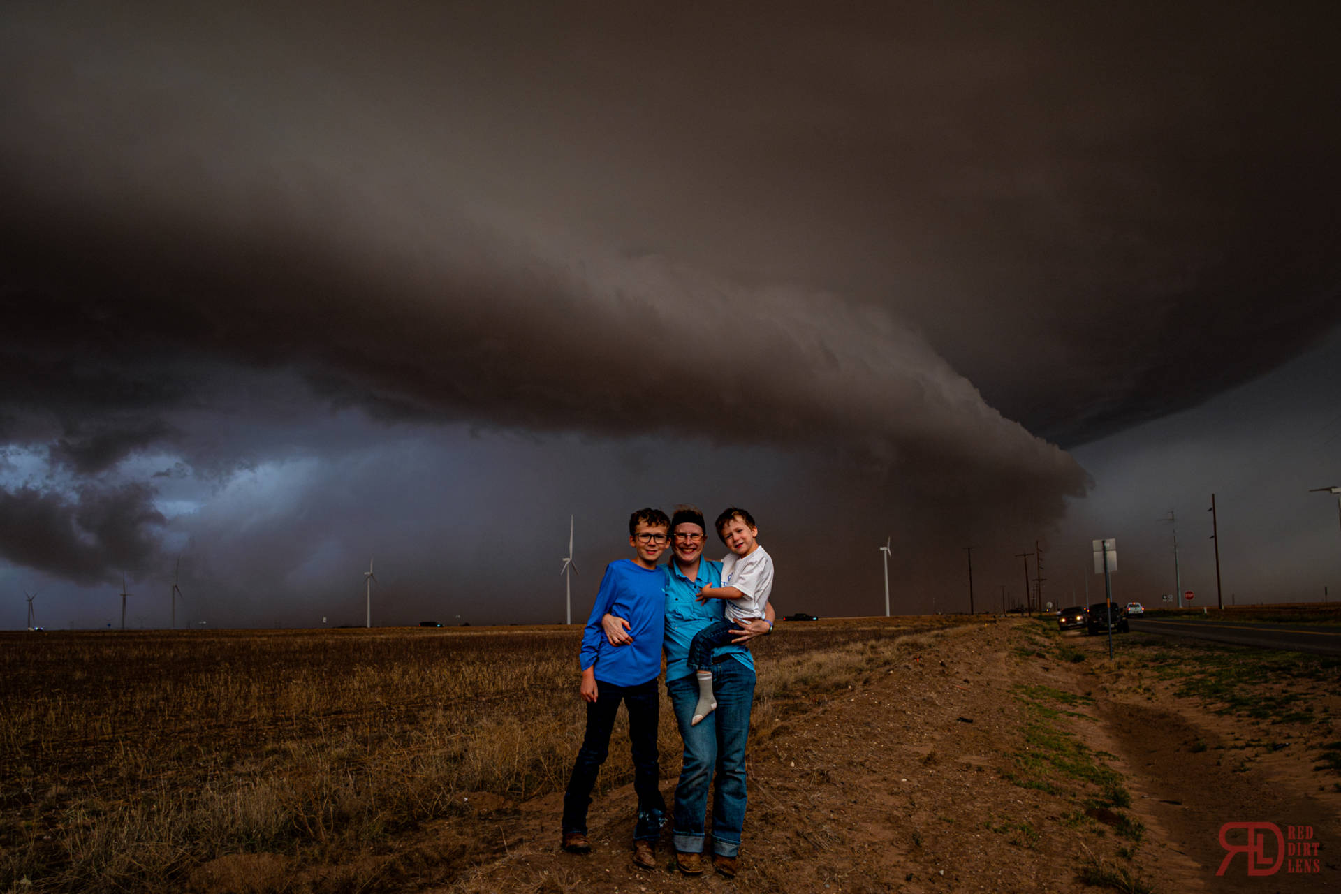
We relocated to the south side of Sundown to an empty lot I’m aware of. It gave us a good view west. So we hung around a little bit. I also had time to put the drone up a little bit more here. I didn’t have long… I got a few pictures and one timelapse. And things happened fast. In only the time it took me to go from landing the drone, packing it back in the case, and stowing it back in the truck… we had a fully fledged wall cloud with some of the more intense horizontal rotation I’ve seen out of a storm in quite some time. If you look closely at the end of the drone timelapse, you’ll see the first bit of RFD hit the ground off in the distance.

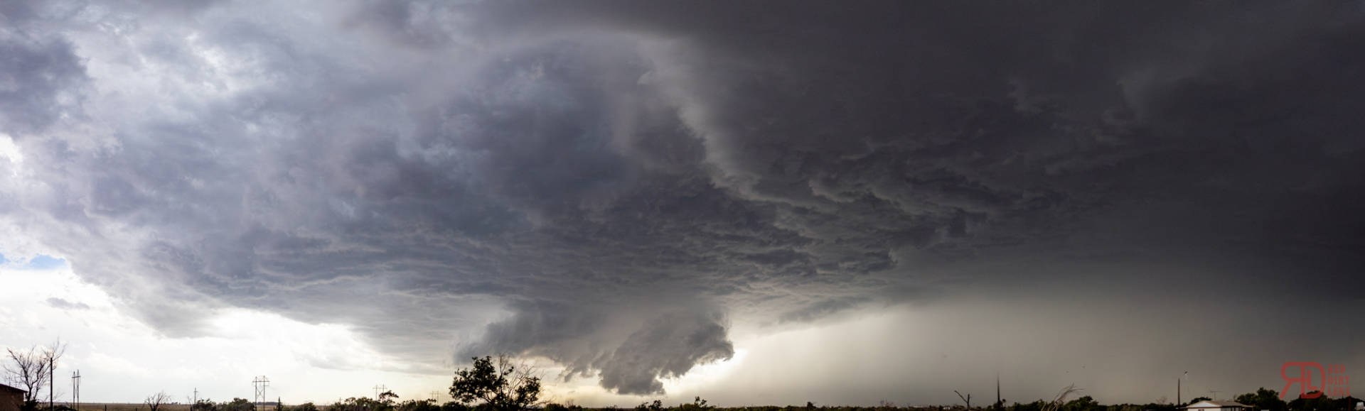
The chase was on at this point. We gradually worked our way back east with occasional dives to the south. Structure was awesome and a few possible touchdowns in there. The one problem with this storm is what was a possible tornadic circulation and what was more of a landspout/dust devil. I think some of the touchdowns that were reported as tornadoes, I have my doubts about. Nonetheless, these were pretty cool to look at, even the one I drove through, haha! By the way, 2025 DUST Theme continues!
As we get through Ropesville…. How about a roping out tornado in Ropesville! Didn’t get much of this one on camera since it wasn’t safe to stop, but definitely there, and it’s remnant funnel was persistent.

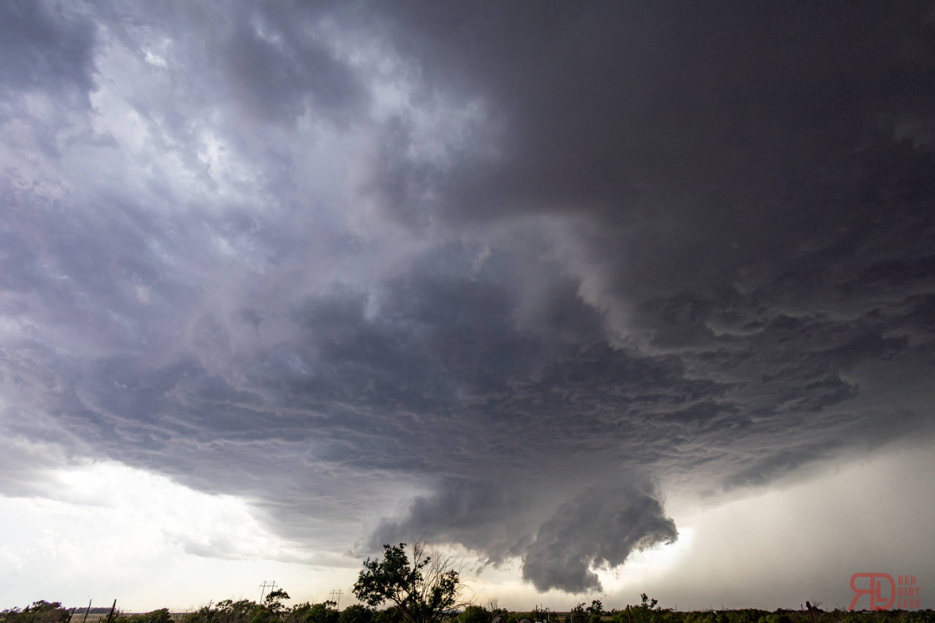
As we left Ropesville, many of my views started to be enveloped by dust. So I kept trucking to get a good distance ahead. But the chatter on social media was quite evident that we were seeing the mothership look happen with another dustbuster of a storm develop. We broke through the dust around Tahoka and got to see it ourselves.
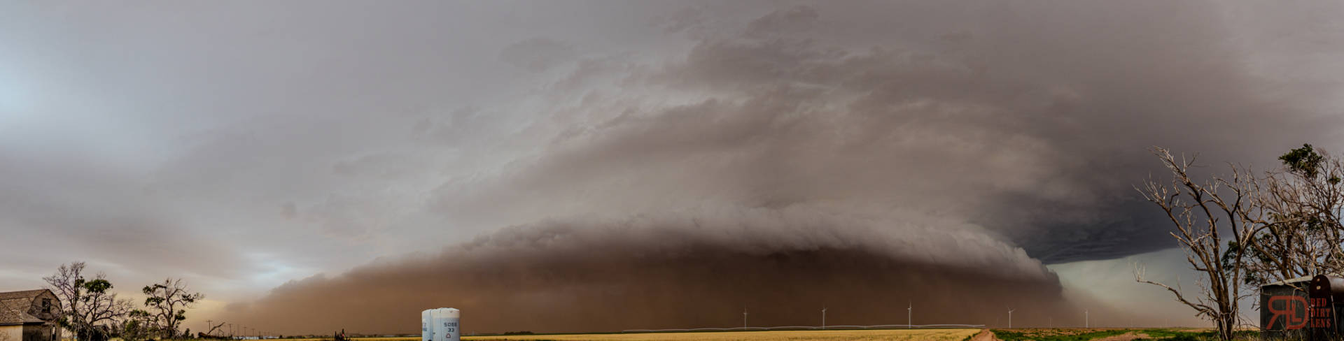
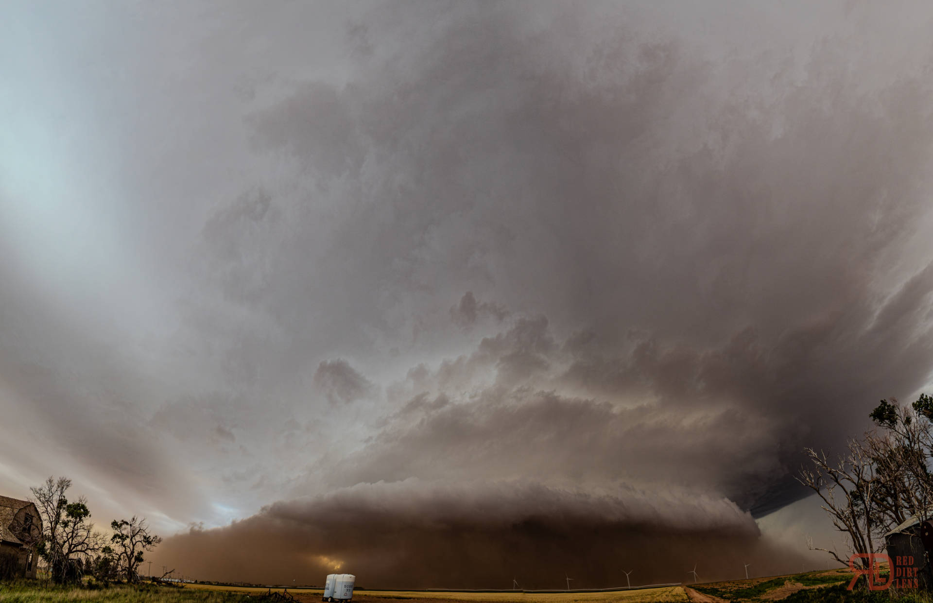

This storm just looked spectacular all the way down 380 to the east. Even had time to take a few artsy shots before the dust found us. As I worked south a little bit as the storm turned a touch, we turned back east. By then, an appendage core started to form, complete with it’s own hail core. It wasn’t a true cell split, but it had enough properties of such. But, with the road network that close to the edge of the caprock being what it is, there wasn’t a good way to get back in front and around that hail. With night falling and the storm no longer tornadic, we decided to abandon the chase. More developing storms to the north gave us a great lightning show as we turned tail and ran back into Lubbock for a much deserved dinner before heading home later that night.


Community Comments
Bros dead by now💀☠️
Reply to Khachasing Storms
Want to leave a comment? Join our community → OR Login →