

Published on
Man, so many people talking about this storm…. it was pretty wild.
Solo chase day for me with the family staying home. I set out with my first target area being around Plains, TX. While enroute, we made the decision to send a second chaser out. We sent Julio and Chase straight west out of Lubbock toward Levelland/Whiteface.
I get to Plains, and I wait a bit.
By now, the storms in western Roosevelt County in New Mexico had fired up. You had two cells and the southern one quickly became dominant. Seeing this, I direct our other unit to head to Morton and the station concured. Once they arrived there, they made the on the ground decision to head further west toward the border and they were able to get the first touchdown of the day near Causey, NM.
I had started heading north, knowing this was going to be the beast of the day. And I already found dust…. my 2025 chase season cam be summed up by DUST/DIRT.
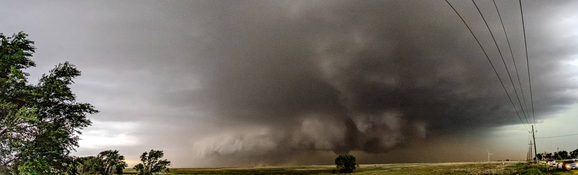
With Julio/Chase near the core meso, I was going to hang back and get structure. They ended up getting behind the storm a bit, so I pounced on it and got to the storm as it was coming out of its first cycle of the day. And that’s when the amazing sights began.
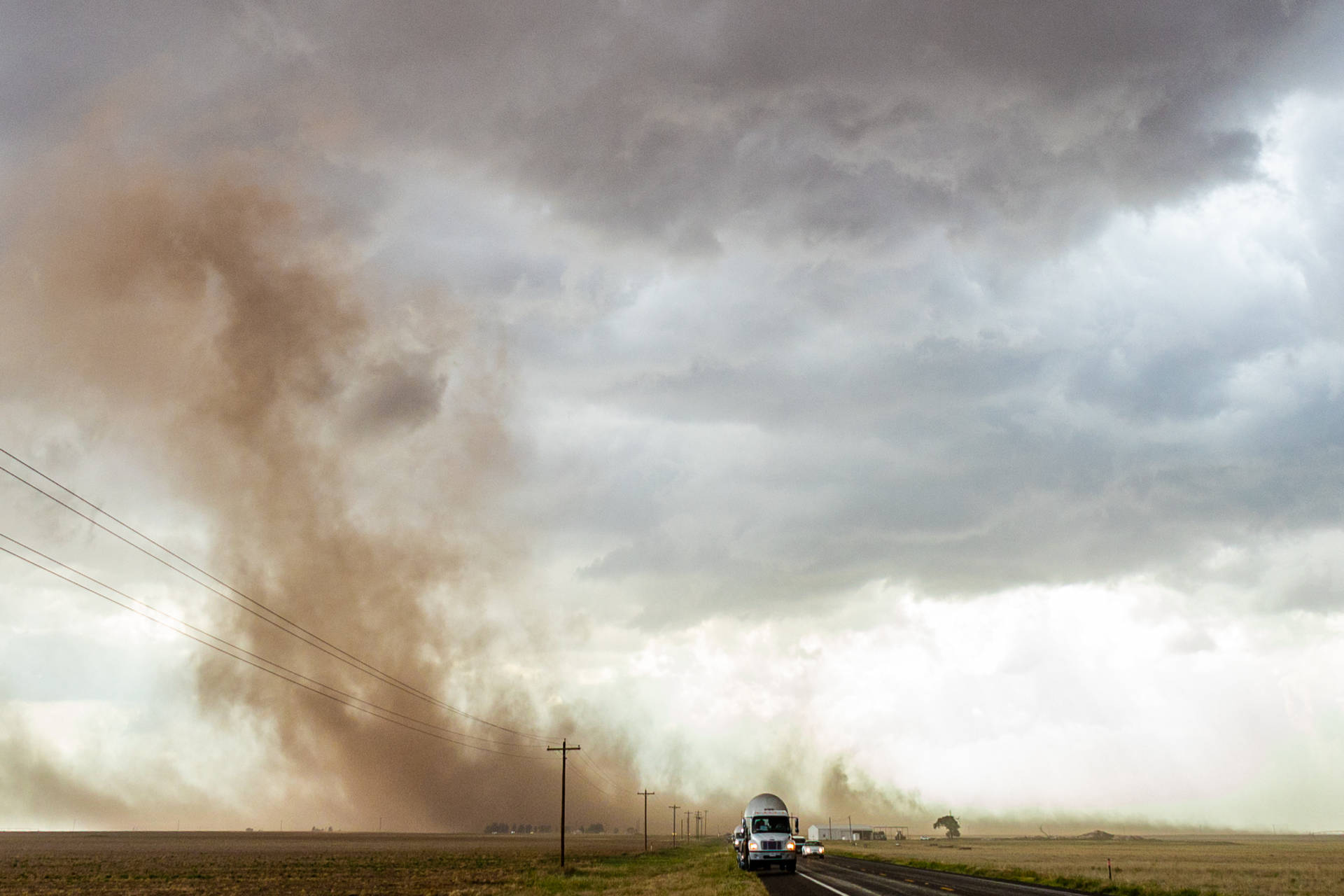

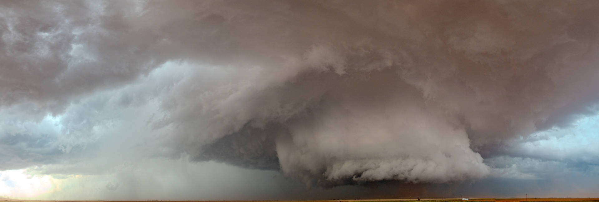

I joined the chaser caravan… so much better behaved then the disaster of the Afton storm a few weeks ago… and followed the storm until close to Morton. Since I was chasing alone and I’m focusing on the TV side of things, it was hard to notice a tornado on the ground at times for me, especially with the dust being picked up, but once you knew it was there, it was awesome.
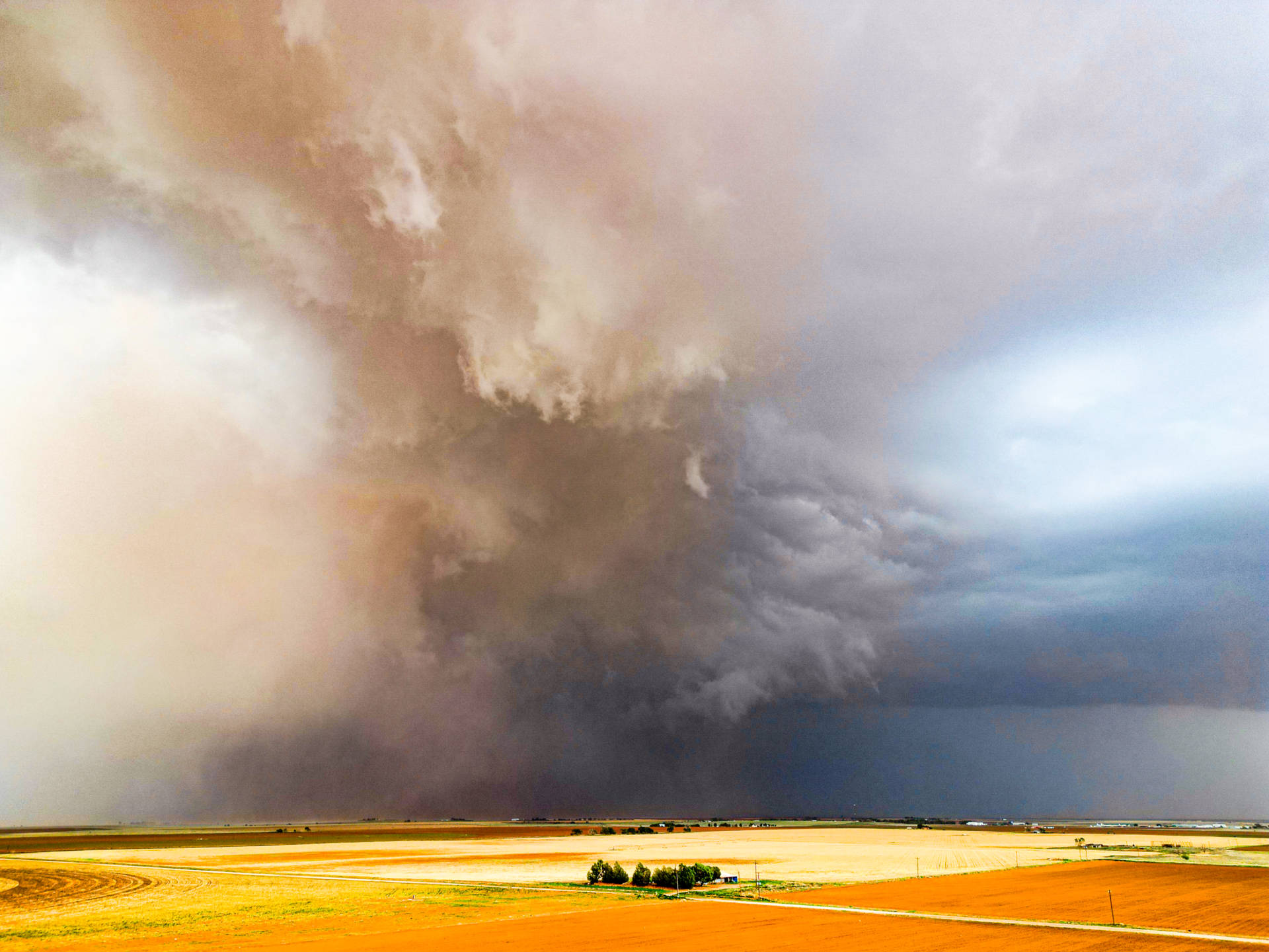
I let the storm get ahead of me a bit while I put the drone up.
I got back on the road, and in Morton, and this guy filled by my rear view. “HI Dr. TIMMER!”
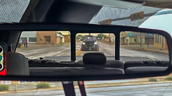
That actually should have been a red flag to me. I don’t core punch. (This comes up later in the day too). Reed is in a vehicle designed to core punch and ride out a tornado. If Reed is behind me, going the same direction I am…. maybe I need to evaluate if I want to be there. What I didn’t realize is that my radar hadn’t updated in 10 minutes. I broke the cardinal rule of not trusting my own eyes and got radar locked, and thought I had time to beat it across the road I was on. Needless to say, we started driving into the core….. and I NOPED right out of that one.
In all of this, I lost track of where Julio/Chase were. We also had a crew from our sister station in Amarillo (KFDA) join the fray. So I just started doing my own thing. The storm also started accelerating. So I ran parallel to it for awhile and got back ahead a bit by Smyer and was able to stop and watch for a bit. This is also where unfortunately a home was lost and its occupants injured. They also lost a pet.
We’re getting really concerned now about Lubbock. We’ve had several, wide tornado touchdowns, a persistent mature supercell, and it’s still digging. I position my self on the north side of Reese Center (the old Reese Air Force Base for those not familiar with the area). Inflow is still very good with this storm, to the point it almost ripped my trucks door off of its hinge. I could see another wide touchdown in the distance. And I stop for awhile and watch until I had to move. There’s also a running joke with me… there might only be one tree in a field… and it’s in my way. I left the chainsaw at home though.


We’re now talking a scenarios I abhor. Chasing in the city of Lubbock itself. And it’s not night, but the storm is blocking enough daylight, it might as well have been.
So I go up the road a few miles and stop for a little longer, and moved at the last minute. Because where I was at got tore up about 5 minutes later (West Carlisle Fire Dept building).
So I bailed out and set course out of the city to the south. By now, additional cells had developed and merged into the rear of our tornadic cell. This was the saving grace for the city of Lubbock from a tornado (although the straight line wind damage around 4th and 19th street is brutal). The merging cells disrupted the low level flow regime enough, that it ended that threat and shifted into a congealed wind threat. As part of that, a new hail core developed near Wolforth, and tore a path through the southside of Lubbock with large, wind driven hail. Lots of windows and roofs taken out.
As of writing this, NWS LUB has not yet posted the damage assesment. I’ll update this paragraph on Monday, June 9th if it’s been released.
Now I bailed out to the south. And I think half of Lubbock decided to also, as US 87 was bumber to bumber, stop and go traffic. With that new hail core quickly descending, I barely escaped without damage… another almost accidental core incident.
I got out of that situation, but had to take a long detour to do it. The storm started racing east and off the caprock. And with that, I decided to call it a night…. or so I thought.

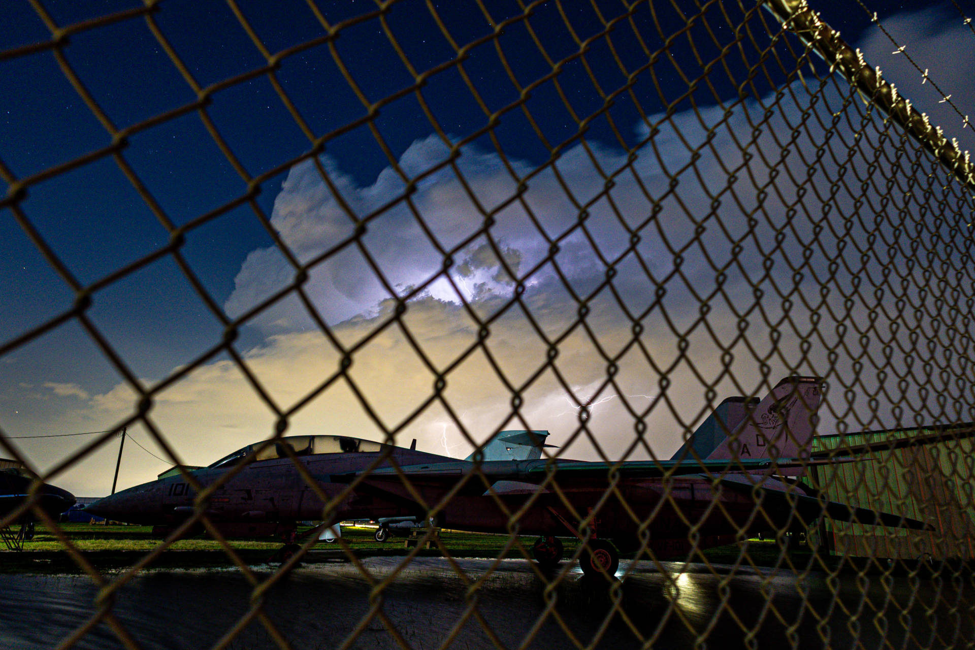
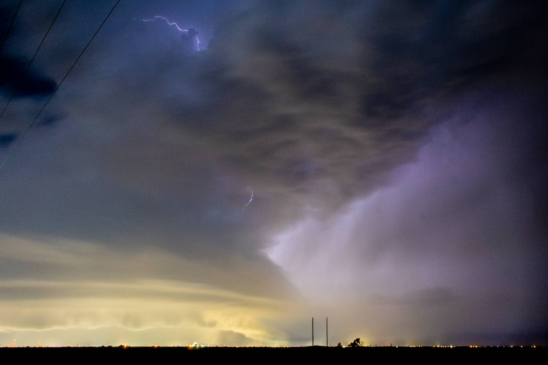
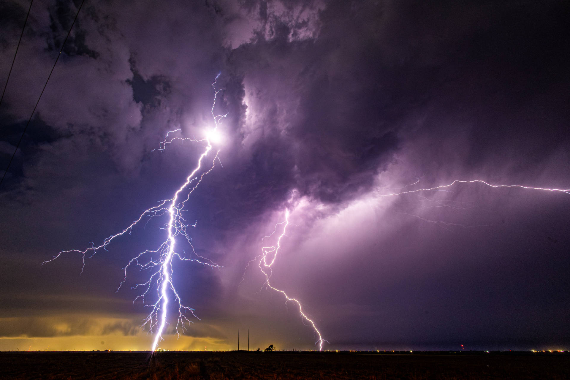
I made the decision to go get some lightning pictures with another severe warned cell over Lubbock. So we’ll close this out with some lightning shots. Enjoy!
Community Comments
There are no comments on this post
Want to leave a comment? Join our community → OR Login →