

Published on

This day ended up producing a Tornado Warned Storm near Okotoks, AB that tracked towards Blackie, AB, and produced a funnel cloud near the town. Also, near Beiseker, AB, a beautiful Low-Precipitation [LP] Supercell formed and slowly tracked to the southeast, before gradually weakening. A total of 5 Tornado Warned storms pummeled Central Alberta near the towns of Sylvan Lake, Red Deer, Sunchild, Drayton Valley, and Rocky Mountain House, with one possible tornado observed near Sunchild, AB.
This day began with meeting up with my chase partner, Austin Hern, in Seven Persons, AB. After looking at the morning models, we made the decision to head to Strathmore, AB and wait for the development of supercells that were forecasted to move off the foothills that afternoon/evening.
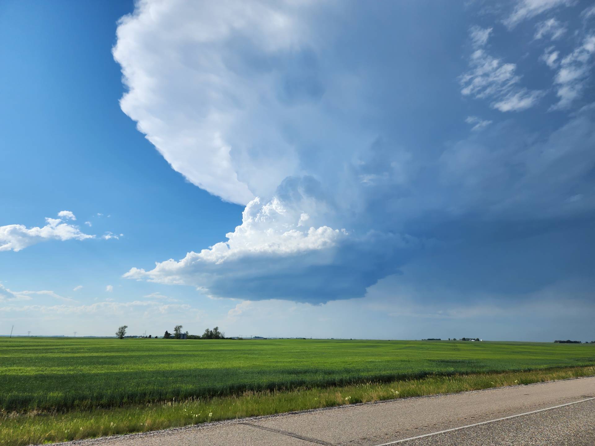
As we were driving along the Trans-Canada Highway towards Strathmore, towering cumulus began to develop to our west and track east towards Okotoks, AB.
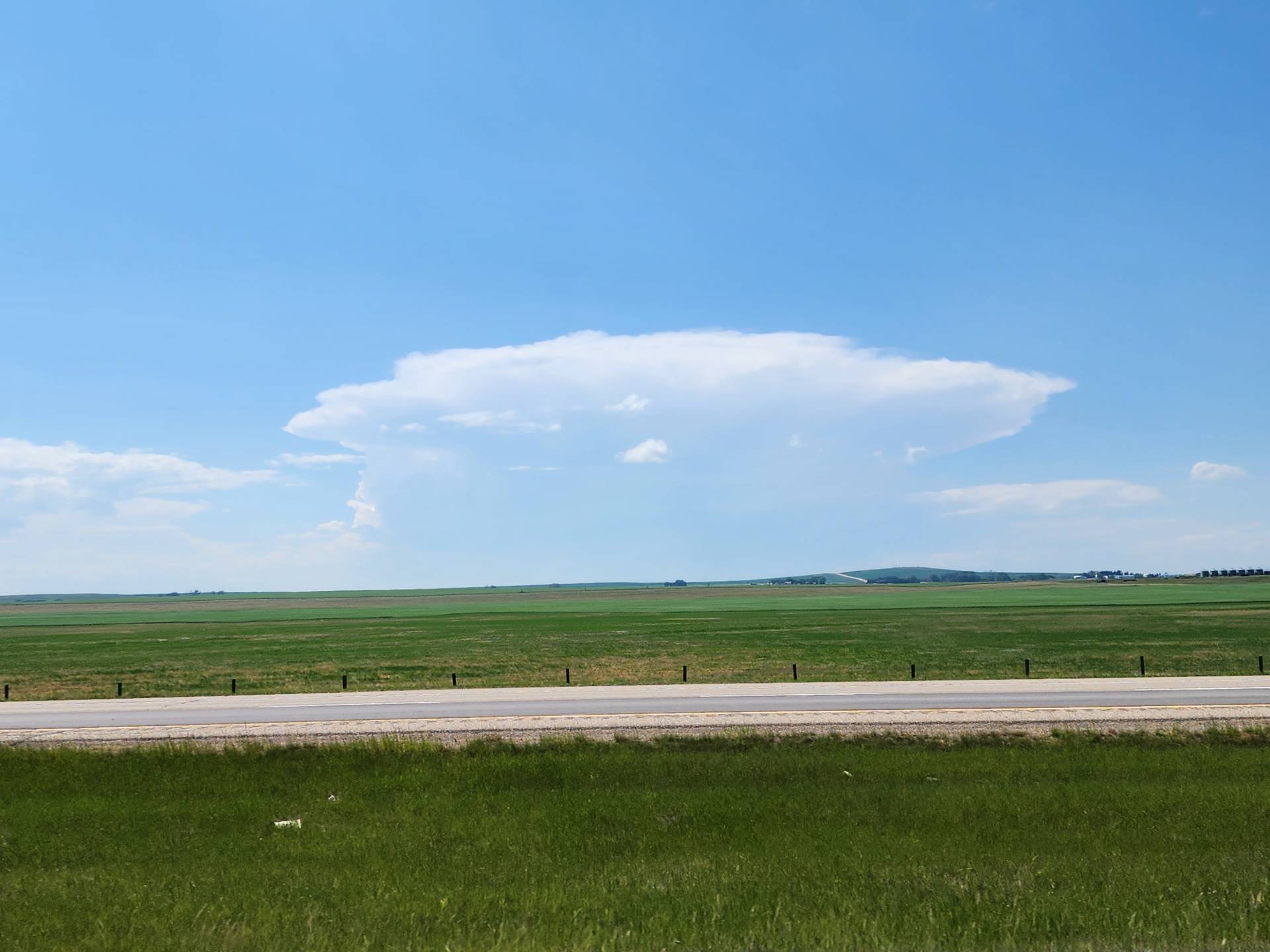
3:08PM MDT
As we arrived in Strathmore to quickly gas up and get a quick bite to eat, the thunderstorm that formed that we were watching became severe warned as it neared Okotoks. We quickly began heading south along Highway 24 to intercept the storm as it moved east.
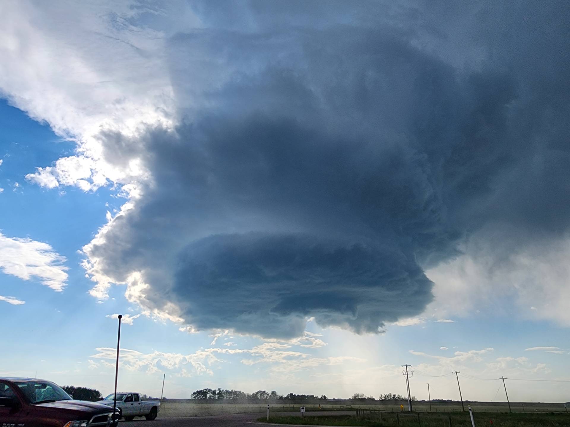
As we approached Highway 547 to turn west towards the storm, the storm became Tornado Warned, with a funnel cloud spotted east of Okotoks.
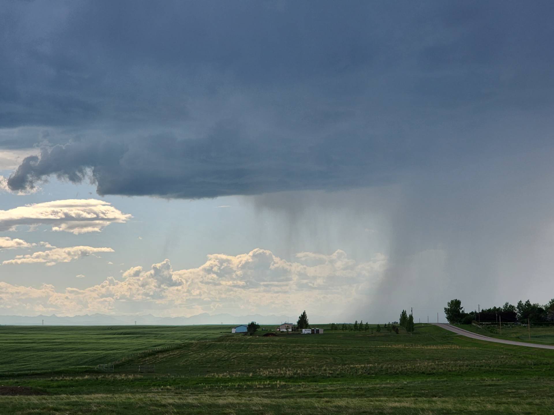
4:51PM MDT
As the supercell gradually moved east across the countryside, it began losing it’s energy, becoming outflow-dominant. We then started seeing cells developing to our north, near Beiseker, AB, and southwest, near Forty Mile, AB.
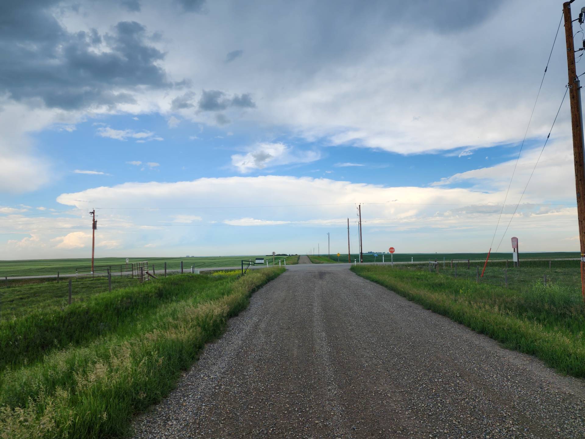
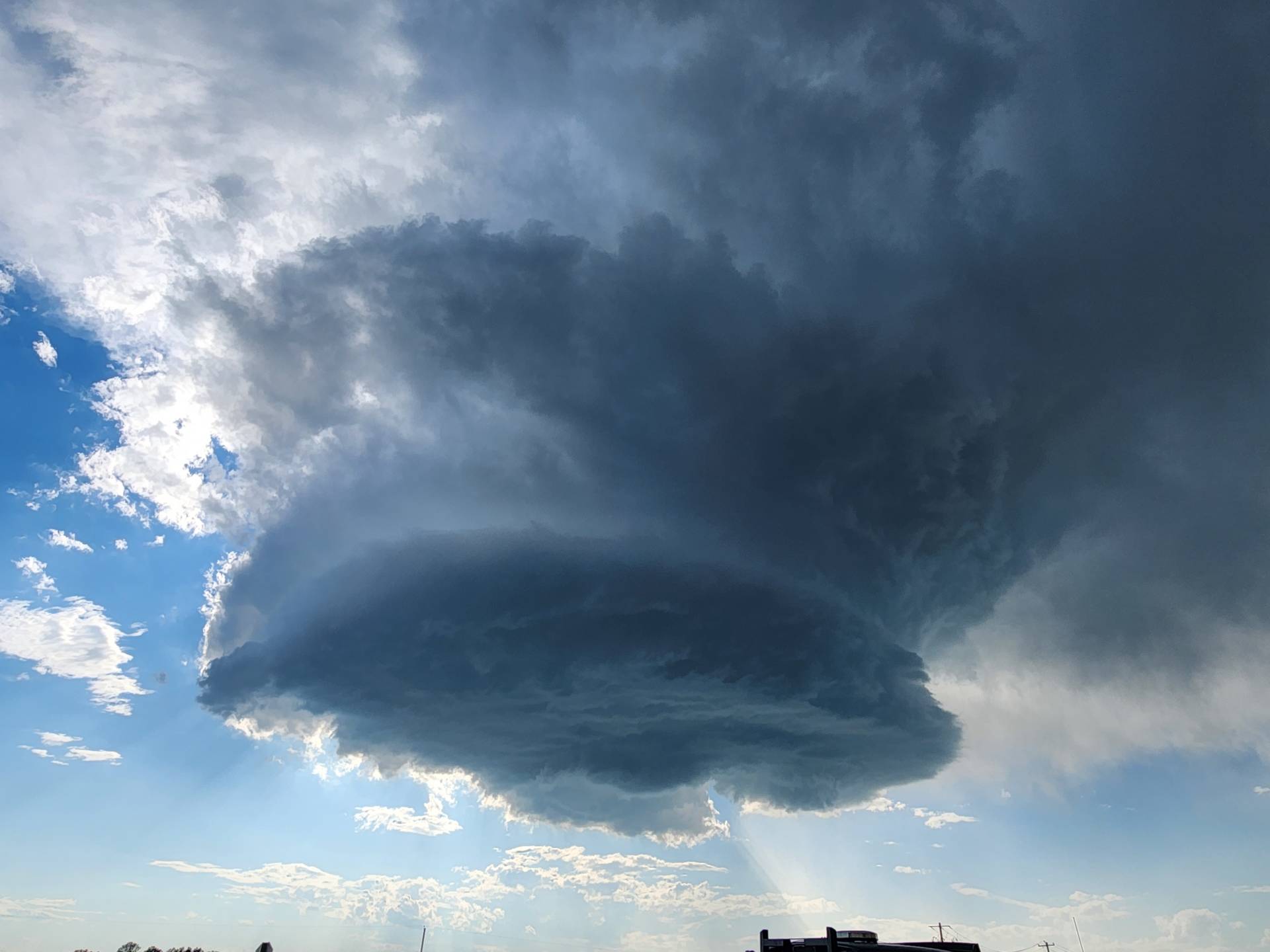
5:09PM MDT
We then quickly raced north, where we witnessed one of the most beautiful severe warned LP Supercells we’ve ever seen. With it only moving 10km/h in a southeasterly direction, we were able to effectively track the supercell along Highway 9 and Township Rd 270.
6:14PM MDT
6:25PM MDT
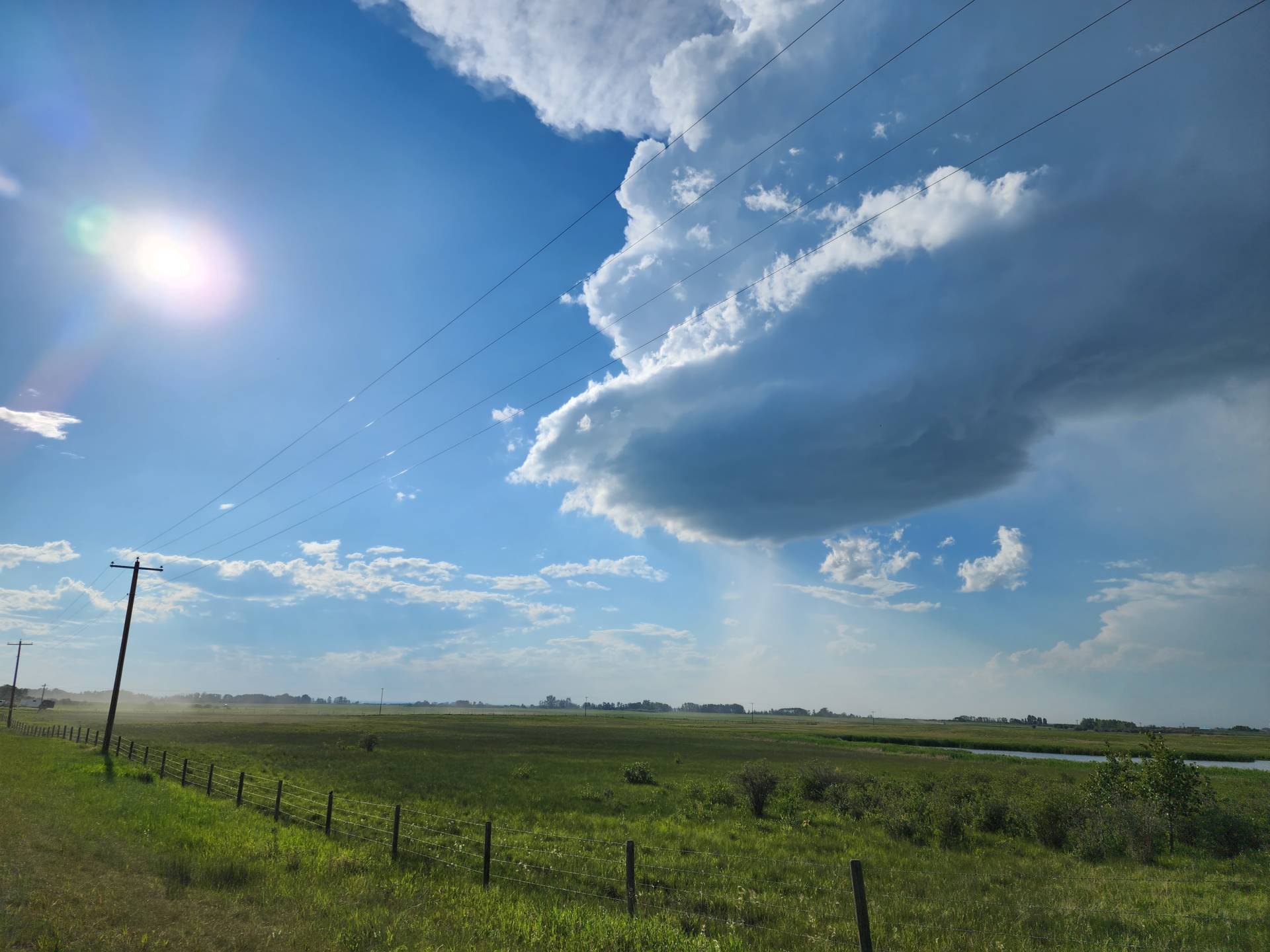
6:51PM MDT
As the storm began to weaken, we met up with a local along Range Rd 270, who shared his experience with us about the Beiseker Tornado on May 31st, 2021.
Even though more storms were forecasted to develop in the HIGH Risk region later that evening, we decided to call the chase to be in better position for tomorrow’s chase, which was forecasted to be a potent day across Central Alberta. We pulled into Olds, AB at the Motel-8, where we began to see supercells fire west of Red Deer, AB. Along with these supercells, multiple rounds of non-severe thunderstorms formed west of Olds and moved east, giving us rounds and rounds of thunder through the overnight hours. We then noticed that a supercell near Sylvan Lake, AB became tornado warned, dumping copious amounts of hail as it tracked east towards Red Deer. Overall, our chase day was a huge success!
Community Comments
AB skies are some of the most dramatic I’ve seen in Canada 😍 Unique combination of prairies and mountains that create some pretty epic storms. Looking forward to this year’s season..
Reply to Mim Oliver
Want to leave a comment? Join our community → OR Login →