

Published on
Whew – what a day! I came into May 25 with little expectation of seeing much – but a little forecasting paid off.
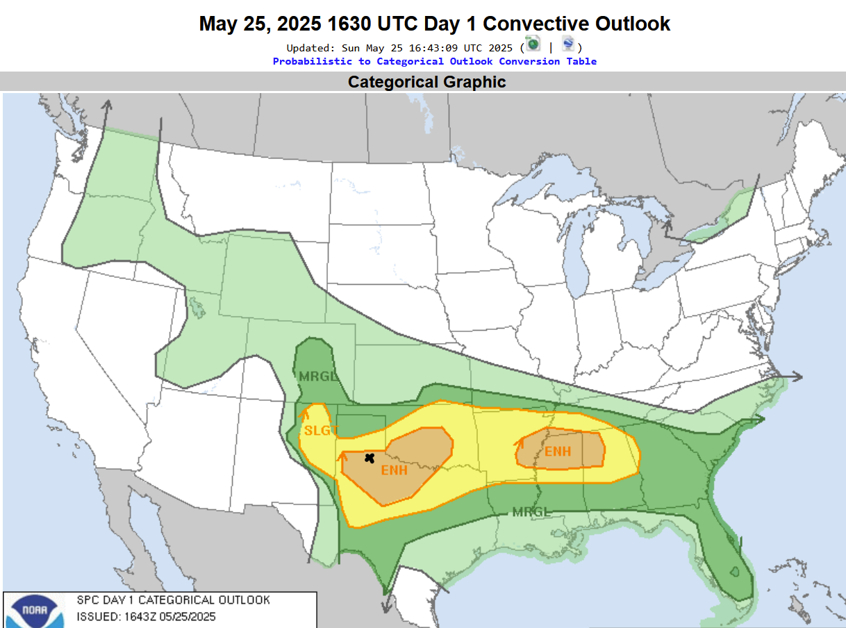
Let’s start with the overall scenario – the Storm Prediction Center had an Enhanced Risk over an area from near Lubbock, Texas into central Oklahoma. My target was Turkey, Texas – which we did pass through, on our way south to Matador.
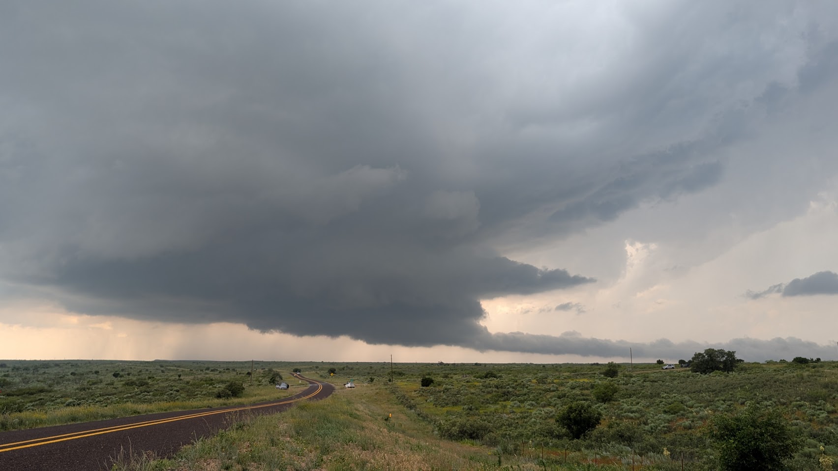
The supercell developed west of Matador and was nearly stationary for an hour. This view was taken about 6 miles west of Matador as the storm started to drift southeast.
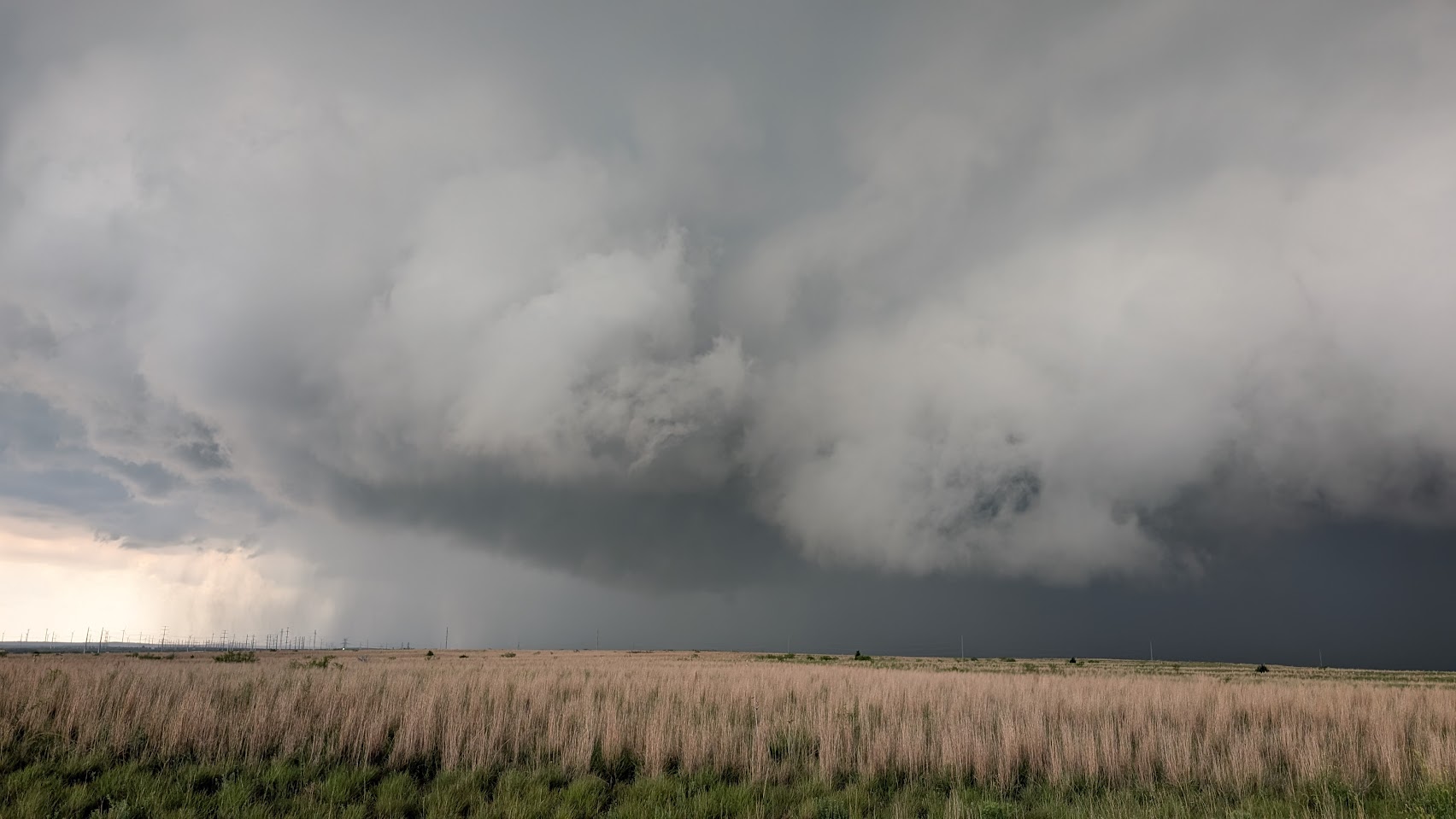
The supercell really began to spin hard just outside of Roaring Springs, Texas.
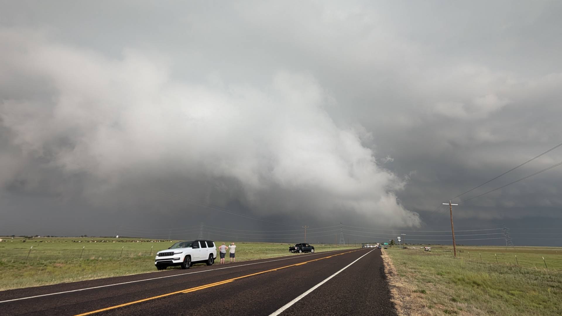
A tornado warning was issued just before the above image was taken. Chaser convergence was extreme, as this was the only storm in the area at the time, and road options were very limited. The supercell did produce a tornado shortly after this image was taken, but with limited road options, I was unable to verify from my location.
Community Comments
There are no comments on this post
Want to leave a comment? Join our community → OR Login →