

Published on
Not the easiest of chase days in Kansas – I teamed up with my friend Alicia Short to chase whatever Mother Nature might throw our way on June 5, 2025.
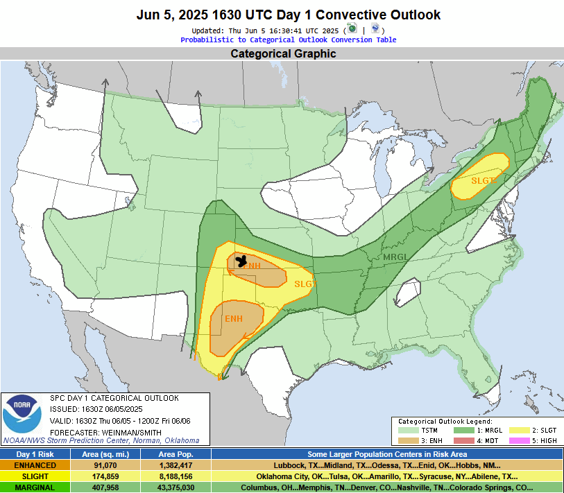
The Storm Prediction Center had an Enhanced area draped over Southwest Kansas for the possibility of a Supercell developing along the Kansas/Colorado border and then moving east southeast through the region.
While Kansas looked to be the secondary target (more on the primary target in a minute) it did look like some storms would likely fire up in the region.
Storms did fire in the area – even earlier than the weather models predicted. We were near Dodge City when the warnings were coming out for a supercell moving into Kansas near Manter, Kansas. We continued our westward projection toward our target near Ulysses.
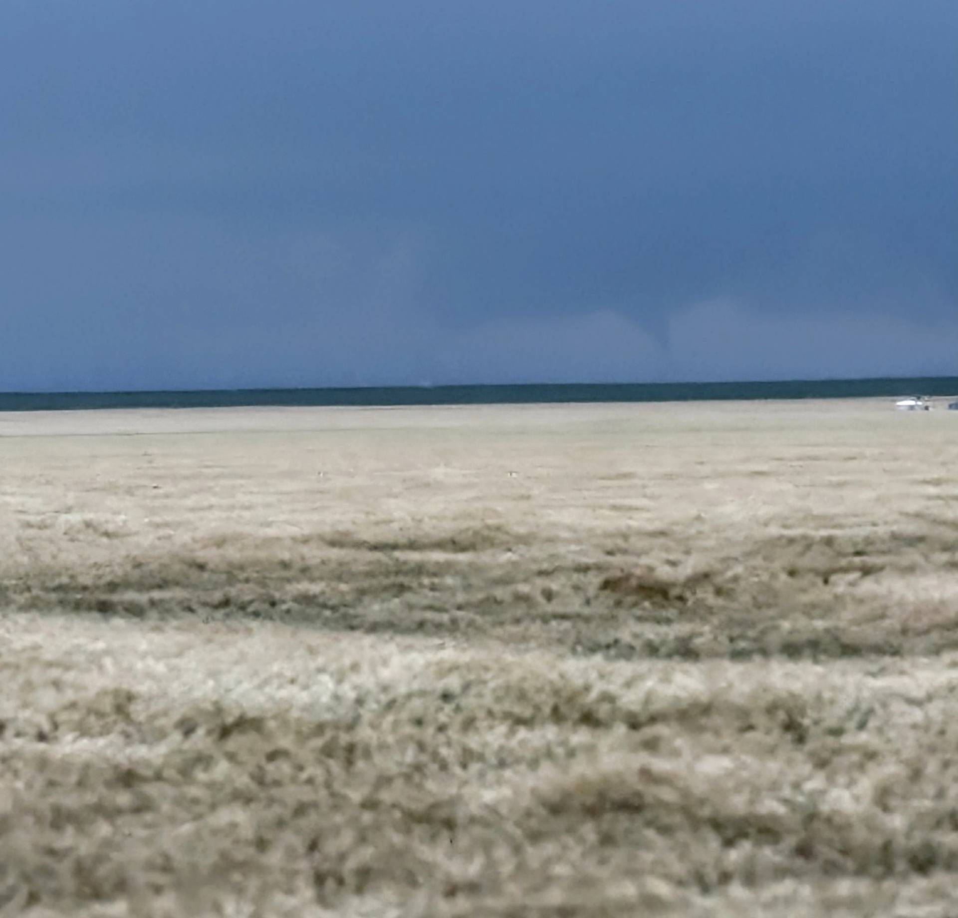
As we approached the supercell, we decided to jump south of Ulysses, since the storm was moving southeast. With the roads being muddy, we stayed on pavement and waited patiently for the storm to get closer. As we were monitoring, we saw a tornado develop about 10 miles to our west. It only lasted about 90 seconds, but that was long enough to snap a few pictures (see below).
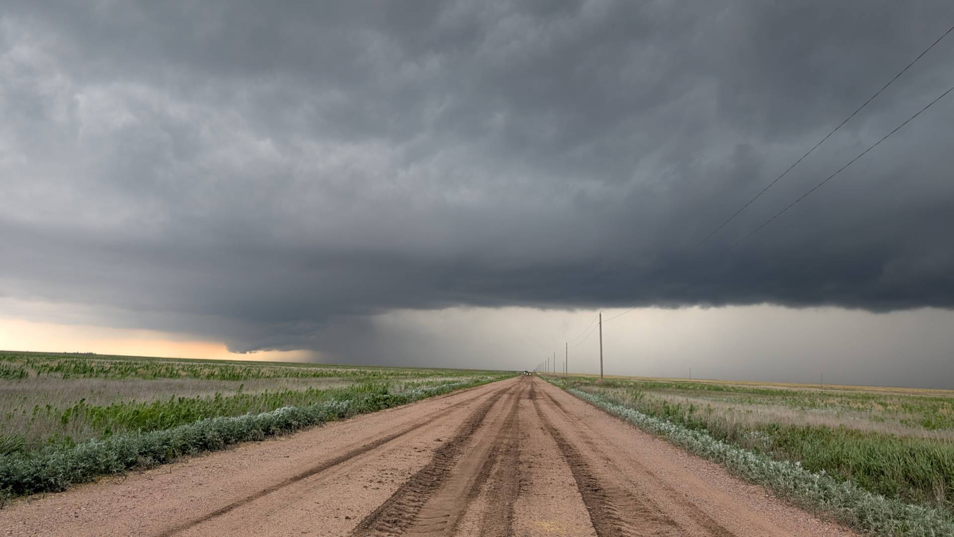
The storm went through a recycling phase after it produced the brief tornado – the above photo taken looking west from about 9 miles southwest of Ulysses.
The storm was producing big hail – in the order of 3″ in diameter, but didn’t seem to get the right mix of streamwise vorticity to produce another tornado.
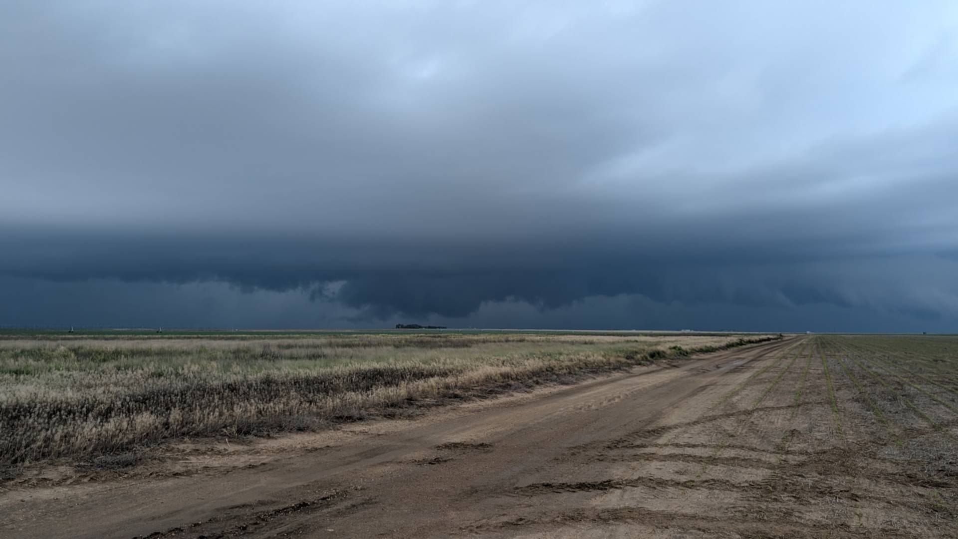
The above image depicts a wall cloud west of Moscow, Kansas. The storm looked potent at times, but just couldn’t develop another tornadic circulation.
Overall it was a fun chase – not a lot of chaser traffic, and some good storms.
Community Comments
There are no comments on this post
Want to leave a comment? Join our community → OR Login →