

Published on
I checked the calendar – it’s definitely September in Kansas. Historically, Kansas has seen some tremendous hail storms in September (look up the September 15, 2010 Wichita hailstorm for reference…hailstones of 7.5 inches in diameter!) but this one didn’t look quite as impressive on paper.
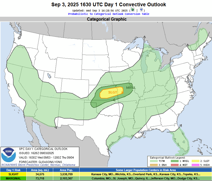
The Storm Prediction Center had a ‘Slight’ risk draped across I-70 and south to around US-54 in Kansas.
Starting the chase from Wichita – it was evident that I wanted to check out the storm that quickly developed near Salina, Kansas. I jumped on the storm near McPherson, and man was it a sight to see.
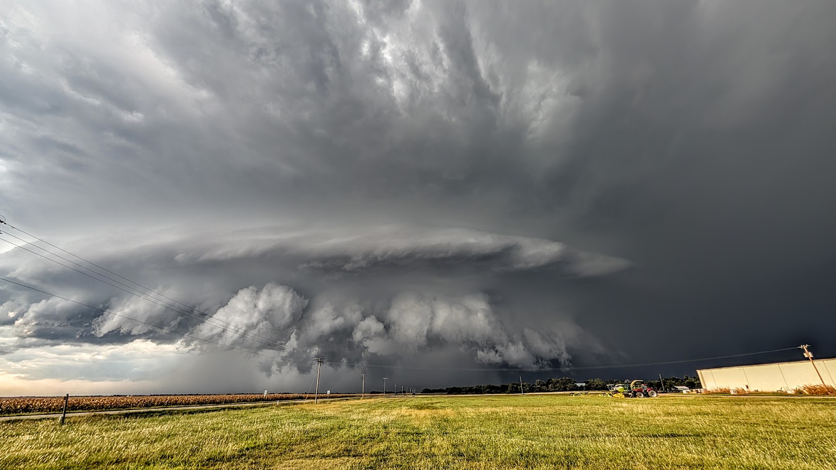
6:28 pm – looking north from Elyria, Kansas towards McPherson, Kansas.
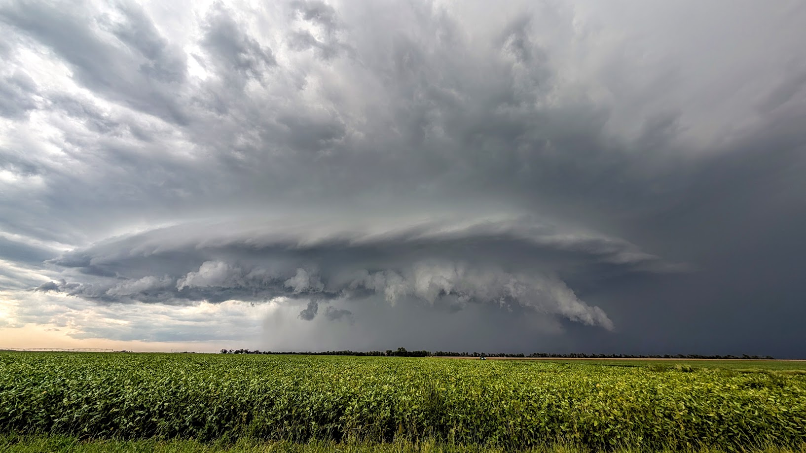
A few minutes later as the storm progressed south near Moundridge, Kansas.
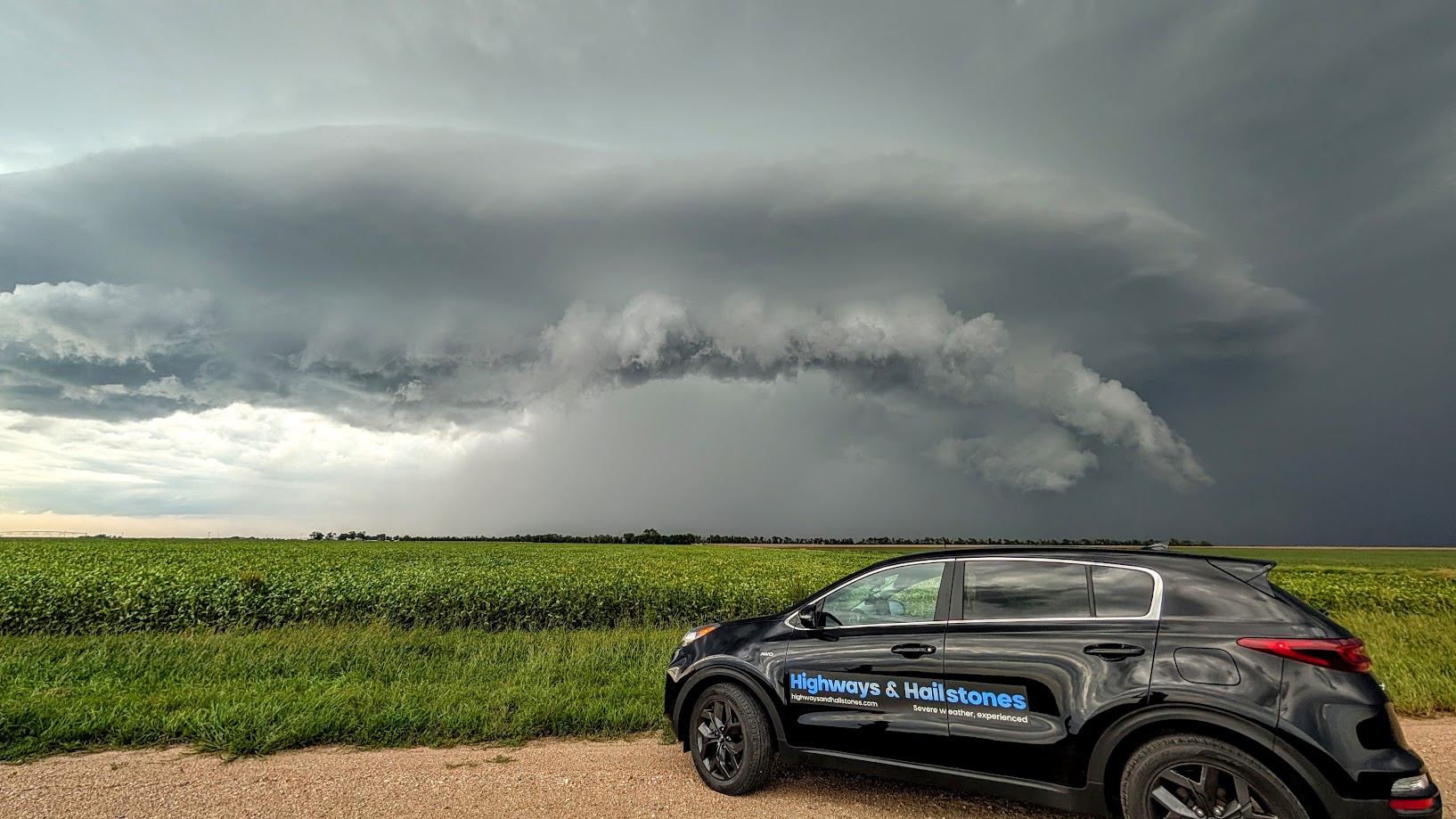
The storm continued south, producing large hail of tennis ball size along its path. This picture was taken near Halstead, Kansas.
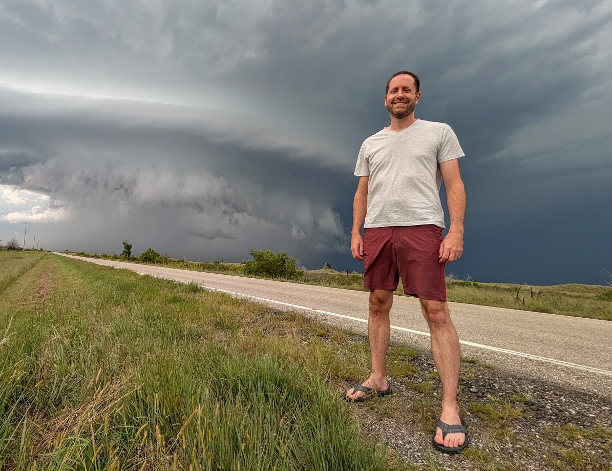
The rare picture of myself in front of a supercell.
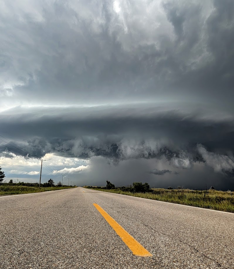
Stormy highway – near Halstead, Kansas.
I wanted to see how large the hail was – so I let the storm overtake my location in Halstead. Unfortunately, no shelters were available, so the car did take some hail damage.
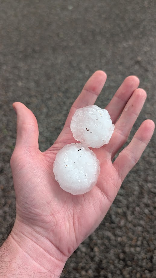
Golfball+ sized hail was common with this storm, and one that moved in right behind the initial hailer. Thankfully, I didn’t lose any windows.
A lot of the Wichita metro area took damage from two prolific supercell storms – my home base was lucky to miss both of them. A fun, local chase for early September!
Community Comments
I would go to Mars 🌩️💧☔🔥🌡️📛⛔🆘
Reply to Khachasing Storms
Want to leave a comment? Join our community → OR Login →