

Published on
With a Moderate Risk draped over the Central Plains, the initial plan was to watch storms develop in South Central Kansas, possibly adjacent areas of North Central Oklahoma.
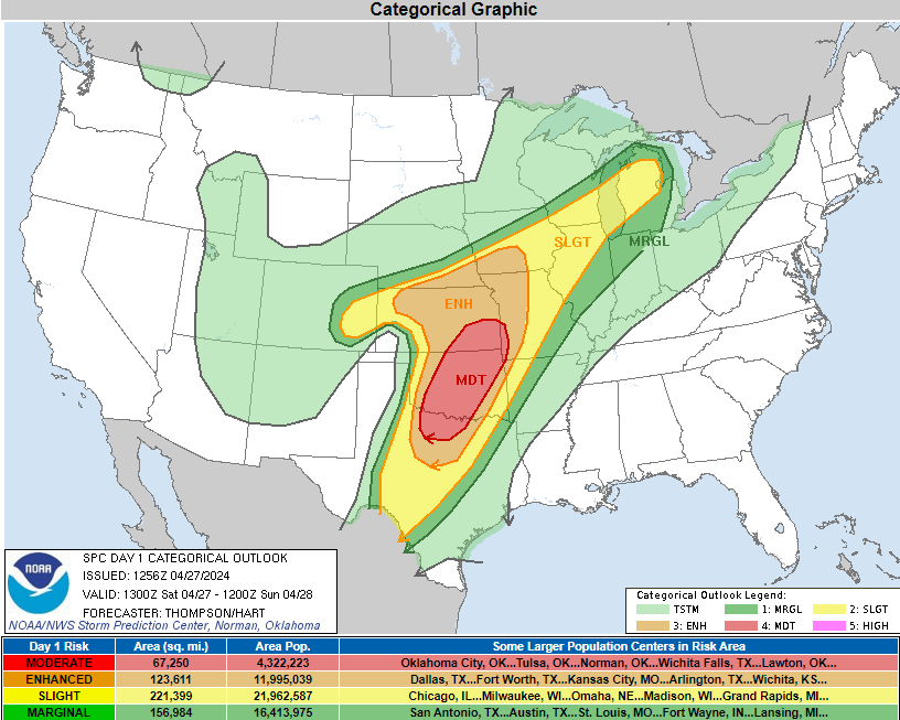
As big days tend to go – this one had some limiting, or “conditional” factors that needed to be met for a regional daytime tornado outbreak. Storm modes were rather sloppy, making for overrunning and storms competing for breathing room, if you will.
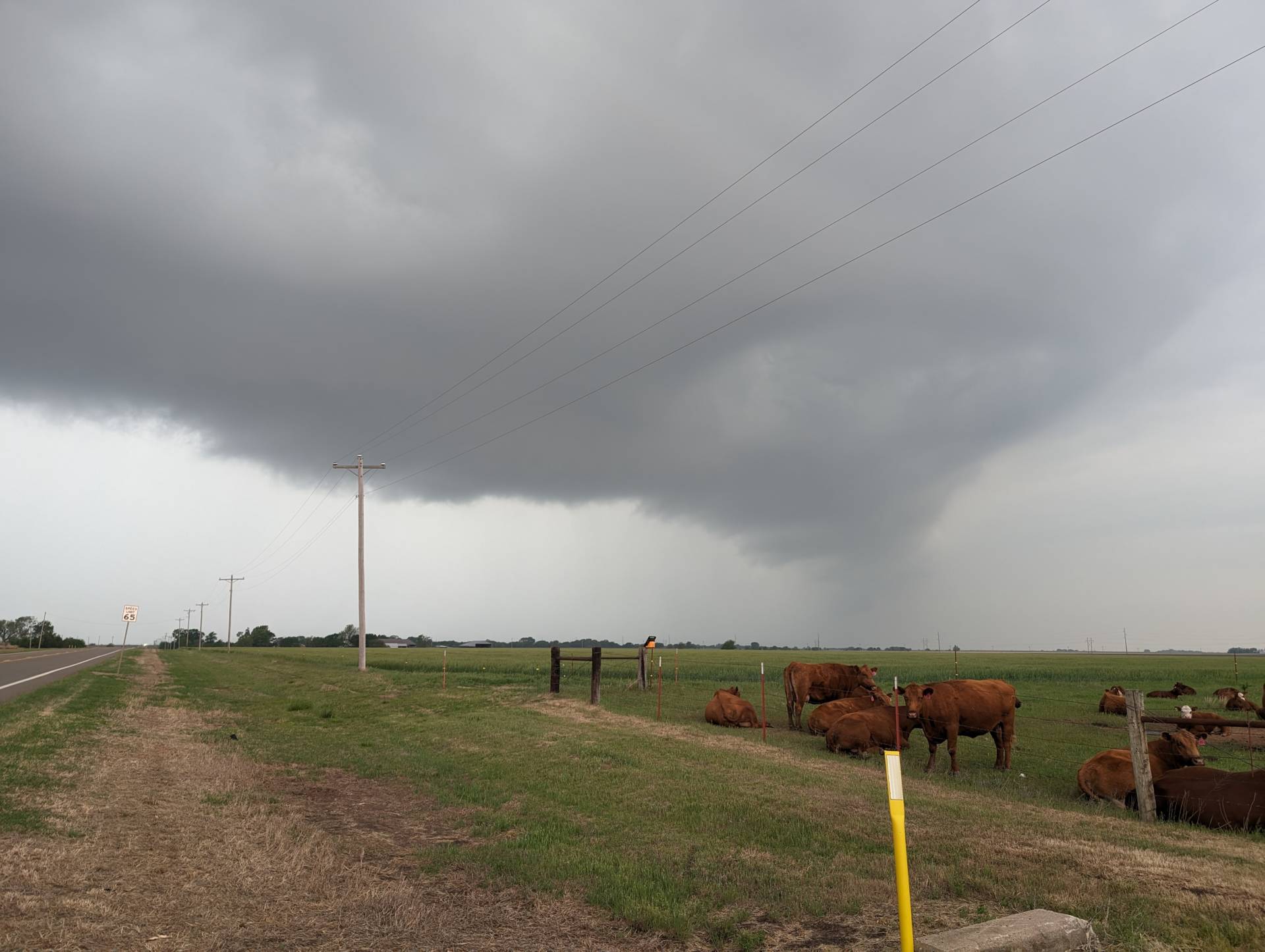
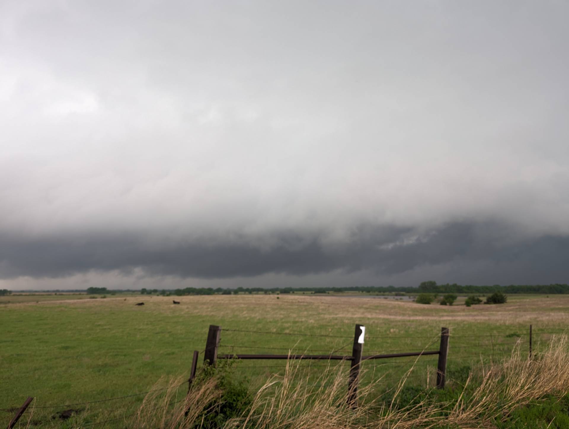
Late in the day – it was evident that our target area (or really anything within a reasonable drive) wasn’t going to be fruitful, so we jumped on a severe storm near Ponca City to see what size the hail might be.

After dark, tornadogenesis really kicked in, with strong, long-track tornadoes south of the Oklahoma City metro, including an EF-1 that rolled over Norman. The strongest tornado being an EF-4 that did significant damage to Marietta, OK, and an EF-3 that tore through the center of Sulphur, Oklahoma.
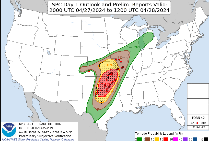
The Kansas tornado reports were mainly in a slop-fest southeast of Wichita with limited sight distance. Southern, Central and Eastern Oklahoma mainly developed after dark. The black X in the northern part of the Moderate Risk being where we mainly chased.
Community Comments
There are no comments on this post
Want to leave a comment? Join our community → OR Login →