

Published on
What looked like an easy chase on paper did not turn out as such. I will go into that in a bit – but lets first look at the setup.
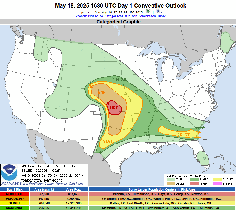
The Storm Prediction Center highlighted a Moderate risk of severe storms and a 15% hatched for tornadoes across southwest and south central Kansas for May 18, 2025.
Okay – back to what I mentioned earlier. Seems like an easy “gentleman’s” chase if you will – as I am located in Wichita. A quick 70 minute drive west and I’m in the heart of the Moderate Risk.
My chase team and I get to Pratt, Kansas, and we realize we still will need to get a bit further west. We hop over to Greensburg, and it’s “pea soup” as we like to call it…foggy, drizzly, with limited visibility. From a science perspective, we know that supercells don’t thrive in environments like that, so after sitting in Greensburg for about 90 minutes, we hop south to Coldwater and eventually over to Ashland.
In Ashland, we at least had clear skies with no fog, so that was already a plus. We fiddled around in that area for a while, as a storm was gaining strength in the east central Texas Panhandle. This storm would eventually develop the Arnett, Oklahoma tornado, but by the time we got in that area, the tornado was long gone.
Yes – we did hop south, getting hailed on near Buffalo, Oklahoma before jumping on south to Woodward. The storm was still tornado-warned at Woodward, but it just wasn’t a pretty storm. It looked grungy with low contrast. Staying the course, we followed the storm from southwest of Woodward back north, getting into a horrific conga line of chasers. As far as the eye could see, chaser traffic was backed up.
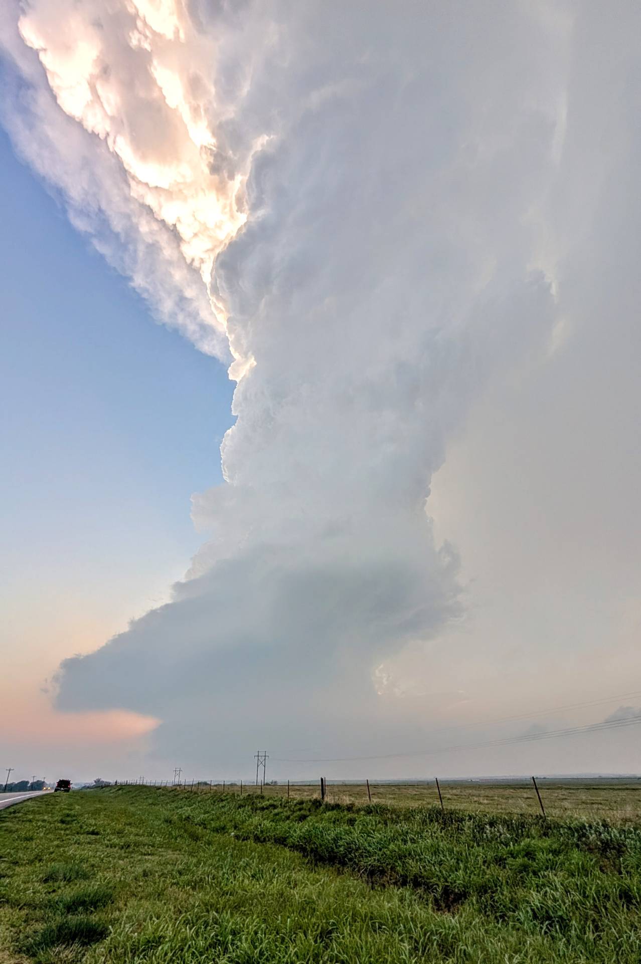
After an hour of driving slow in traffic, we caught up with the storm, fairly close to sunset. It was a low-precipitation supercell that continued to chunk out large pieces of hail. The below picture was taken near Freedom, Oklahoma, several miles to the east, yet we were still getting hail at the location.
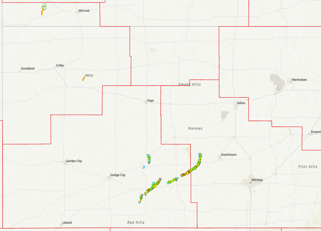
Overall, it was a painful day. We bailed on Kansas because of the low clouds and fog – but low and behold…the sky would turn evil as nightfall came. Greensburg, Kansas was nearly hit by an EF-3 tornado. Grinnell, Kansas was hit by a tornado earlier in the day, and Plevna, Kansas was hit closer to midnight. The tornado tracks, as of May 22, 2025 are imaged below.
Community Comments
Shots 🤩
Reply to Khachasing Storms
Want to leave a comment? Join our community → OR Login →