

Published on
On paper, it looked like the setup on June 17, 2025 for southern Kansas was pretty clear – and it did turn out to be so. The models indicated a supercell or two could develop in the late afternoon hours east of Medicine Lodge, Kansas. *If* a storm could stay isolated, a couple of tornadoes would be possible.
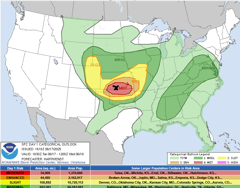
The Storm Prediction Center had the area highlighted with a Moderate Risk – mainly driven by damaging winds. The Wichita metro had significant damage very early on this day from a measured 101 mph wind recorded at the airport. The black X is the target zone.
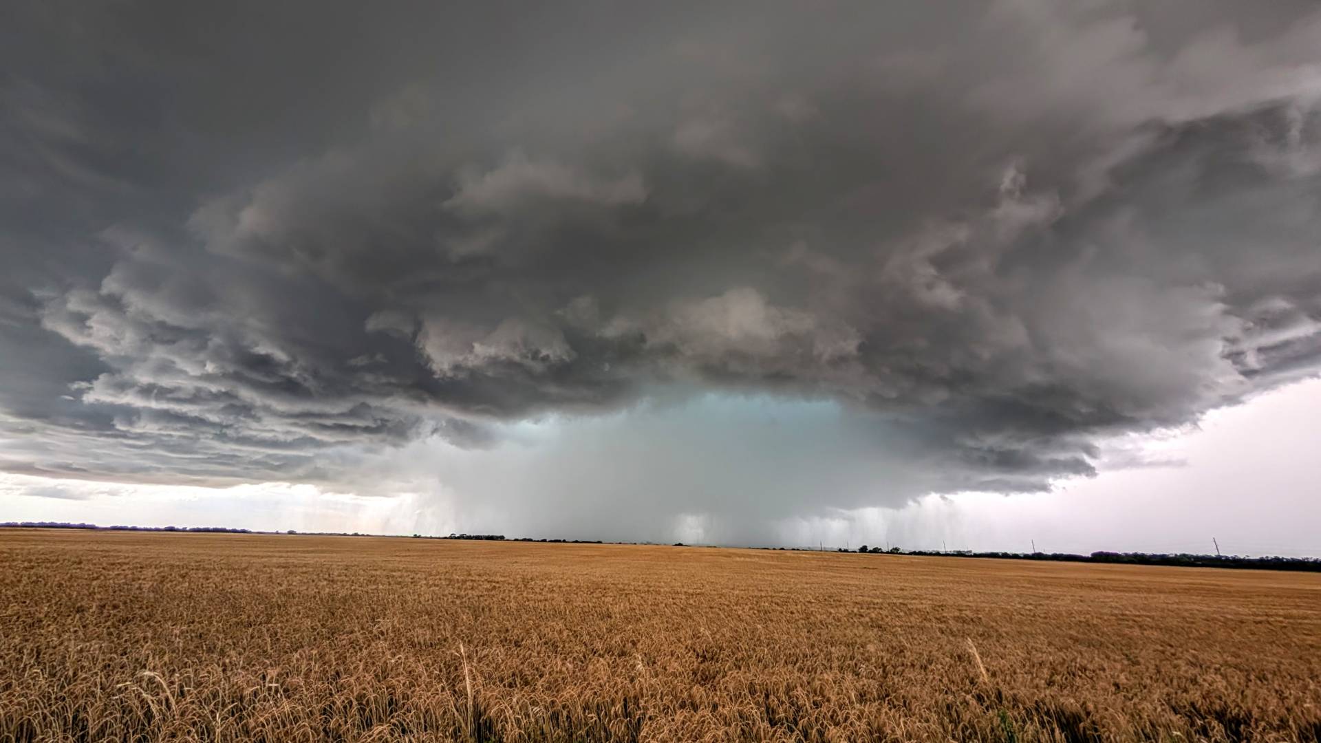
As expected, a storm did develop east of Medicine Lodge and to the west of Harper, Kansas. This photo was taken as the storm was really getting its momentum.
We tracked the supercell, which was tornado-warned at times from Harper on east to Danville, and then on east closer to Wellington, Kansas.
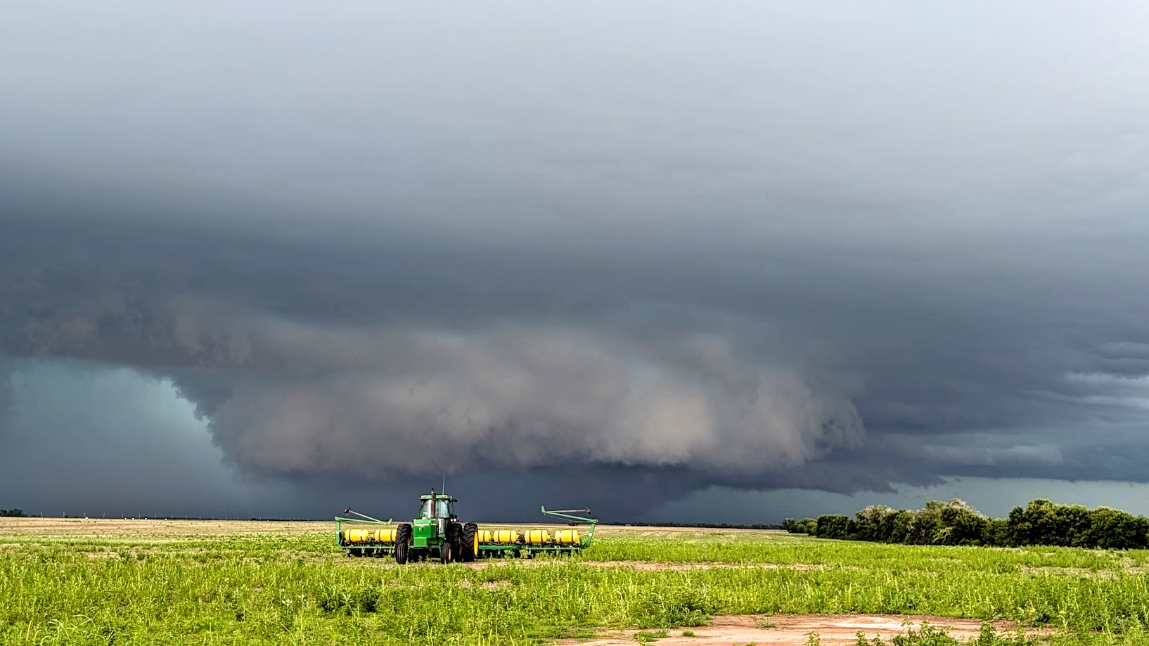
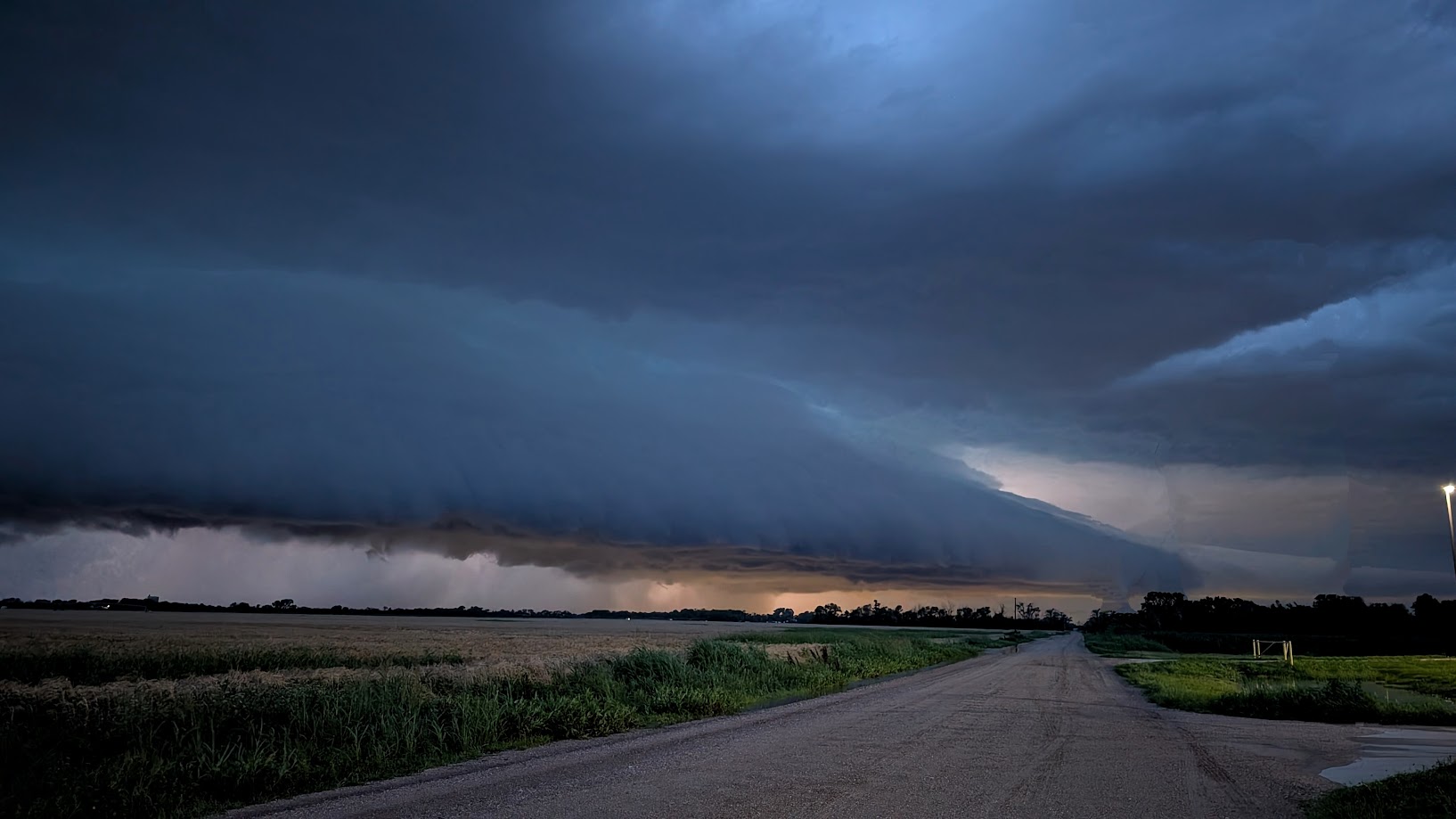
The scenery at times was just what you’d expect it to be in this part of Kansas, in June – with a gnarly supercell roaming the area. The above photo was taken near Perth, Kansas at 5:31 pm.
The supercell produced on and off wall clouds, but never did see a tornado from my multiple vantage points. Some other chasers that were right in the rotation did report a tornado a few miles south of Harper.
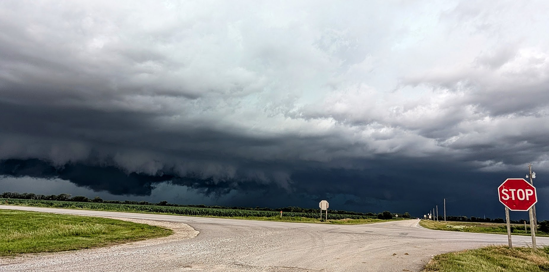
A visible wall cloud on the supercell as it neared Ashton, Kansas.
We took shelter in Arkansas City, KS to see how big the hail would get – and we weren’t disappointed.
Hail ranged in size from quarts to baseballs – after the worst of the hail had fallen, we went to investigate further.
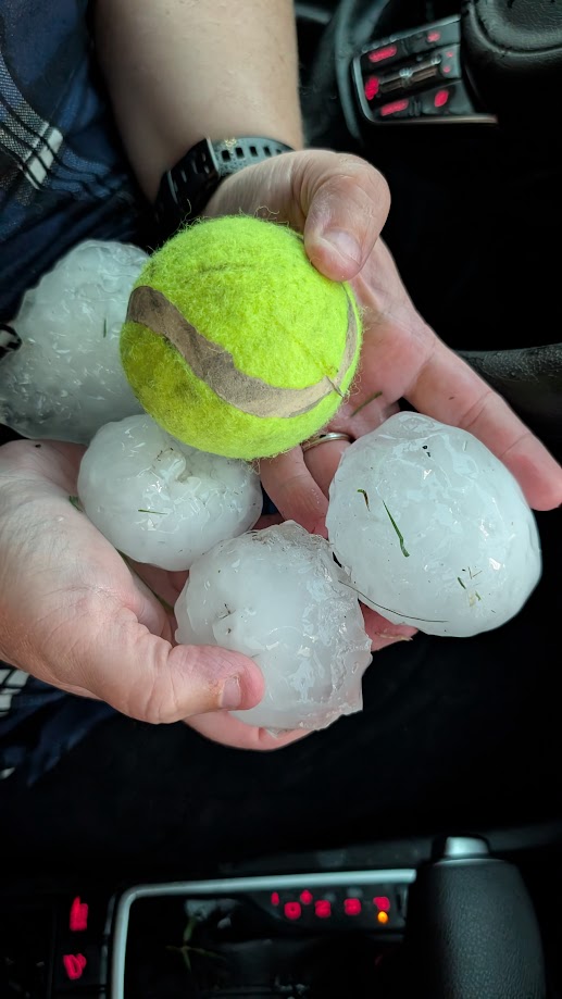
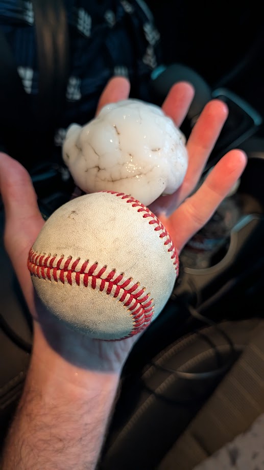
We did find hail just under the size of a baseball near downtown Arkansas City, KS – and there was a lot of stones from golfballs to tennis ball sized as well.
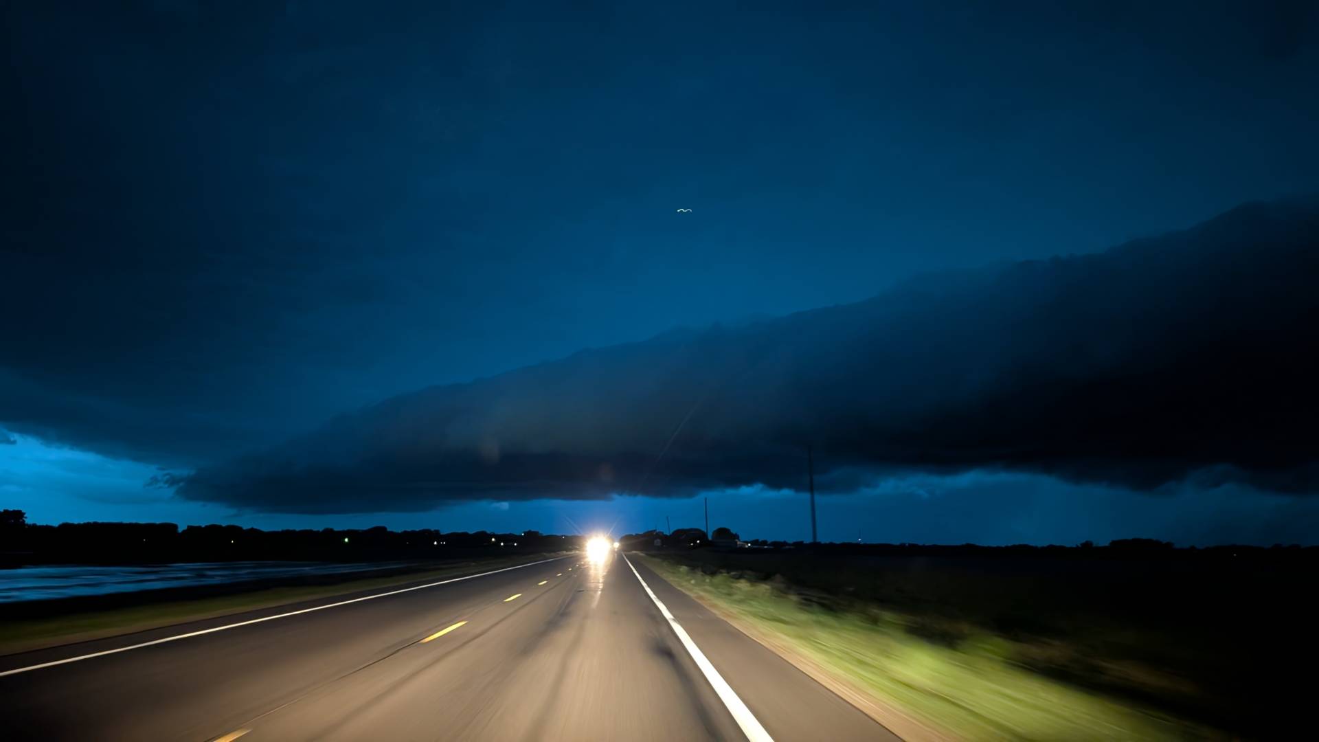
As the sun set – we headed back to Wichita, but had to divert due to high winds and another hailstorm moving over the metro.
Overall – a good chase – thinking the reason this supercell didn’t produce prolific tornadoes was due to its proximity versus the outflow boundary about 15 miles to its south. Had it latched on to the boundary – the situation would have been much different.
Community Comments
There are no comments on this post
Want to leave a comment? Join our community → OR Login →