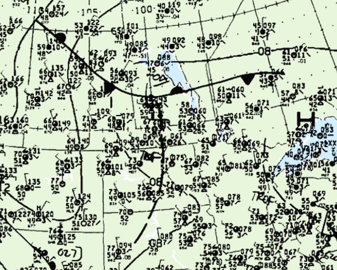
Figure 1 shows the surface observations at 1:00 pm CDT, which shows a low pressure system on the Saskatchewan/Manitoba border with a warm front extending east across Manitoba and a cold front extending west across Saskatchewan. A trough of low pressure is also observed extending south across western Manitoba from the low pressure. This trough was the focus for storms in the warm sector across Manitoba in the afternoon hours of June 24th, which ultimately led to several tornadoes.
Several tornadoes occurred on this day:
- Kelwood, MB F0 Tornado
- Winnipeg, MB F0 Tornado
- Plumas, MB F0 Tornado
- Morden, MB F0 Tornado
- Roseisle, MB F0 Tornado
- Miami, MB F0 Tornado

According to Environment and Climate Change Canada (2018), an F0 tornado touched down at 3:00 pm CDT about 13 km south of Kelwood, MB. The tornado tracked for 5.22 km and had a maximum width of 350 metres. The tornado caused no fatalities, injuries or property damage.
Sources
NWS Weather Prediction Center Surface Analysis Archive. (2017). Surface analysis 18Z Wed Jun 24 1992. Retrieved from: https://www.wpc.ncep.noaa.gov/archives/web_pages/sfc/sfc_archive.php
Environment and Climate Change Canada Data. (2018). Canadian National Tornado Database: Verified Events (1980-2009) – Public. Retrieved from: http://donnees.ec.gc.ca/data/weather/products/canadian-national-tornado-database-verified-events-1980-2009-public/

