

The tornado had a path that was about half a kilometre long and 60m wide, touching down at 4:40 pm. It developed over Windy Lake which is about 100 kilometres to the west-northwest of North Bay. It passed across the water, then moved onto land at the north end of the lake at Windy Lake Provincial Park, but did not produce any damage. Witnesses captured photos of the tornado, a cone funnel with a ring of spray as it moved across the water.
This was one of two tornadoes that touched down in Ontario on May 26; the other was an F0 at Reynolds Lake, north of North Bay.
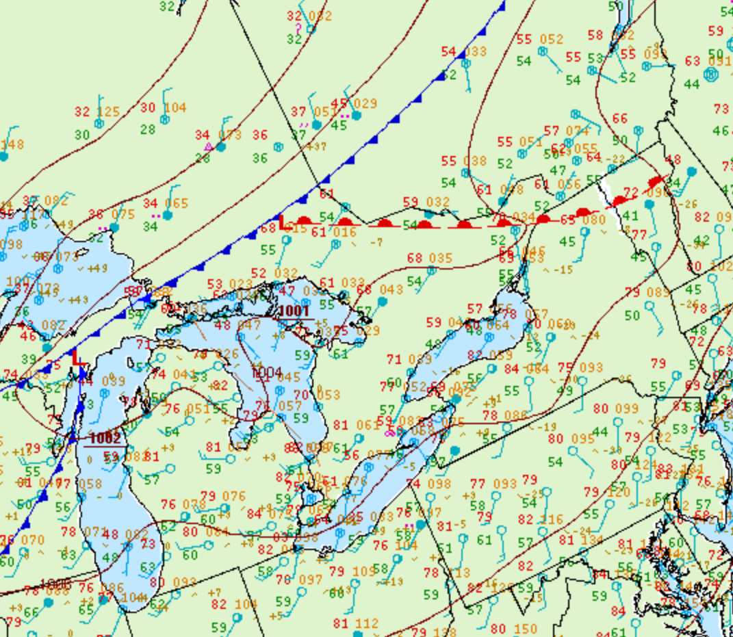
Figure 1 depicts the surface observations at 2:00 pm EDT, which shows a cold front slicing through central Ontario and a warm front clashing with said front. This frontal interaction would have caused substantial vertical motion, triggering thunderstorms. These thunderstorms would ultimately lead to two F0 tornadoes across Ontario.
According to Environment and Climate Change Canada (2018), an F0 tornado touched down at 4:40 pm near Windy Lake Provincial Park, ON. The tornado travelled for 500 metres and had a maximum width of 60 metres. The tornado caused no fatalities, injuries or property damage.
Sources
NWS Weather Prediction Center Surface Analysis Archive. (2017). Surface analysis 18Z Mon May 26 2008. Retrieved from: https://www.wpc.ncep.noaa.gov/archives/web_pages/sfc/sfc_archive.php
Environment and Climate Change Canada Data. (2018). Canadian National Tornado Database: Verified Events (1980-2009) – Public. Retrieved from: http://donnees.ec.gc.ca/data/weather/products/canadian-national-tornado-database-verified-events-1980-2009-public/