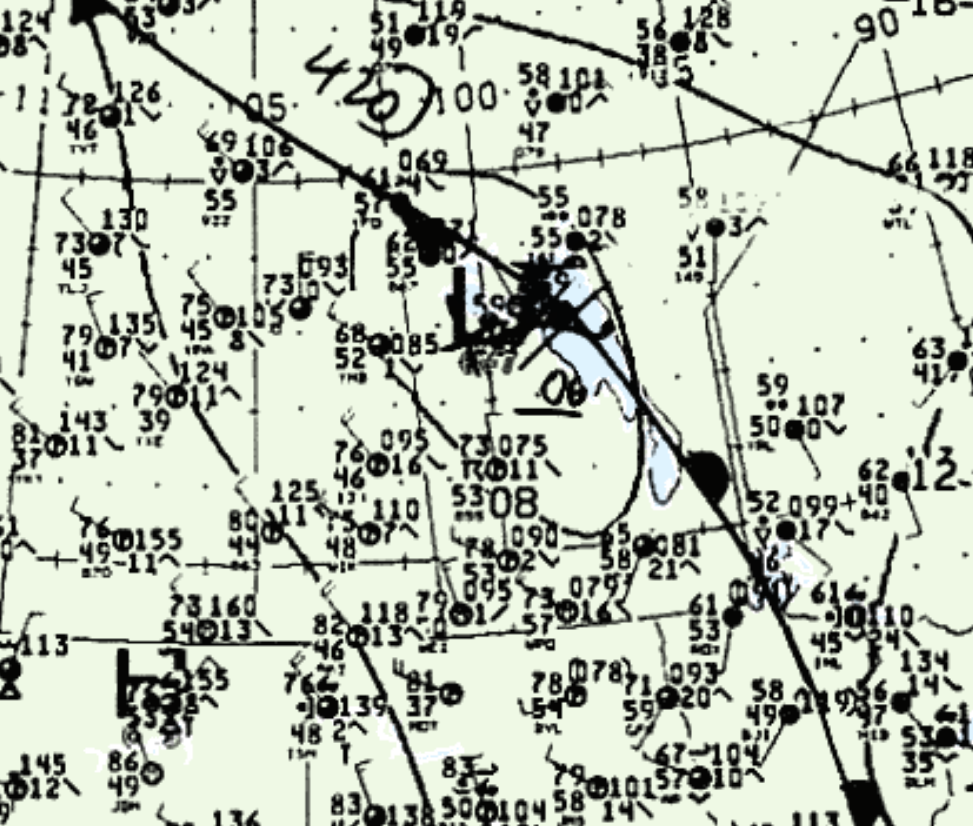
Figure 1 shows the surface observations at 4:00 pm CDT, which shows a low pressure over Lake Manitoba and a warm front extending south across southeastern Manitoba. Northerly flow is observed across Lake Manitoba, which likely triggered lake-breezes south of the lake. Lake-breezes, aided by terrain interactions with the Manitoba Escarpment and a developing cold front (not depicted on Figure 1), likely triggered thunderstorms south of Lake Manitoba, which ultimately led to this tornado.
Several tornadoes occurred on this day:

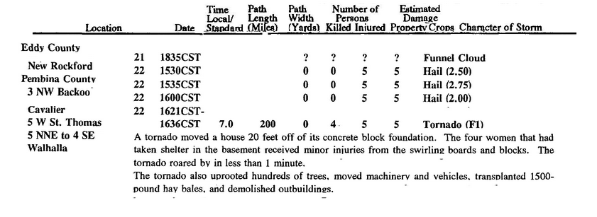
This tornado touched down in Manitoba, just south of Reinland. The tornado then moved into Pembina County in North Dakota. According to NOAA (2019), the F1 tornado caused no fatalities, but injured four people and caused $250 thousand dollars in property damage in Pembina County. The tornado travelled for approximately 2 km across Manitoba and for 7 miles across North Dakota and had a maximum width of 200 yards.

Sources
NWS Weather Prediction Center Surface Analysis Archive. (2017). Surface analysis 21Z Mon Jun 22 1992. Retrieved from: https://www.wpc.ncep.noaa.gov/archives/web_pages/sfc/sfc_archive.php
Environment and Climate Change Canada Data. (2018). Canadian National Tornado Database: Verified Events (1980-2009) – Public. Retrieved from: http://donnees.ec.gc.ca/data/weather/products/canadian-national-tornado-database-verified-events-1980-2009-public/
NOAA National Centers for Environmental Information (2020). Storm Events Database. Retrieved from: https://www.ncdc.noaa.gov/stormevents/

