

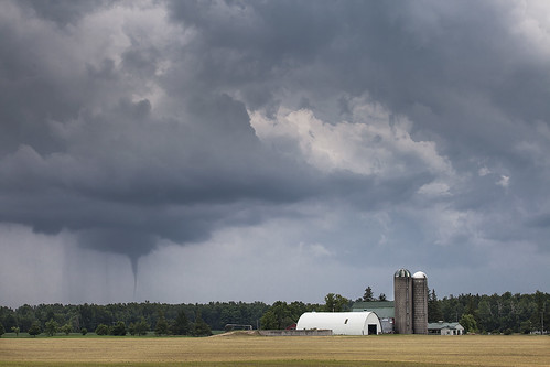
This slender EF0 tornado touched down briefly near Millbank but caused no damage. While the main line of storms along a cold front was crossing into Ontario along the shores of Lake Huron, a number of small storms popped up ahead of the line. Several photogenic funnel clouds were produced as these storms rapidly intensified.
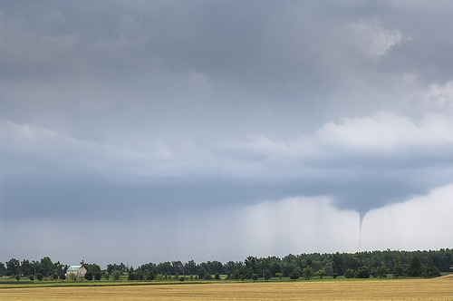
In particular, one funnel near Millbank was captured in photos and on video by several witnesses, a slender pencil-shaped tube that was condensed almost all the way to the ground. A Canwarn spotter did report observing swirling dust and debris at its base, confirming the tornado touchdown, though no damage was done.
This was one of two tornadoes to touch down on July 27, 2014. The other:
- Grand Bend (EF1)
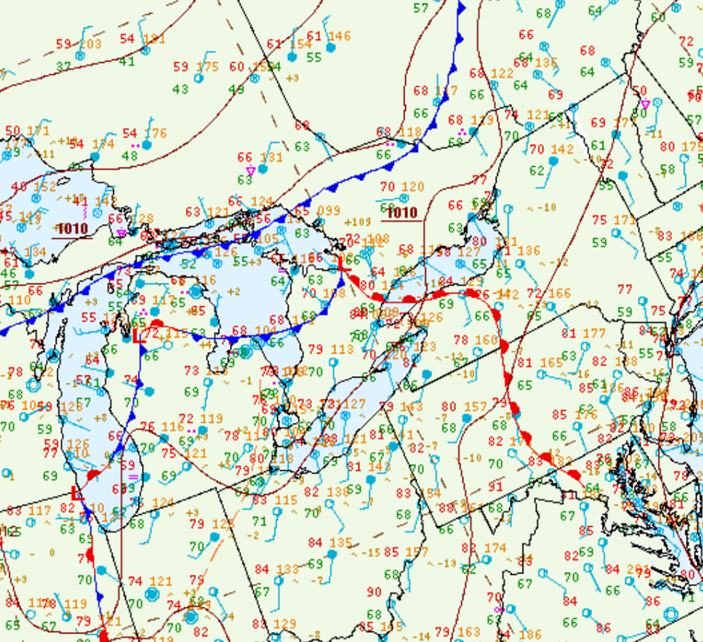
Figure 1 depicts the surface observations at 2:00 pm EDT, which shows a low pressure system across northern Michigan with its associated cold front moving across the state and a stationary front across southern Ontario. This stationary front became the focus for thunderstorm activity in the afternoon hours of July 27th, which ultimately led to two tornadoes.
Sources
NWS Weather Prediction Center Surface Analysis Archive. (2017). Surface analysis 18Z Sun Jul 27 2014. Retrieved from: https://www.wpc.ncep.noaa.gov/archives/web_pages/sfc/sfc_archive.php