

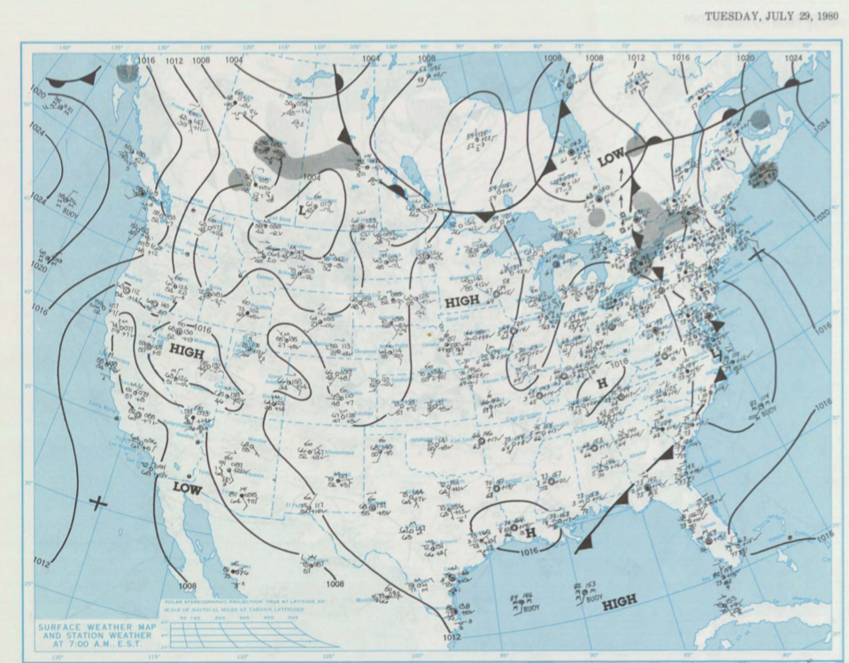
Figure 1 shows the surface observations at 7:00 am CDT, which shows a stationary front across Manitoba, a cold front moving south across northwestern Ontario and a developing low pressure in extreme southwestern Saskatchewan. This low pressure moved east-northeast throughout the day, dragging a cold front extending south into the United States. The low pressure and stationary front was likely the focus for thunderstorm activity in the late evening hours of July 29th, which likely resulted in this tornado.
According to Environment and Climate Change Canada (2018), an F0 tornado touched down at 11:45 pm CDT near Bowsman, MB. The track and width of this tornado was not documented by ECCC. The tornado caused no injuries, fatalities or property damage.
Sources
NOAA Central Library. (2020). U.S. Daily Weather Maps. Tuesday July 29, 1980 [PDF]. Retrieved from https://library.noaa.gov/Collections/Digital-Collections/US-Daily-Weather-Maps
Environment and Climate Change Canada Data. (2018). Canadian National Tornado Database: Verified Events (1980-2009) – Public. Retrieved from: http://donnees.ec.gc.ca/data/weather/products/canadian-national-tornado-database-verified-events-1980-2009-public/